
April showers into Friday; stronger warm front next week
A push of much warmer air may arrive in Minnesota late next week
Go Deeper.
Create an account or log in to save stories.
Like this?
Thanks for liking this story! We have added it to a list of your favorite stories.


April is a promise that May is bound to keep. — Hal Borland
Get ready for some April showers.
Our latest weather system brings rain that favors the southern half of Minnesota. Showers increase on radar through Thursday night. Friday brings some soaking rains that favor southern Minnesota during the morning hours.
NOAA’s GFS model is among the more aggressive models for rainfall in the Twin Cities metro area. Most other models paint the heaviest rainfall totals across southern Minnesota. Friday looks cool and damp, but showers should gradually fade in the afternoon.

Minor soaker
Northner Minnesota remains mostly dry with this system focused further south. Most of us in the southern half of Minnesota will likely pick up rainfall totals between .10 inch and .25 inch. The heavier rainfall total between a quarter inch and half-inch favor southern Minnesota. There could be some pockets of locally heavier rainfall.
Turn Up Your Support
MPR News helps you turn down the noise and build shared understanding. Turn up your support for this public resource and keep trusted journalism accessible to all.
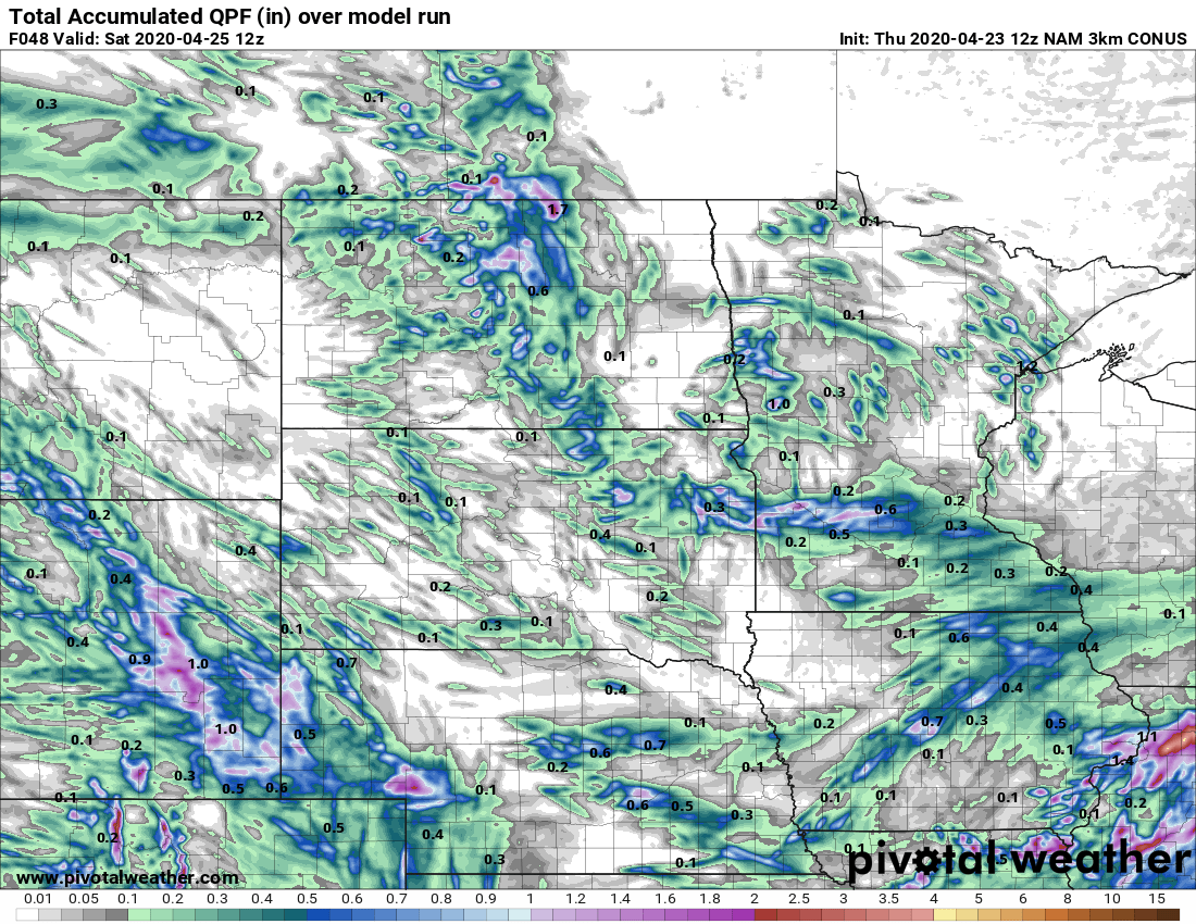
Pretty nice weekend
A few showers favor southwest Minnesota this weekend. But most of the state should enjoy a mix of sun and a few clouds. Highs in the lower 60s, combined with light winds will make for a pretty decent last weekend of April.
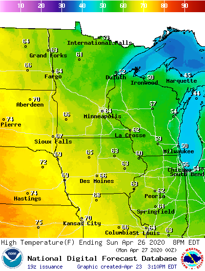
Warm front next week
A stronger weather system brings showers and thunderstorms Monday night into Tuesday. Highs run in the 60s through early next week.

A stronger warm front appears ready to brings the warmest air mass of the season into Minnesota late next week. The Canadian and American models hint at highs in the 70s again by next Thursday and Friday.
Stay tuned.

