
Chilled sunshine returns Wednesday; 70s again late next week?
This week feels more May than October. Warmth returns late next week.

Go Deeper.
Create an account or log in to save stories.
Like this?
Thanks for liking this story! We have added it to a list of your favorite stories.


Ahh, Minnesota weather.
Just when you think you’ve turned the corner on spring, another chilly speed bump. Our weather maps look and feel more October than May this week. A few pulses of chilly air ooze southward through the weekend. Frosty mornings loom Friday and Saturday.
The good weather news? Warmer air appears ready to return later next week.
This time for good?
Turn Up Your Support
MPR News helps you turn down the noise and build shared understanding. Turn up your support for this public resource and keep trusted journalism accessible to all.
Temperatures tumble
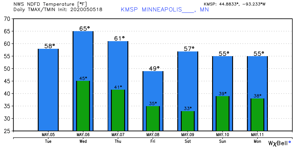
Our cold air fest comes in waves through early next week. Wednesday feels pretty decent in the Twin Cities and southern Minnesota as highs make the lower 60s. The coldest air pulses arrive Friday and Saturday.
Frosty mornings?
You’ve heard of the two seasons in Minnesota. Winter and road construction.
But there’s also freezing, and not freezing. We’re rarely done with frost in Minnesota until summer. In fact, frost is typical in northern Minnesota in June, and again in August. Yes, I’m a big hit at parties.
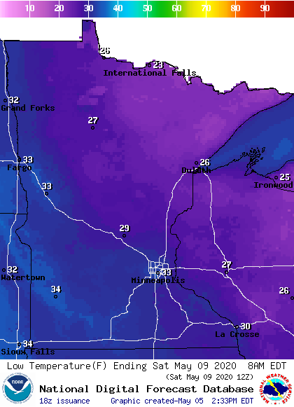
Friday and Saturday mornings are the coldest this week. Most of Minnesota will see frost or freezing temps. The inner Twin Cities metro core may just escape a killing frost. But you may want to cover those pretty new petunias.
Warmer late next week?
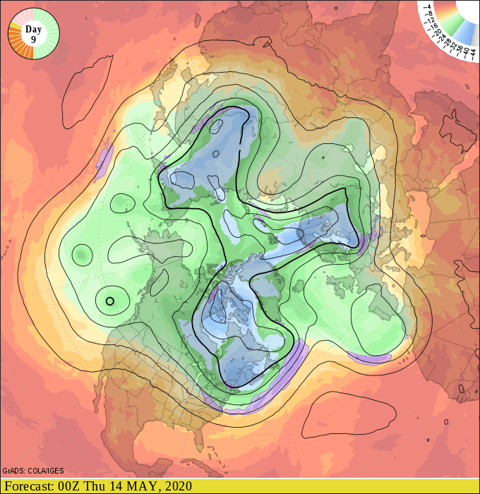
We hover in the 50s early next week. But the upper air forecast maps suggest milder Pacific breezes by late next week. Here’s the upper air map for next Wednesday.
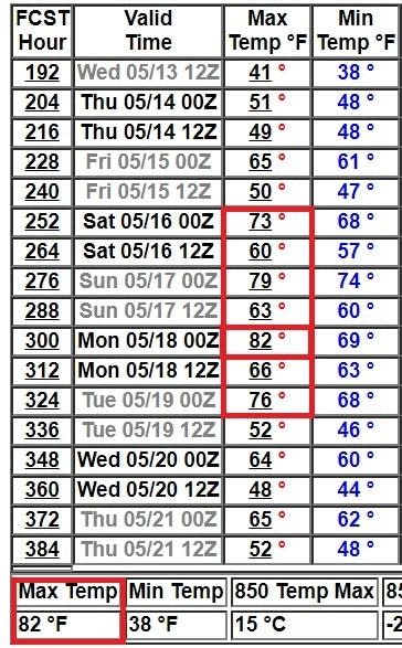
The 16-day GFS temperature output trends strongly toward warmer temperatures by the weekend of May 16-17. Again. focus on the trend here, but highs in the upper 70s to low 80s sure sound nice, don't they?
A (weather) guy can dream.

