
Freeze warnings; cool bias but warmer next week
Rain and snow showers likely for fishing opener Saturday; 60s to 70 again later next week
Go Deeper.
Create an account or log in to save stories.
Like this?
Thanks for liking this story! We have added it to a list of your favorite stories.


Patience is a virtue when it comes to Minnesota weather.
Our past three springs in Minnesota have been reluctant: late-season snows, stubborn ice-outs, frosty mornings.
Our cool bias continues into early next week. Anglers will deal with temperatures in the 40s and 50s. Rain and snow showers blow through Saturday. The sun may peek out for Mom late Sunday.
Warmer air returns again late next week. Until then, we wait for spring to fully blossom.
Turn Up Your Support
MPR News helps you turn down the noise and build shared understanding. Turn up your support for this public resource and keep trusted journalism accessible to all.
Freeze warnings
Freeze warnings are flying for a big chunk of the Upper Midwest including all of southern Minnesota. Prepare for a blue-fest on the weather maps.
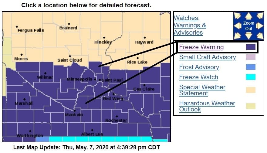
Temperatures plunge below freezing across most of Minnesota Friday morning.
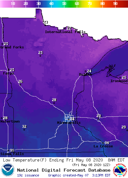
The inner Twin Cities urban core (494/694 loop) may just escape freezing temperatures, but it’s going to be close.
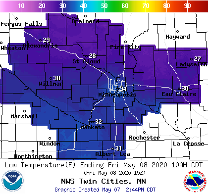
The Weather Lab sits outside the 494/694 loop. I’m definitely covering up the new annuals Thursday night.
Fishing opener and Mother’s Day weekend
Minnesota anglers will deal with cold, rain and some snow Saturday. An unseasonably cold clipper brings rain and some snow showers to Minnesota Saturday into early Sunday.
NOAA’s GFS model paints the likely rain and snow zones across Minnesota this weekend.
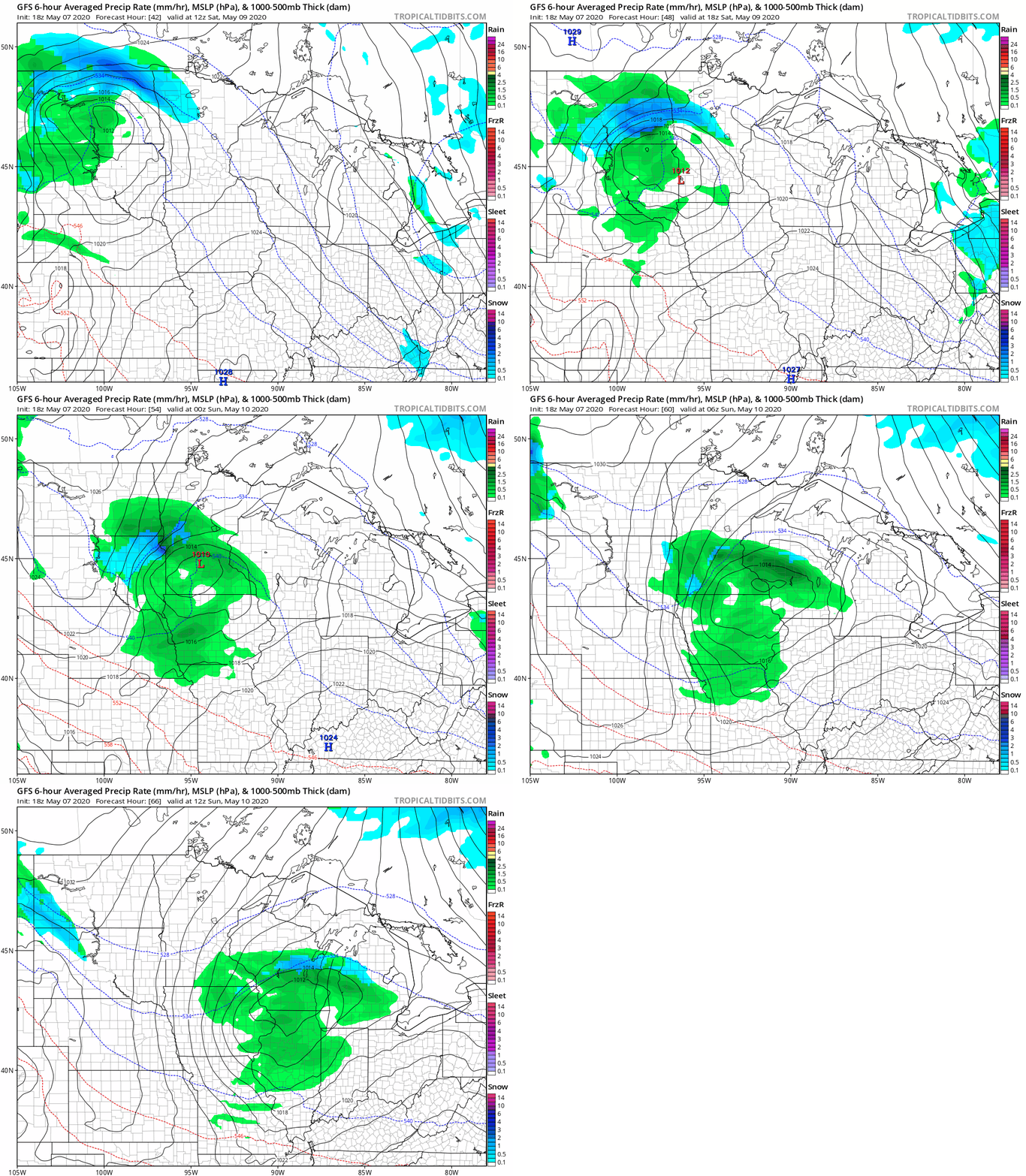
Mom may enjoy a few fleeting peeks of sun through the cloud deck Sunday.
Warming trend next week
The upper air forecast charts continues to advertise warmer air masses next week. Phase l arrives with a more westerly Pacific flow next Wednesday.
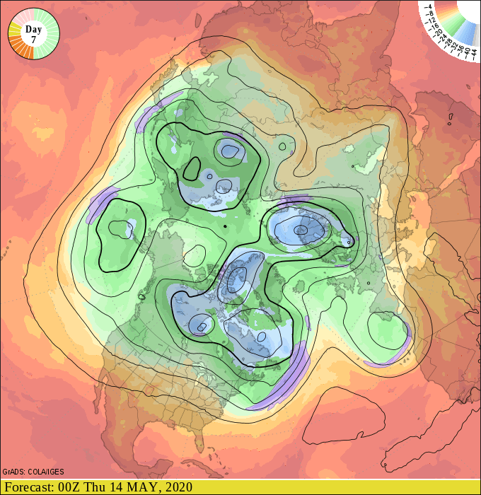
Phase ll appears ready to bring the warmest air mass of 2020 so far into Minnesota leading up to Memorial Day weekend.
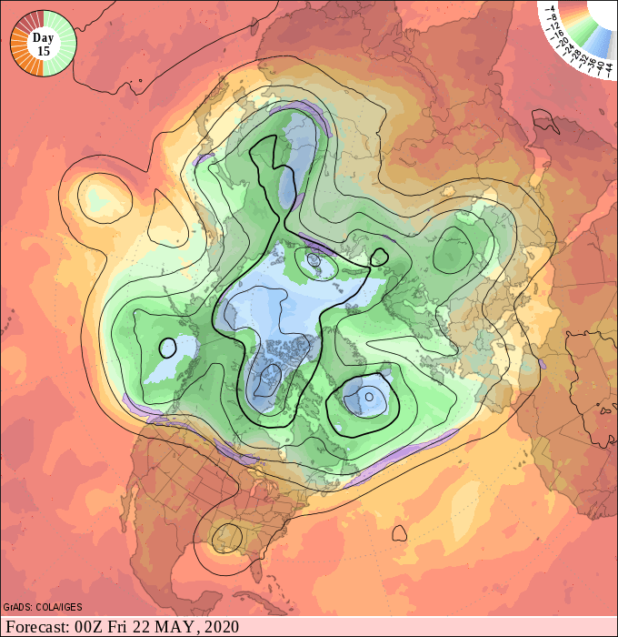
If this pattern verifies, it would likely push temperature into the 80s across parts of Minnesota for the first time this year.
Show me.

