
Instant summer? Medium-range outlooks trending warm
An upper air pattern change brings the warmest air of 2020 so far to Minnesota next week

Go Deeper.
Create an account or log in to save stories.
Like this?
Thanks for liking this story! We have added it to a list of your favorite stories.


We live at the mercy of the wind in Minnesota.
Our position in the center of the continent with no physical obstructions (mountains) means air masses sweep freely from all directions across Minnesota.

And this time of year when winds turn southerly, warmer and humid maritime tropical air masses can sweep in quickly from the Gulf of Mexico.
Upper air pattern change
The upper winds across North America drive weather patterns here on the ground where we live. Take a look at the forecast upper air maps for next week. The bulging lines across southern Canada show a ridge of warm high pressure setting up in the upper atmosphere.
Turn Up Your Support
MPR News helps you turn down the noise and build shared understanding. Turn up your support for this public resource and keep trusted journalism accessible to all.

This pattern brings summery air into the Upper Midwest this time of year.
From winter to summer in a week
Don’t like the weather in Minnesota? Just wait a week. Temperature output for next week pumps 80s into Minnesota. The Canadian model shows 80s by Tuesday.

The European model brings peak warmth Wednesday. It cranks out 87 degrees for the Twin Cities on May 20.

Humid, too
Check out the dew point readings next week. NOAA’s GFS model pumps dew point into the 60s and 70s into Minnesota as early as Monday evening.

Warmth here to stay?
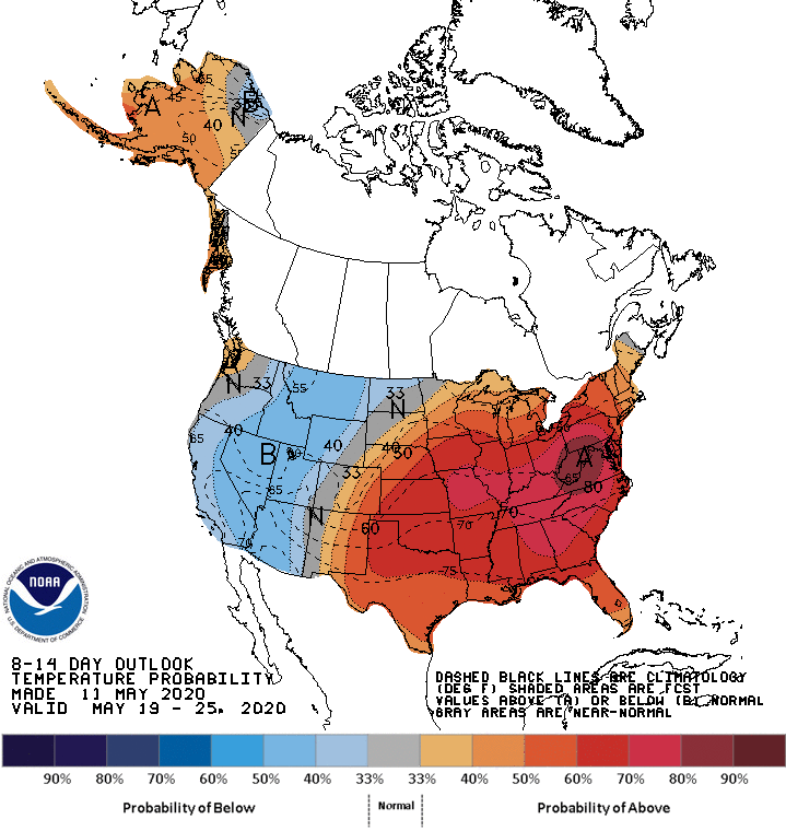
Temperatures may moderate again later next week. But the medium-range temperatures outlooks favor warmer than average temperatures overall through the Memorial Day weekend.
We’re due.

