
Major warming trend: From furnace to AC in a week?
Freeze warnings again Monday night. 70s and 80s into Minnesota next week. With tropical humidity.
Go Deeper.
Create an account or log in to save stories.
Like this?
Thanks for liking this story! We have added it to a list of your favorite stories.


Get ready for some big weather changes in the next week across Minnesota.
Our weather goes from freezing to lake weather in the next week. Our warming trend is gradual this week. But then forecast models insist on a gush of warmer, and more humid air blowing into Minnesota.
First, one more freeze for much of Minnesota. The Twin Cities escaped widespread frost as a cloud deck held temperatures up to 39 degrees at MSP Airport this morning. We may not be so lucky tonight.
Freeze warnings are in effect once again for the blue zones below.
Turn Up Your Support
MPR News helps you turn down the noise and build shared understanding. Turn up your support for this public resource and keep trusted journalism accessible to all.

201 PM CDT Mon May 11 2020
...FREEZE WARNING IN EFFECT FROM MIDNIGHT TONIGHT TO 9 AM CDT TUESDAY...
* WHAT...Sub-freezing temperatures in the upper 20s to lower 30s
expected.
* WHERE...Portions of west central Wisconsin and central, east
central, south central, southeast, southwest and west central Minnesota.
* WHEN...From midnight tonight to 9 AM CDT Tuesday.
* IMPACTS...Frost and freeze conditions will kill crops, other sensitive vegetation and possibly damage unprotected outdoor plumbing.
What’s the perfect recipe for freezing temperatures in Minnesota? Clear skies, light winds and low dew points. It’s all in place tonight as temperatures plummet after sunset tonight. Lows tumble into the teens in northern Minnesota. Temperatures hover around freezing in the Twin Cities Tuesday morning.
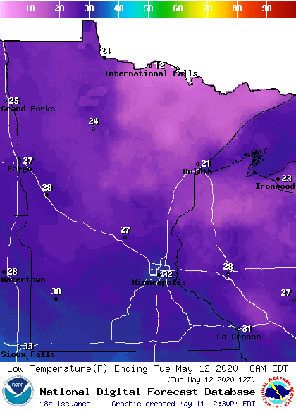
The only hope for preventing a widespread freeze in the Twin Cities are the shorter nights now.
It’s possible we may challenge some record lows Tuesday morning across Minnesota. The record low at MSP Airport Tuesday morning is 28 degrees.
Warming trend this week
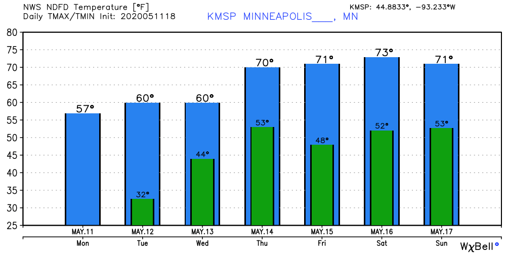
May returns to form this week as temperatures warm. Highs return to near 70 degrees by Thursday and through the weekend.
Wet Wednesday
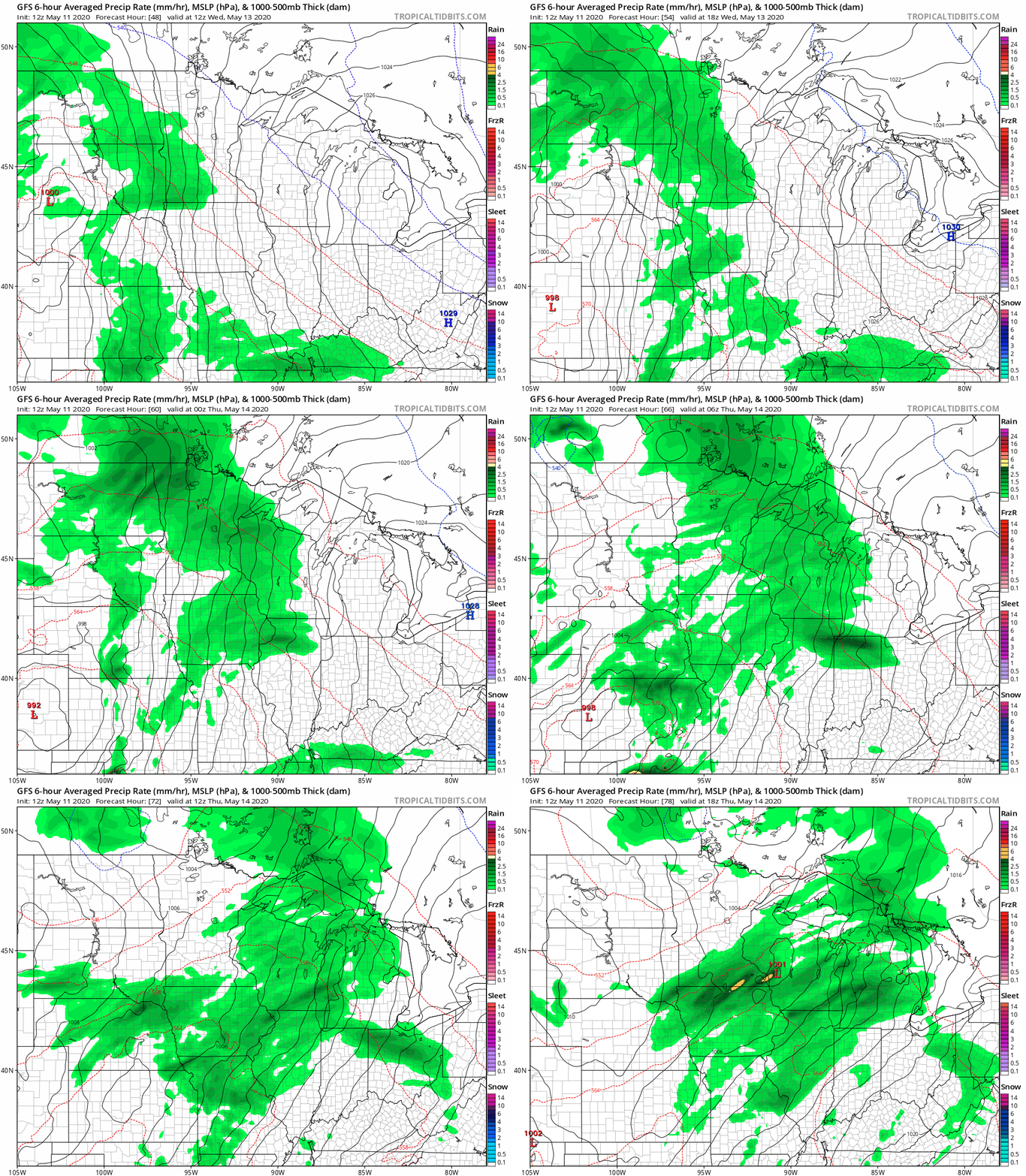
Wednesday looks like the wettest day this week. NOAA’s GFS model paints riving shower bands.
Summery next week
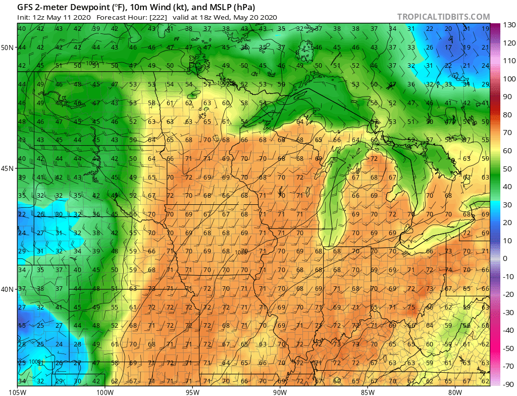
All major forecast models insist the warmest air mass of 2020 so far will blow into Minnesota next week. The only differences center on how warm. Models have been cranking out highs in the 70s and 80s, with a few approaching 90 degrees in southern Minnesota next week.

Next week’s summery air mass comes with the first shot of tropical humidity. Forecast models paint dew points int he 60s and 70s across Minnesota next week.
Get ready, here it comes.

