
Drought monitor: 51 percent of Minnesota now abnormally dry
Southern Minnesota has been wet, near-drought conditions north of the Twin Cities
Go Deeper.
Create an account or log in to save stories.
Like this?
Thanks for liking this story! We have added it to a list of your favorite stories.


There’s been plenty of rain on lawns and fields in the Twin Cities and southern Minnesota. But much of central and northern Minnesota is trending abnormally dry according to this week’s latest U.S. Drought Monitor.
Fifty-one percent of Minnesota is now listed as abnormally dry — up from just 28 percent last week. You can see the yellow dry swath running from the Canadian border through central and western Minnesota.
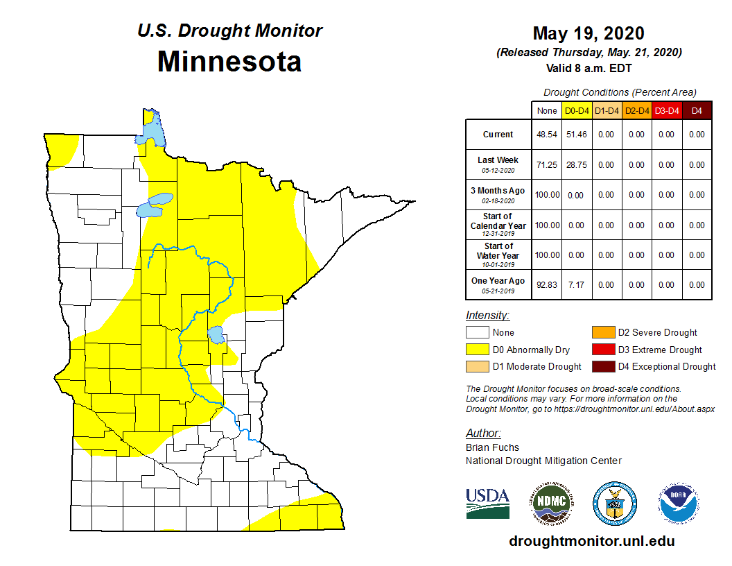
A small sliver of southeast Minnesota is also listed as abnormally dry.
Running dry
The latest 30-day precipitation departure map from the Midwest Regional Climate Center shows that most of central and northern Minnesota have received just 10 to 50 percent of average precipitation in the past month.
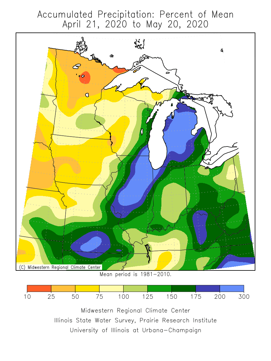
Duluth and International Falls are running more than 2 inches below average precipitation since March 1. Also, note the green zone across the Twin Cities. The Minneapolis-St. Paul International Airport has picked up 3.66 inches of rain in the past week. That’s about an inch above average for May so far.
Weekend rainfall
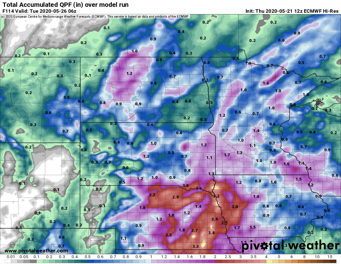
Occasional showers and thunderstorms will bring rain to much of Minnesota this weekend. Many locations could pick up a half inch to 1 inch.
Turn Up Your Support
MPR News helps you turn down the noise and build shared understanding. Turn up your support for this public resource and keep trusted journalism accessible to all.

