
Heat on the horizon? 80s to near 90 next weekend?
Forecast models teasing us again with heat in about nine days
Go Deeper.
Create an account or log in to save stories.
Like this?
Thanks for liking this story! We have added it to a list of your favorite stories.


Here we go again.
The forecast models are teasing us again with notions of the first significant summer hot spell in about eight to 10 days.
Blocking pattern ahead?
The upper air forecast maps suggest a possible blocking pattern setting up across the central U.S. in about a week. NOAA’s GFS model build a ridge of high pressure aloft over the Upper Midwest by next Sunday.
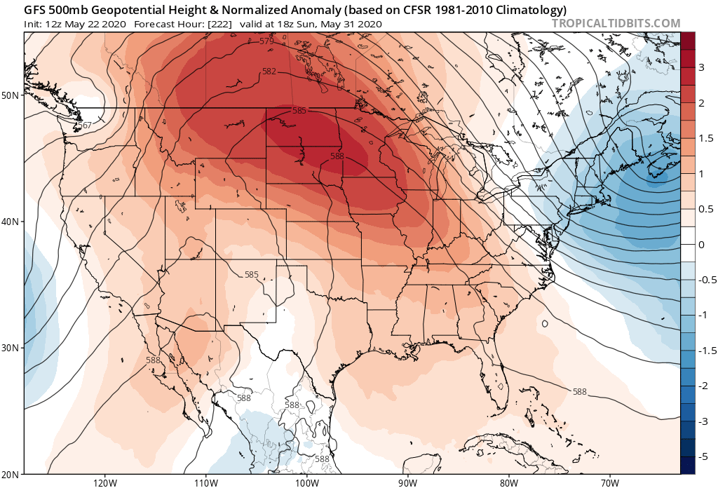
If this pattern evolves, the first significant batch of summery heat will build across the central U.S.
Turn Up Your Support
MPR News helps you turn down the noise and build shared understanding. Turn up your support for this public resource and keep trusted journalism accessible to all.
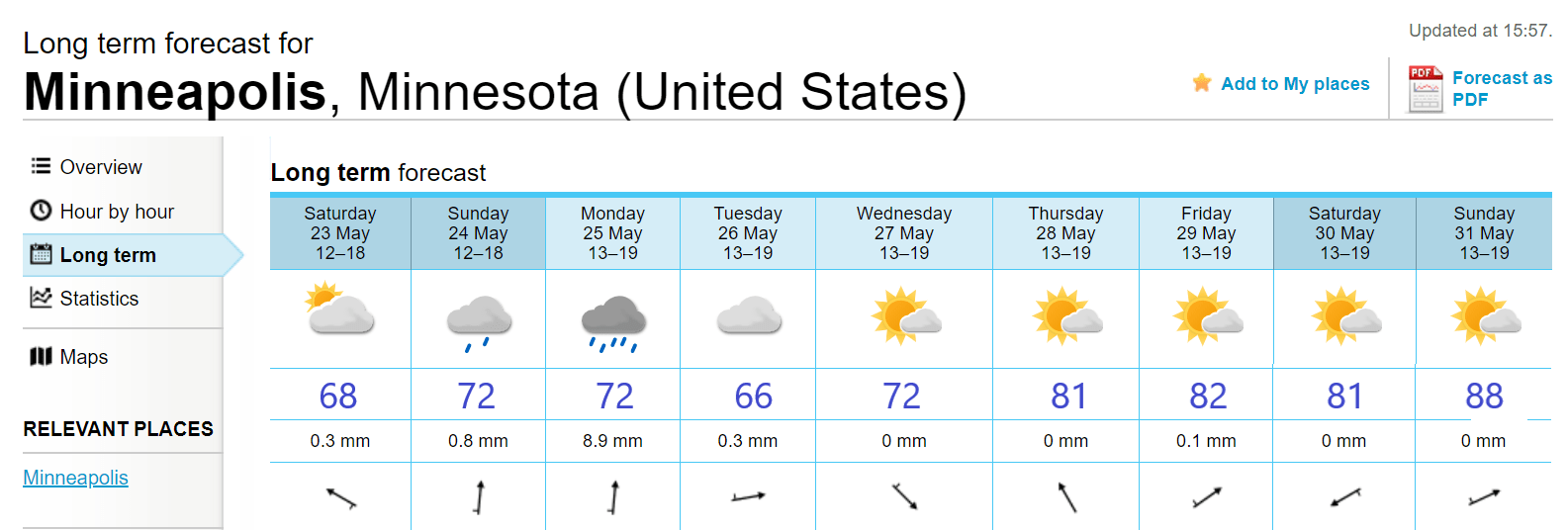
European model is warm
The usually trusty European model is cranking out highs into the upper 80s by the last weekend in May.
NOAA’s week 3-4 temperature outlook also favors warmer than average conditions across the Upper Midwest.
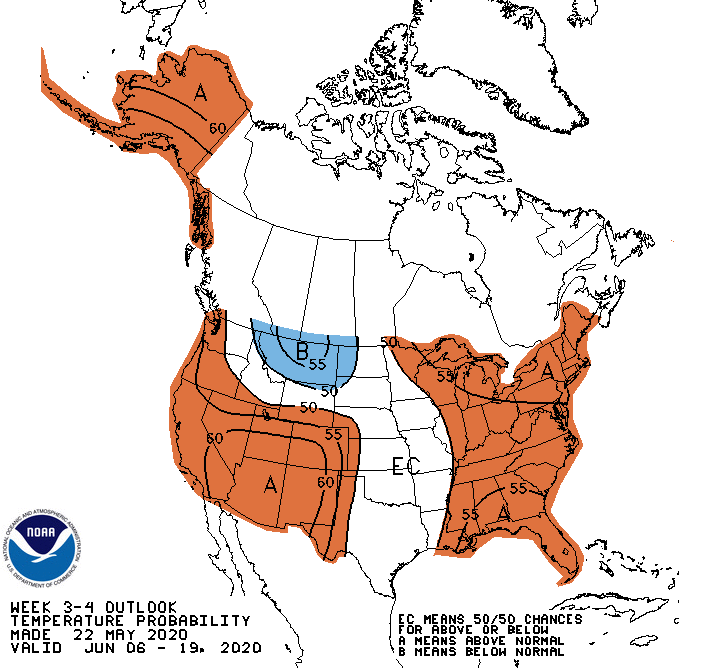
The forecast models overpredicted warm temperatures for this week. Let’s see how next week’s prediction verify.
Stay tuned, and have a great long weekend Minnesota!

