
Mixed bag: More dry than rainy hours this weekend
Highs in the 70s for most of Minnesota
Go Deeper.
Create an account or log in to save stories.
Like this?
Thanks for liking this story! We have added it to a list of your favorite stories.


Welcome to the first big holiday weekend and the unofficial start of summer in Minnesota.
This weekend brings a mixed bag of dry and rainy hours. The good news? We’ll enjoy many more dry than rainy hours this weekend. We’ll also see abundant cloud cover, and fewer hours of sunshine.
Rain timing
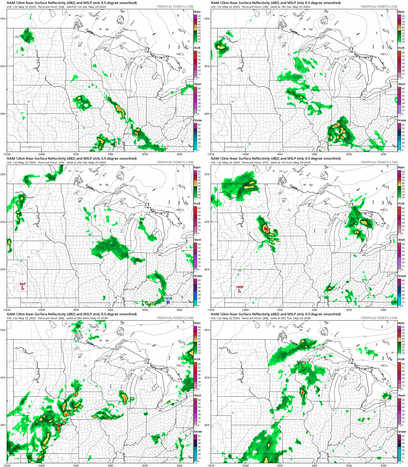
I’ll be honest. The forecast models are not helping us time out specific rainfall zones and timing this weekend. The best chances for rain and thunder appear to be Sunday afternoon, and again Monday.
NOAA’s NAM model grasps the concept of spotty pop-up showers Saturday, with the chance for a band of stronger thunderstorms rumbling across southern Minnesota Sunday afternoon. Then, a few more showers Memorial Day. We’ll have to walk and boat between the raindrops this weekend. But there will be opportunities.
Turn Up Your Support
MPR News helps you turn down the noise and build shared understanding. Turn up your support for this public resource and keep trusted journalism accessible to all.
Mostly 70s
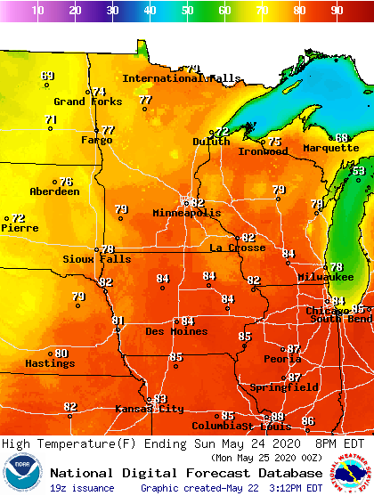
It’s interesting how temperatures are so sunshine dependent this time of year. Areas that hang onto clouds all day will hover in the 70s. A couple hours of afternoon sun? Our air mass is warm enough to shoot up toward 80 degrees.
If we get enough sun, the best chance for hitting 80 degrees this weekend looks like Sunday afternoon.
Warmer days ahead?
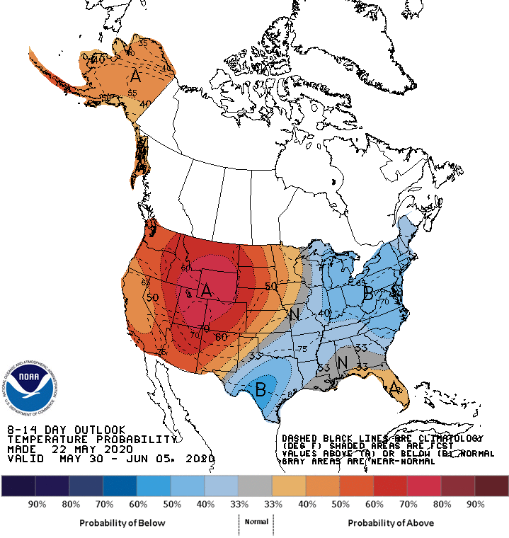
The forecast models keep teasing us with notions of warmer temperatures ahead. The upper air pattern continue to favor warmer air as we approach early June.

NOAA’s eight- to 14-day outlook favors a building heat dome in the western U.S. that could spill into Minnesota around June 1.
Stay tuned.

