Hot front: 90s arrive; tracking severe storm risk Tuesday
Temperatures hit 97 degrees in western Minnesota Monday.
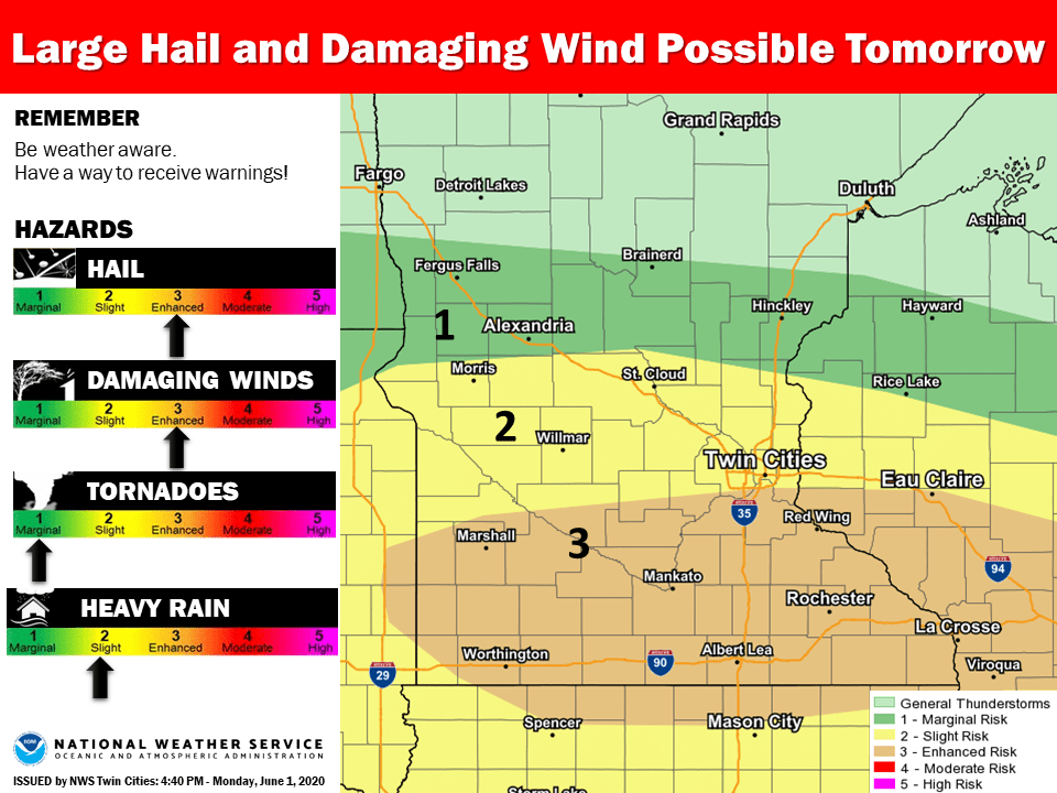
Well, that escalated quickly.
Much of southern and western Minnesota felt our first 90-degree heat of the summer Monday. The hottest air mass of the year so far pushed north to the Canadian border Monday afternoon.
Temperatures hit 97 degrees at Ortonville and Appleton in western Minnesota Monday afternoon.
Our early June heatwave extends into Tuesday. Look for another day with highs into the 90s across southern Minnesota.
Create a More Connected Minnesota
MPR News is your trusted resource for the news you need. With your support, MPR News brings accessible, courageous journalism and authentic conversation to everyone - free of paywalls and barriers. Your gift makes a difference.
Tuesday severe risk
Severe weather risk increases Tuesday afternoon and evening across Minnesota. NOAA’s Storm Prediction Center’s (SPC) latest update maintains an enhanced risk for severe storms across southern Minnesota Tuesday afternoon and evening.
Here’s the language from NOAA’s SPC.
Supercells may initially develop near a triple point over southeast SD east/northeast along the surface boundary across southern MN. Thermodynamic and shear parameters will support storms initially capable of very large hail (some potentially bigger than 2 inches in diameter), and damaging gusts.
Here’s more insight from the Twin Cities NWS office in their Monday afternoon forecast discussion.
The main concern is exactly where the storms will initiate and progress, and this is dependent on how far north-or-south the cold front stalls out. However, the storm mode looks to start out as discrete cells in southwestern and western MN during the early afternoon hours. Model helicity values do support the potential for isolated tornadoes, particularly close to the front, at the start of the event along with deep growth for large hail. As the event unfolds, the mode is likely to transition to one of lines of storms (bowing segments) as outflows take over the push the storms east. This will make all hazards of severe weather in play: large hail, damaging winds and isolated tornadoes. SWODY2 maintained the Enhanced Risk of severe weather for much of the area, mainly along and south of I-94, which is completely reasonable.
There is still some question in my assessment as to precisely where storms will form Tuesday. Several models suggest the main focus for severe cells could be just south of the Twin Cities.
One important note. Forecasting convective severe weather in summer is often an hour-by-hour process. Pay close attention to evolving forecasts, watches, and warnings Tuesday across central and especially southern Minnesota.