
Free AC now; steamy forecast ahead next week
Tracking tropical heat and humidity again next week
Go Deeper.
Create an account or log in to save stories.
Like this?
Thanks for liking this story! We have added it to a list of your favorite stories.


Push-pull. That’s how you might describe Minnesota weather in a nutshell.
We live in one of the most changeable weather zones on the planet. Fronts of all shapes and sizes sweep through Minnesota at will. Windy and cooler today? Hot and steamy next week.
Lather, rinse, repeat.
Heat builds next week
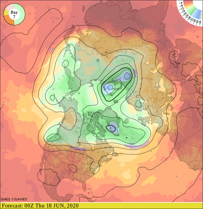
Meteorologists pay special attention to upper air forecast charts in the one to two-week range. They often reveal important clues about changes in future weather patterns. The position of large waves in the upper atmosphere drive weather patterns here on the ground.
Turn Up Your Support
MPR News helps you turn down the noise and build shared understanding. Turn up your support for this public resource and keep trusted journalism accessible to all.
The upper air charts for next week suggest another bubble of hot high pressure developing across the central U.S.
90s return
It’s going to get hot again next week. The big question today is, how hot?
Many meteorologists have noted that NOAA’s recent upgrade of its bellwether GFS model shows a strong cold bias. I’ve observed several instances where the GFS temperature output for Minnesota seems much colder than the actual weather.
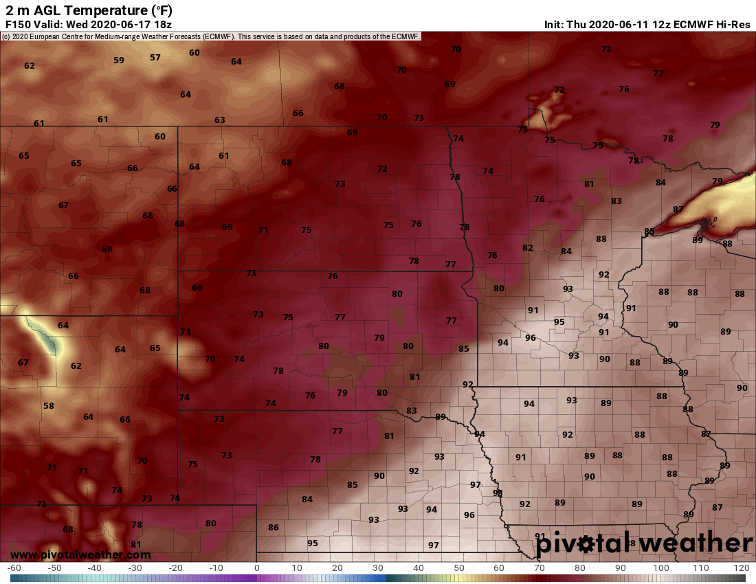
I’m leaning toward the European model solutions next week. The usually trusty (but not perfect) Euro suggest highs well into the 90s across a big chunk of Minnesota next Tuesday and Wednesday.
Here’s Tuesday’s Euro temperature forecast.
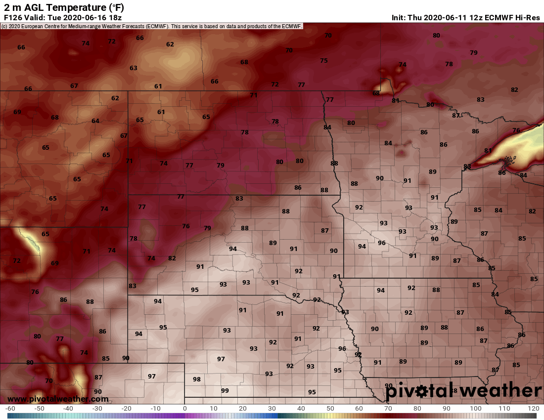
Note that these maps are the 1 p.m. temperature output. The typical daily maximum temperature this time of year usually occurs closer to 4 pm. You can probably add 2 to 4 degrees to these numbers to assess the daily high temperature.
Here is the Wednesday map.
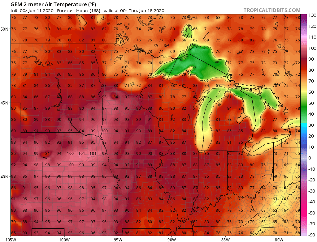
The Canadian model is similar with the magnitude of temperatures next week. Note the temperatures approaching 100 degrees along the Minnesota River Wednesday.
Warm June
June temperatures are running 8.5 degrees warmer than average in the Twin Cities through the first 10 days. The core of heat so far this month is over southwest Minnesota, eastern Nebraska and western Iowa. Temperatures there are running more than 10 degrees warmer than average so far in June.
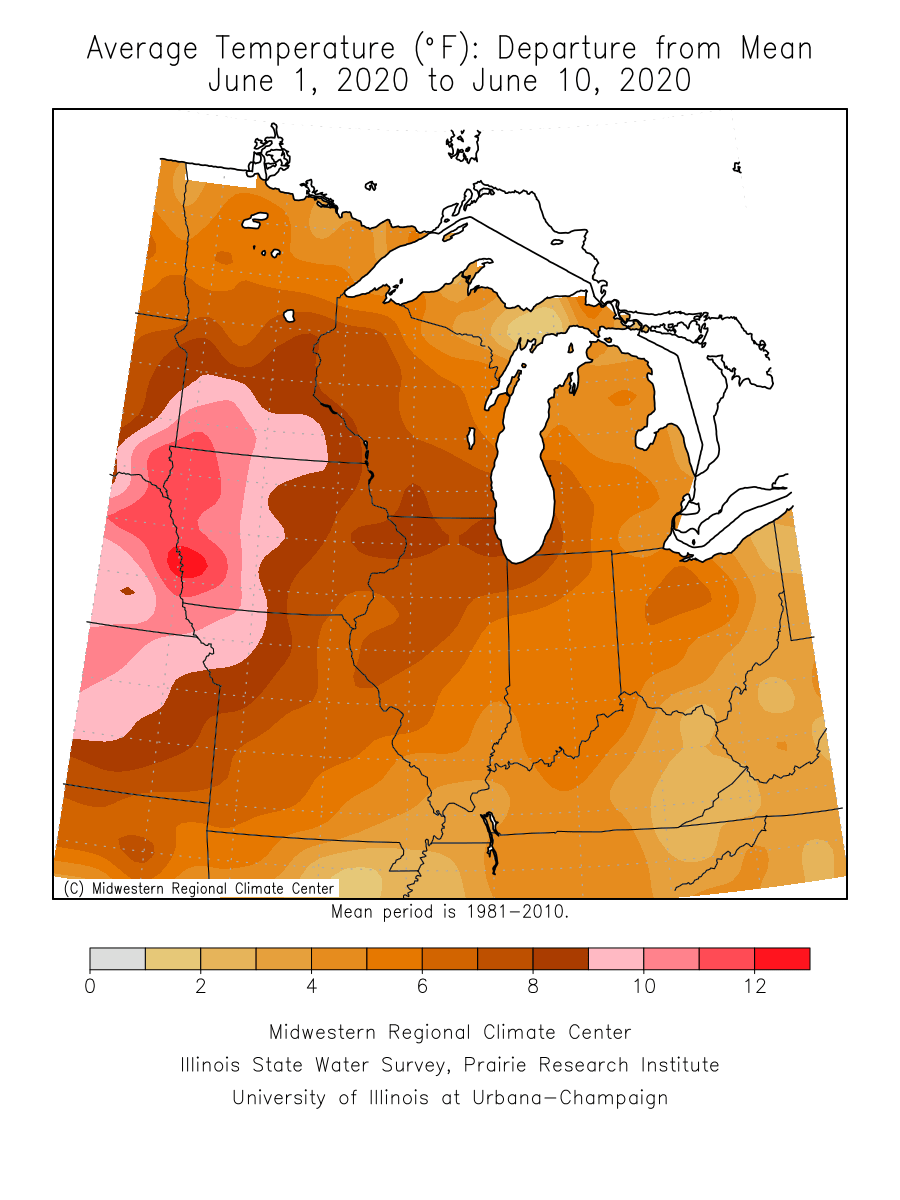
With 90s to near 100 again next week, June is likely to go into the weather books much warmer than average across the Upper Midwest.

