
Scattered thunderstorms north; drought persists in parts of MN
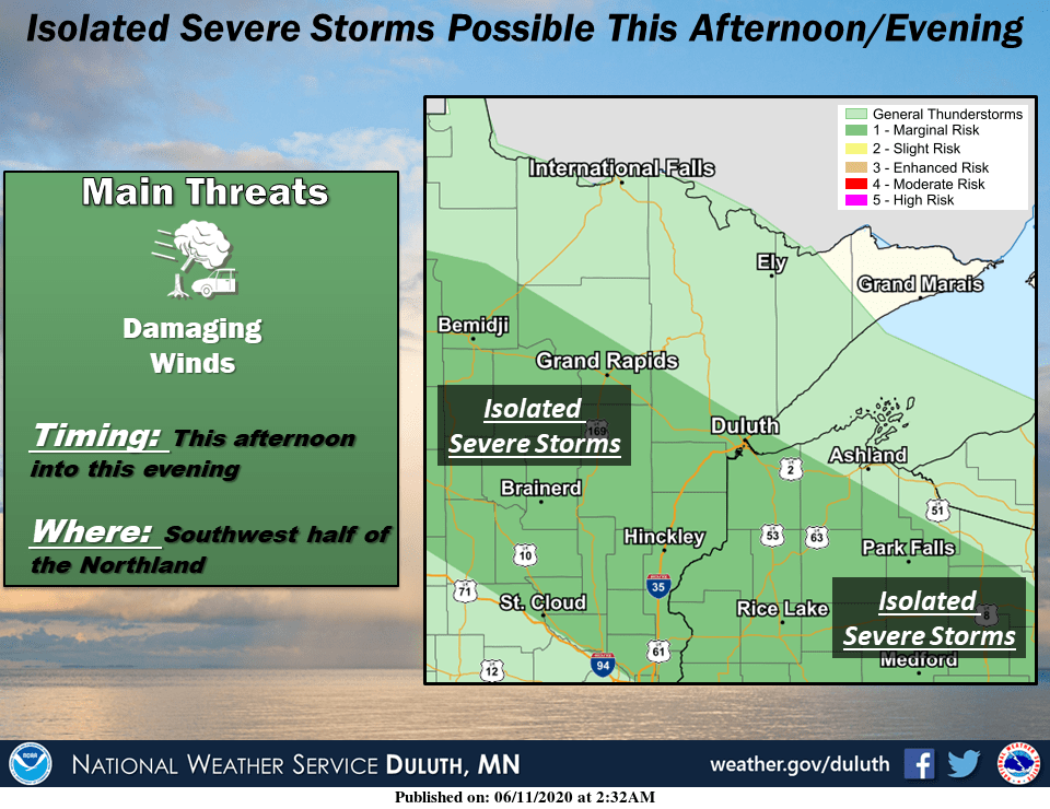
There is a marginal risk for a severe thunderstorm up north
Go Deeper.
Create an account or log in to save stories.
Like this?
Thanks for liking this story! We have added it to a list of your favorite stories.


Minnesota is one state. But we often have a variety of weather conditions.
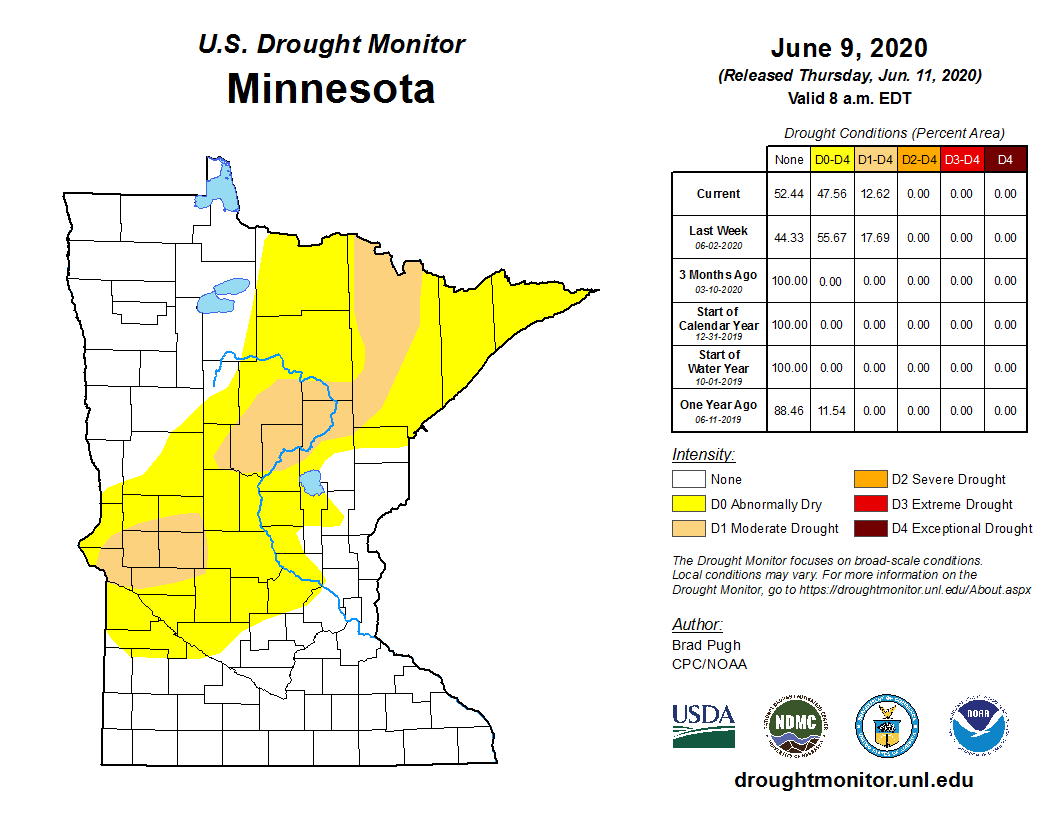
This spring is a classic example. Parts of southern Minnesota are soggy from several inches of rainfall. Parts of northern and western Minnesota are in moderate drought. All weather is local.
Scattered thunderstorms north
Our blustery mid-June atmosphere is unstable enough to trigger a few scattered showers and thunderstorms up north. NOAA’s HRRR model paints the zone of spotty showers moving quickly southeast this afternoon and evening.
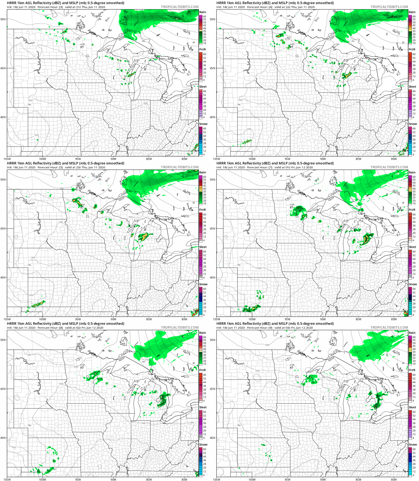
A few storms could approach severe limits. These quick-hitting storms could pack downpours, gusty winds, and hail today as they move in quickly from the northwest.
Turn Up Your Support
MPR News helps you turn down the noise and build shared understanding. Turn up your support for this public resource and keep trusted journalism accessible to all.
Remember, severe thunderstorm criteria are wind gusts of at least 58 mph, and hail 1-inch diameter or larger.
Classic June
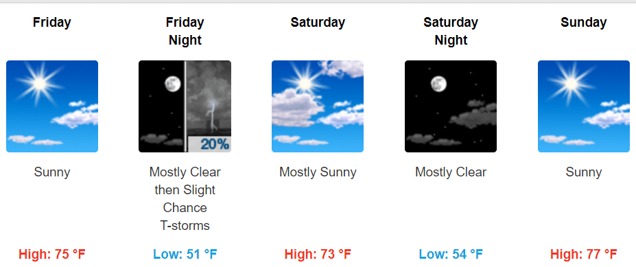
Our forecast looks spectacular as we move toward the weekend. Bright sin, blue skies, mild temperatures, and low humidity? Most Minnesotans will take it.
Drought persists
Areas of moderate drought continue to show up across western and northern Minnesota in Thursday’s updated U.S. Drought Monitor.
The forecast for the next week looks mostly dry up north in the drought zone.
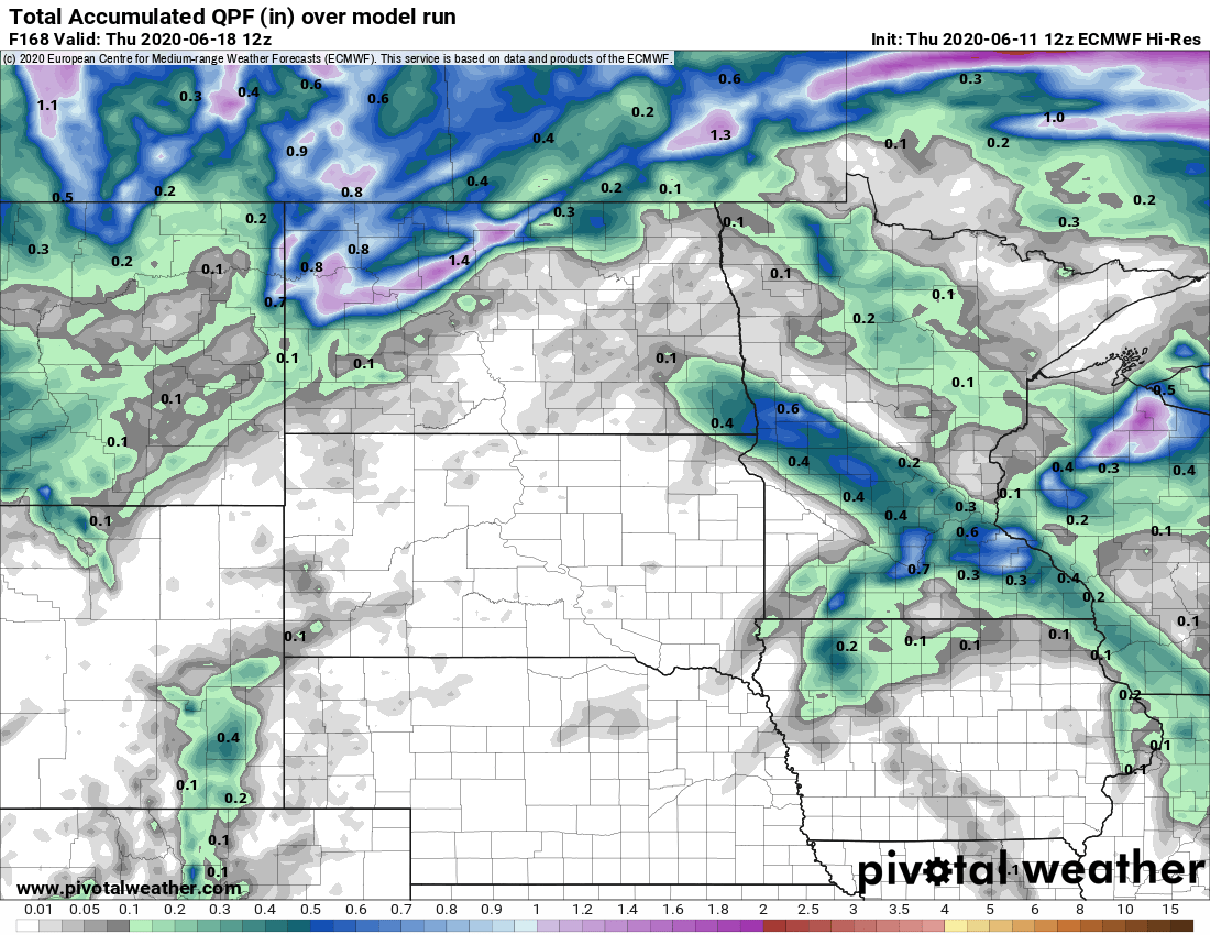
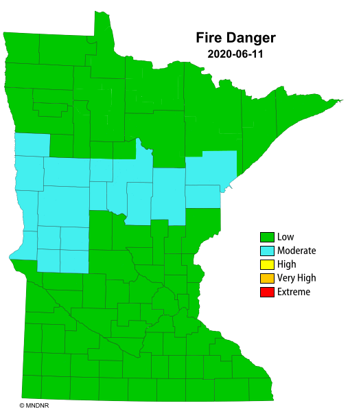
I’m getting a little concerned about increased fire danger up north if the trend continues.
Stay tuned.

