
Steamy and stormy: Timing weekend storm chances
Excessive heat warning Friday; heavy rainfall threat Saturday

Go Deeper.
Create an account or log in to save stories.
Like this?
Thanks for liking this story! We have added it to a list of your favorite stories.


Recipe for a Minnesota July weekend: One part heat, two parts humidity, a dash of thunder, a generous splash of heavy rainfall.
We’ll experience all of the above this weekend. The excessive heat warning kicks in for the greater Twin Cites area at noon Friday.

Timing weekend thunderstorms
A few scattered thunderstorms will favor western into central Minnesota Friday night and Saturday nights. A few models suggest thunderstorms could reach the Twin Cities early Friday morning.
Another wave of storms will likely move from the eastern Dakotas Friday night into Saturday morning. The storm threat favors the Twin Cities late Saturday afternoon through evening.
Turn Up Your Support
MPR News helps you turn down the noise and build shared understanding. Turn up your support for this public resource and keep trusted journalism accessible to all.
NOAA’s NAM 3 km resolution model captures the essence of chaotically scattered storm clusters this weekend.
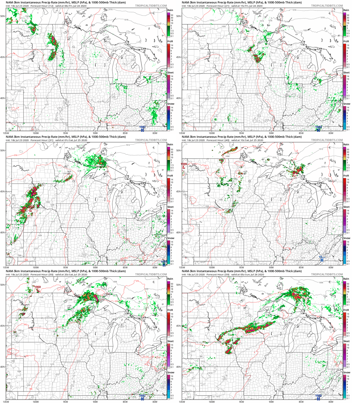
Don’t take coverage and timing in the above model loop as gospel, but use it to get a sense for the thunder threat.
Heavy rainfall threat
The highest threat zone for heavy, flooding rainfall appears to favor central Minnesota and possibly areas near the Twin Cities this weekend.

Stay alert for storms late Saturday that could produce flooding rains.

