Severe drought in Duluth area
Extreme dew points and scattered storms this weekend
Go Deeper.
Create an account or log in to save stories.
Like this?
Thanks for liking this story! We have added it to a list of your favorite stories.


Midsummer in Minnesota. Heat. Humidity. Scattered storms. Drought.
The chaotic nature of summer rainfall is evident in Minnesota this season. In the past few weeks, north-central Minnesota has picked up abundant, drought-busting rainfall. But the most beneficial rains have largely missed some areas around Duluth.
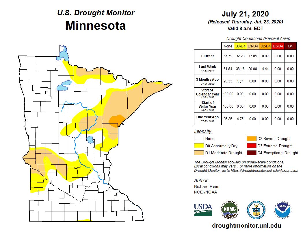
Duluth and the surrounding area remain in the severe drought category in this week’s U.S. Drought Monitor. The North Shore remains in moderate drought.
Several inches
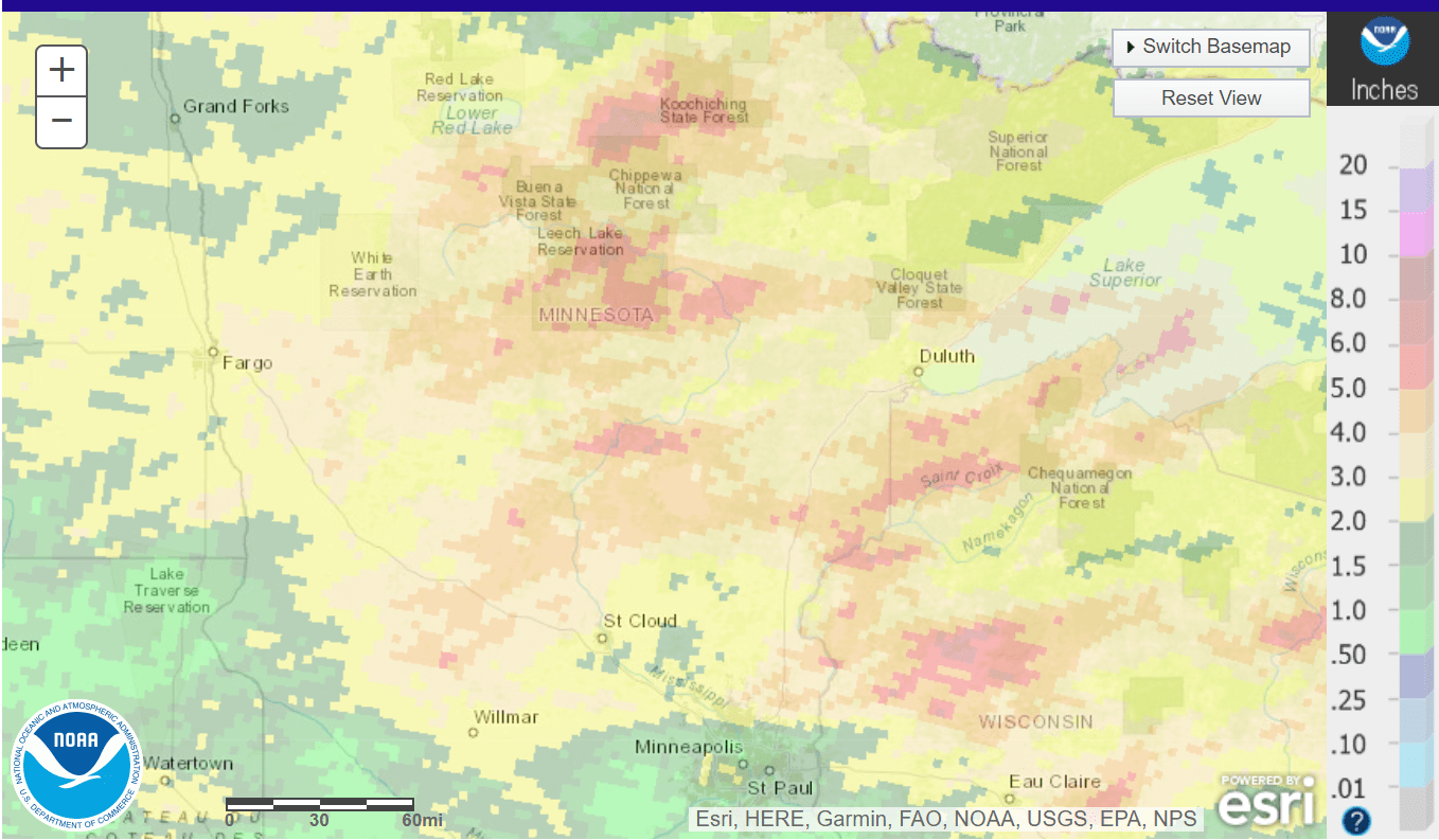
Many locations in northern Minnesota have recorded 3 to 6 inches of rain in the past month. That’s helped shrink the drought zone substantially. Here’s NOAA’s rainfall analysis for the past 30 days.
Turn Up Your Support
MPR News helps you turn down the noise and build shared understanding. Turn up your support for this public resource and keep trusted journalism accessible to all.
Timing weekend storms
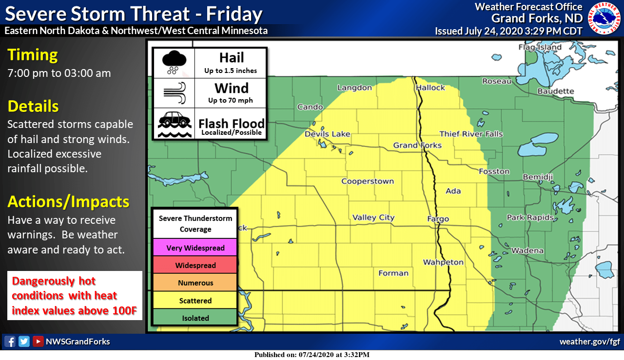
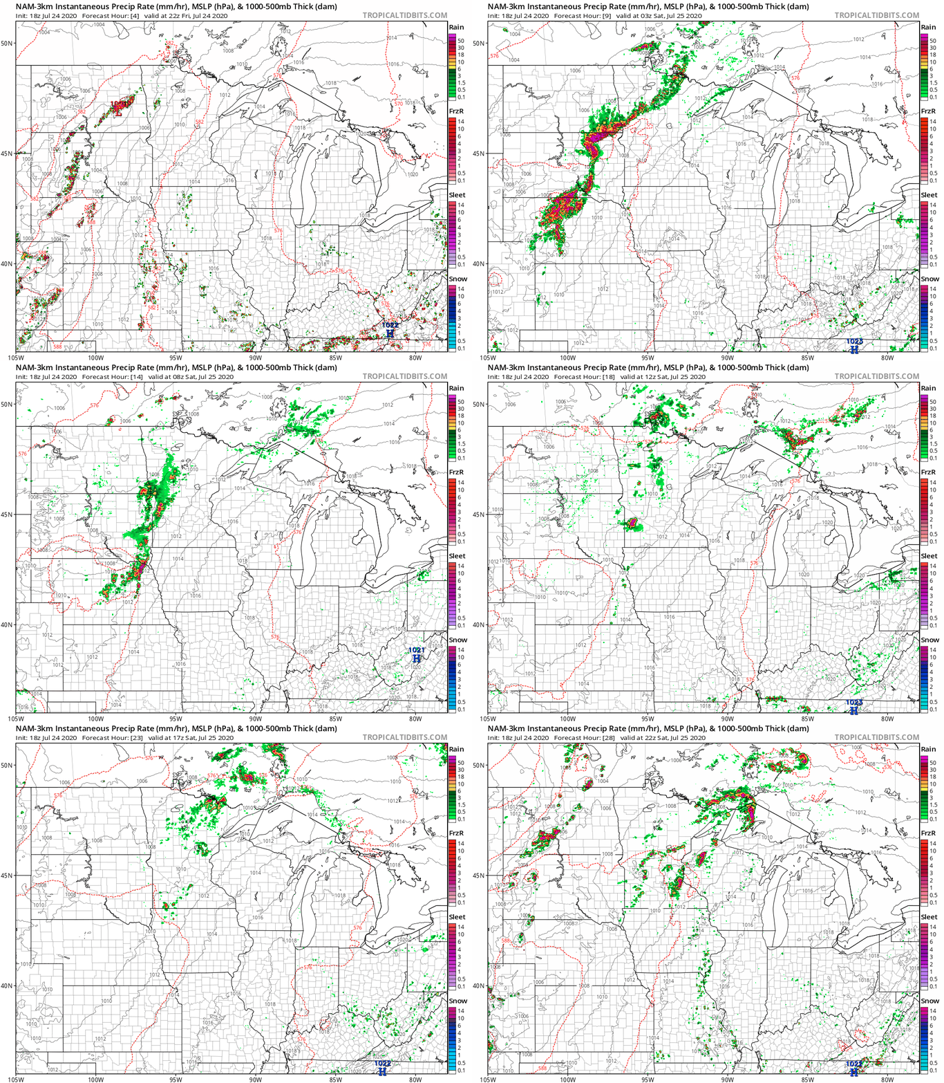
Storm coverage this weekend will remain chaotic across Minnesota. The Red River Valley through north-central Minnesota is the focus Friday night into Saturday morning.
NOAA’s NAM 3 km resolution model tracks explosive thunderstorm development across the Red River Valley and northwest Minnesota Friday night. It also depicts scattered storms developing near or just southeast of the Twin Cities late Saturday.
Heavy rainfall threat
Our air mass over Minnesota is rich with deep tropical moisture. Dew points once again hit 80 degrees Friday. NOAA’s GFS model cranks out dew points around 80 degrees again Saturday. This time it looks like the deepest tropical moisture will pool across southern Minnesota, and near the Twin Cities.
How lovely.
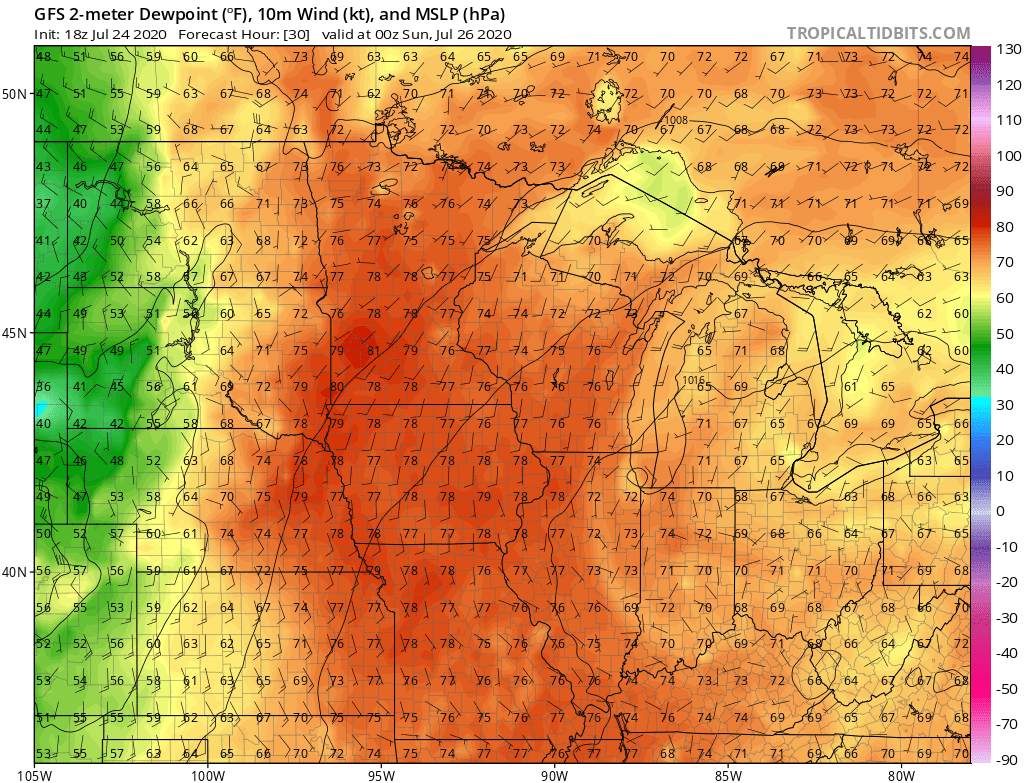
Slow-moving storms in a deep moisture pool can produce torrential rainfall. The risk for flooding rains is there this weekend.
Excessive heat warning
As I type this post, Hallock in northwest Minnesota records a heat index of 113 degrees Friday afternoon. Yes, I consider that excessive.
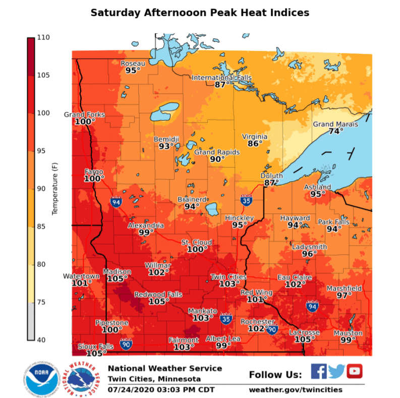
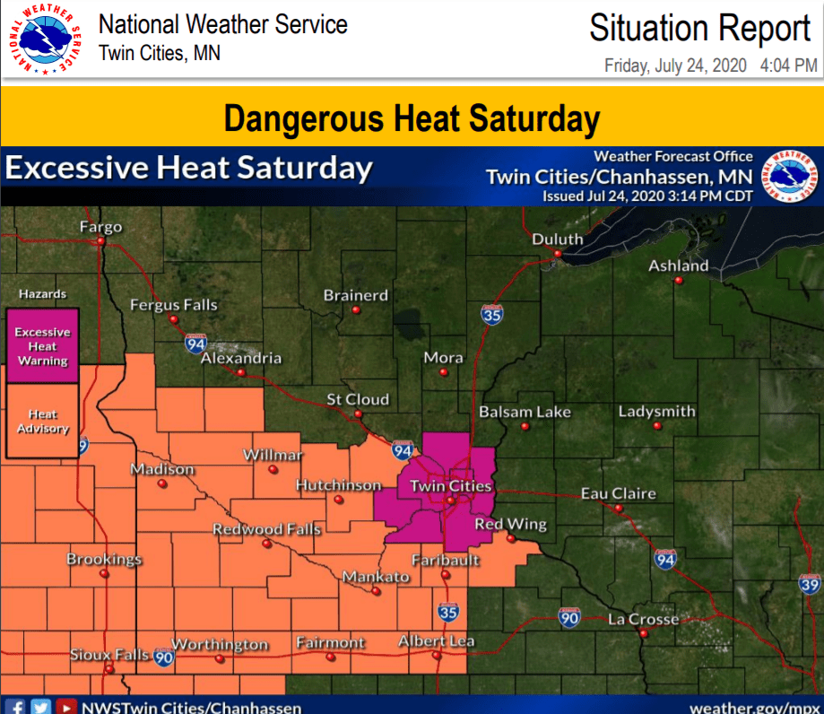
The heat focus shifts south Saturday. Excessive heat warnings and heat advisories are flying again Saturday.
Stay cool, and keep an eye out for weekend storms.