
Pleasantly stable weather pattern continues; thunder threat Saturday
Tropical threat for Florida this weekend?
Go Deeper.
Create an account or log in to save stories.
Like this?
Thanks for liking this story! We have added it to a list of your favorite stories.


Our quiet, stable weather pattern continues over Minnesota through Friday.
On the weather maps, weak high pressure continues to provide mostly fair weather across Minnesota through Friday. By Friday night, a front begins to creep into northwest Minnesota.

Highs continue to run in the low to the mid-80s across Minnesota this week, with some 70s in northeast Minnesota.

Tropical moisture lurking just south
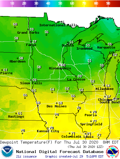
Dew points across Minnesota remain very comfortable in the 50s and low 60s. But that deep tropical moisture we sweated through the past few weeks is not far away. I see dew points in the upper 70s down Interstate 35 in southern Iowa. A little of that moisture may be sucked north ahead of an approaching front Saturday.
Turn Up Your Support
MPR News helps you turn down the noise and build shared understanding. Turn up your support for this public resource and keep trusted journalism accessible to all.
Saturday thunder threat
Said front crosses Minnesota from northwest to southeast Saturday. NOAA’s GFS model captures the notion of scattered thunderstorms along the advancing frontal zone Friday night to Saturday night in the loop below.
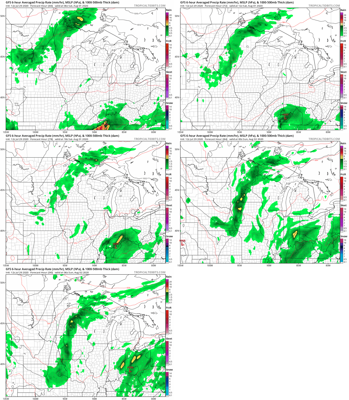
The highest chances for thunderstorms in the Twin Cities area favor Saturday late afternoon through evening.
Tropical system ahead for Florida?
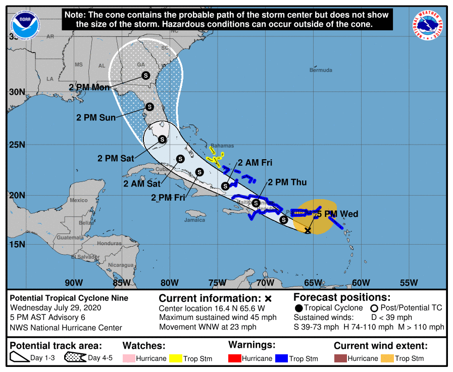
It’s still early so uncertainty is high about forecast track and intensity. But the suite of forecast models brings what will likely become Tropical Storm Isaias near the southeast U.S. coast by this weekend.
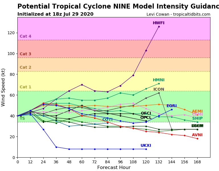
Most intensity forecasts retain Isaias a tropical storm, but a few push her to Hurricane strength.
Stay tuned.

