
Summery weather pattern returns
Warmer and more humid days ahead

Go Deeper.
Create an account or log in to save stories.
Like this?
Thanks for liking this story! We have added it to a list of your favorite stories.


Our early August respite from heat and humidity will fade soon.
Winds shift to a southerly direction across Minnesota the next few days. A warmer, more humid air mass blows our way as we move toward the weekend.
Air mass transition
One way to track a summer air mass transition across Minnesota is to watch the dew points.
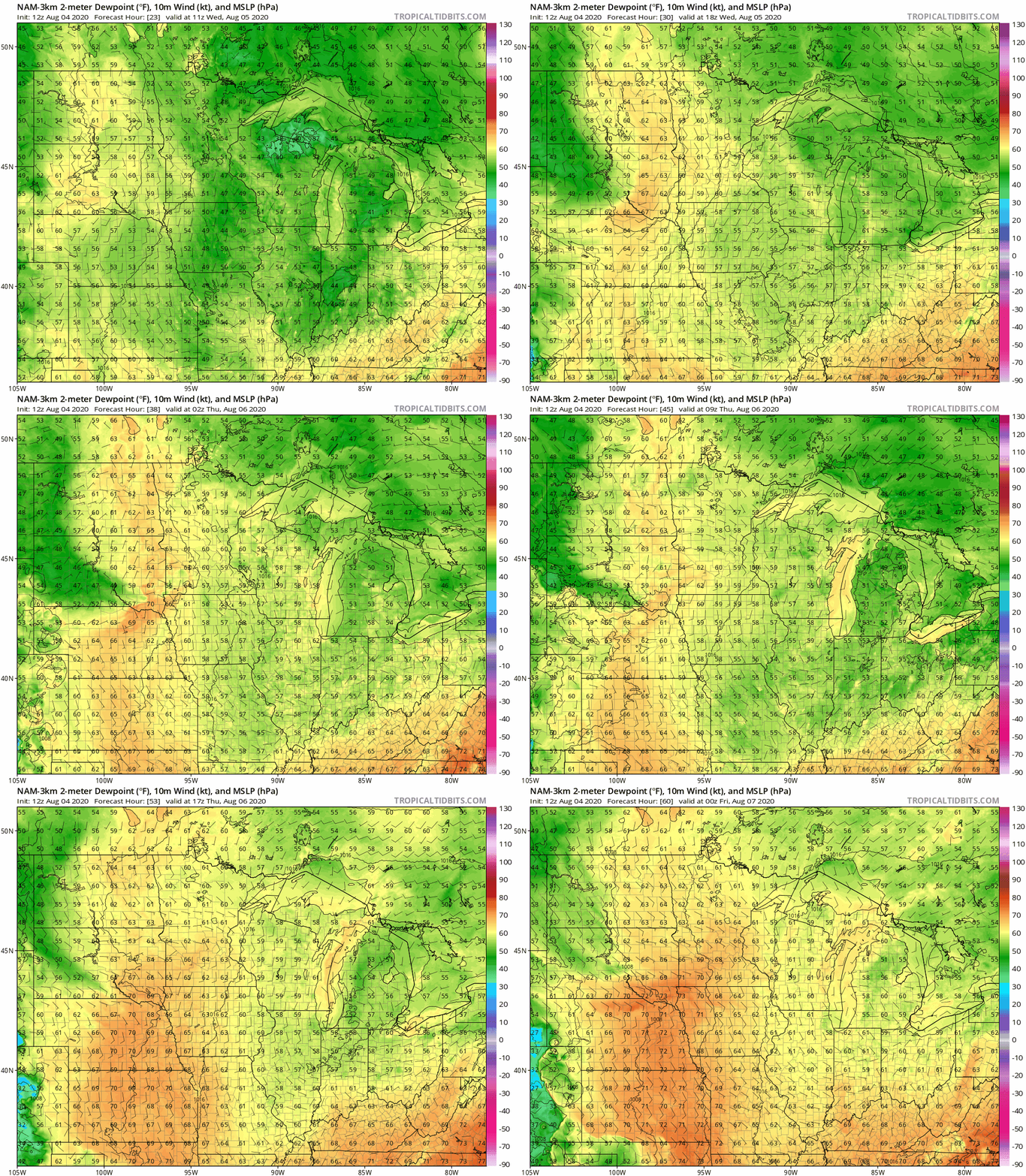
Check out this NOAA NAM 3 km resolution model dew point loop from Wednesday morning to Thursday evening. Watch as dry dew points in the 40s (green) are replaced by sticky dew points near 70 degrees (orange) by late Thursday.
Turn Up Your Support
MPR News helps you turn down the noise and build shared understanding. Turn up your support for this public resource and keep trusted journalism accessible to all.
Scattered thundershowers Wednesday
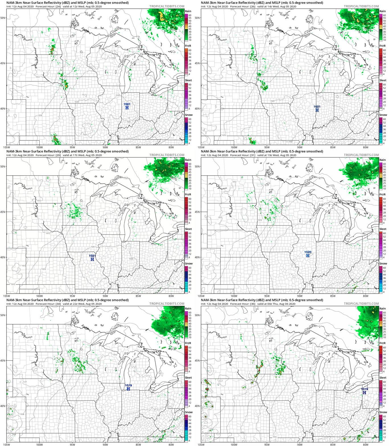
Higher moisture will trigger a few scattered showers and thundershowers Wednesday. There is a marginal (low) risk for a severe storm in southwest Minnesota Wednesday.
NOAA’s NAM 3 km resolution model depicts spotty hit or miss thundershowers Wednesday.
80s return
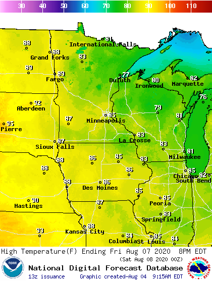
Most of Minnesota will enjoy highs in the 70s again Wednesday and Thursday. But highs push back into the 80s starting Friday through the upcoming weekend.
Mid-August heatwave?
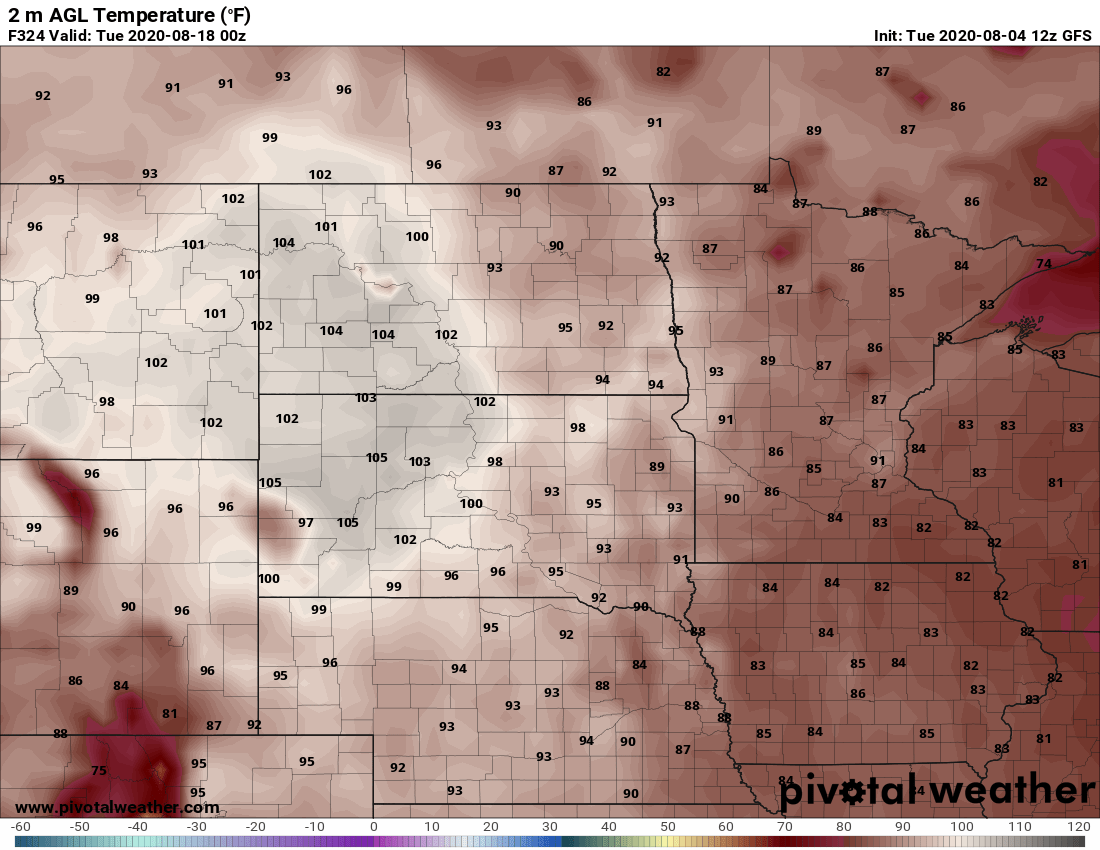
The medium-range forecast maps suggest another hot spell in mid-August.
Upper air forecast maps suggest a hot high-pressure dome building over the Rockies and spilling into the Upper Midwest.
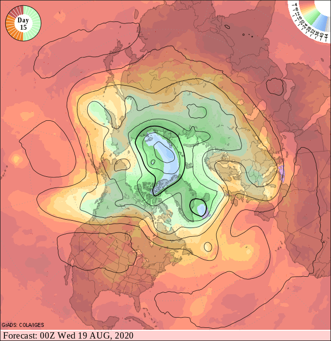
Early model output suggests temperatures above 100 degrees in the western Dakotas, with 90s spilling into Minnesota again in mid-August.
Stay tuned.

