
Sticky air mass fuels thunderstorms Friday night
Dew points near 70 degrees through Saturday in parts of Minnesota
Go Deeper.
Create an account or log in to save stories.
Like this?
Thanks for liking this story! We have added it to a list of your favorite stories.


Minnesota is getting our money’s worth in the summer of 2020.
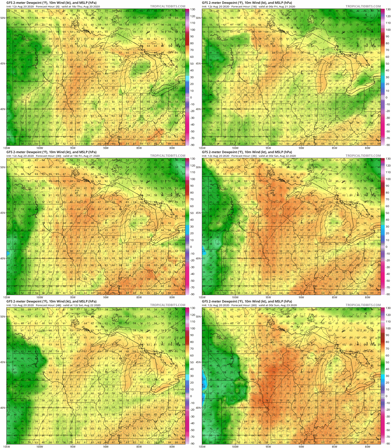
Another slightly sticky tropical air mass is pooling across the Upper Midwest. Dew points in the 60s are widespread. Dew points are hovering near 70 degrees in western Minnesota Thursday afternoon.

The moisture pool will hover over most of Minnesota through Saturday. Many of us will feel points near 70 degrees at some point in the next 48 hours. NOAA’s GFS model shows the tropical air mass holding firm through Saturday evening.
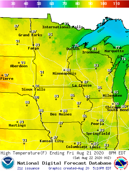
Highs through Saturday will run in the 80s across much of Minnesota with a few 70s up north. Highs reach the low 90s in southwest Minnesota Friday afternoon.
Scattered storms Friday night and Saturday
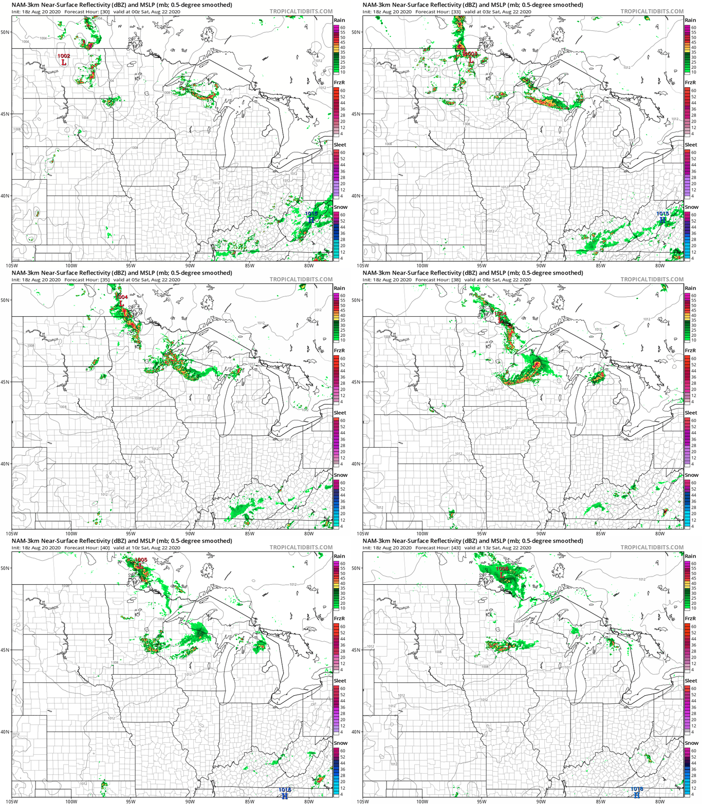
A weak cool front eases across Minnesota Friday night and Saturday. As it does, it will trigger a few showers and thunderstorms.
NOAA’s NAM 3 km resolution model suggests a few storms in western Minnesota Friday evening, then in eastern Minnesota late in the evening and the Twin Cities after midnight.
Turn Up Your Support
MPR News helps you turn down the noise and build shared understanding. Turn up your support for this public resource and keep trusted journalism accessible to all.

