
Fall-front ahead: Feeling 30 degrees colder next week?
Steamy tropical weather pattern gives way to September-like air mass next week.
Go Deeper.
Create an account or log in to save stories.
Like this?
Thanks for liking this story! We have added it to a list of your favorite stories.


Our currently steamy tropical air mass pushed the dew point to 76 degrees and the heat index to 100 degrees in the Twin Cities Tuesday afternoon.
But Minnesota’s other weather shoe is visible on the forecast maps. In our current late August weather context, the other shoe is a family of cold fronts ready to push south through Minnesota starting this weekend.
September begins 1 week from today. How. Did. That. Happen?
Jet stream changes
Turn Up Your Support
MPR News helps you turn down the noise and build shared understanding. Turn up your support for this public resource and keep trusted journalism accessible to all.
The jet stream is the driver of all things weather in Minnesota.
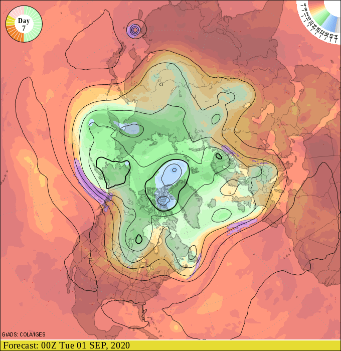
The upper air weather maps suggest the jet stream’s annual Canadian summer vacation comes to an end next week. The upper air forecast maps for early next week feature a chillier trough of low-pressure diving south into the Upper Midwest.
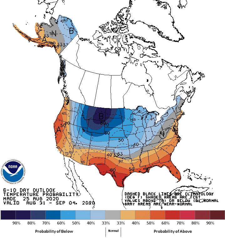
NOAA’s Climate Prediction Center grabs hold of the change with a big blob of blue colors strongly favoring below-average temperatures next week.
30 degrees colder
Heat index values pushed the 100-degree mark Tuesday. In just a week, high temperatures across Minnesota will struggle to make it into the 60s and low 70s. That means it will feel about 30 degrees colder in most of Minnesota by next Tuesday.

Get ready Minnesota. The weather times they are a-changing.

