
Spotty storms tonight, better chance for heavy rain Friday morning
Pattern change brings much cooler weather by next week.
Go Deeper.
Create an account or log in to save stories.
Like this?
Thanks for liking this story! We have added it to a list of your favorite stories.


We’re watching thunderstorm chances once again across Minnesota into Friday morning. It’s the start of a bigger pattern change that will bring much cooler air to Minnesota this weekend into next week.
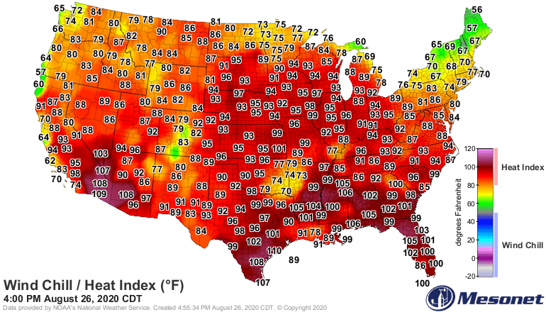
Southern Minnesota sweated through one more 90-degree day Wednesday. It’s the tip of a tropical air mass delivering 90-degree temperatures and heat index values to the Upper Midwest. The air mass is considerably cooler behind the front across northern Minnesota.
Scattered storms into Thursday morning
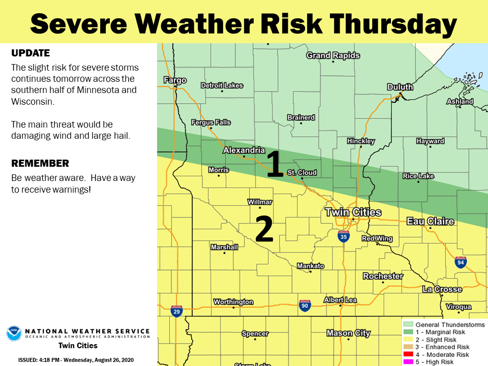
A cold front draped across central Minnesota sags slowly south overnight. The front is driving a few scattered storms. Coverage of severe storms looks spotty to me across Minnesota into Thursday morning. There is a slight risk of severe storms favoring central Minnesota mainly north of the Twin Cities.
Turn Up Your Support
MPR News helps you turn down the noise and build shared understanding. Turn up your support for this public resource and keep trusted journalism accessible to all.

Heavy rain potential Friday morning?
The severe risk zone shifts south with the frontal boundary Thursday night into Friday morning.
To my eye, the more impressive weather event appears to be the potential for heavy rains that could generate flash flood warnings late Thursday night into Friday morning.
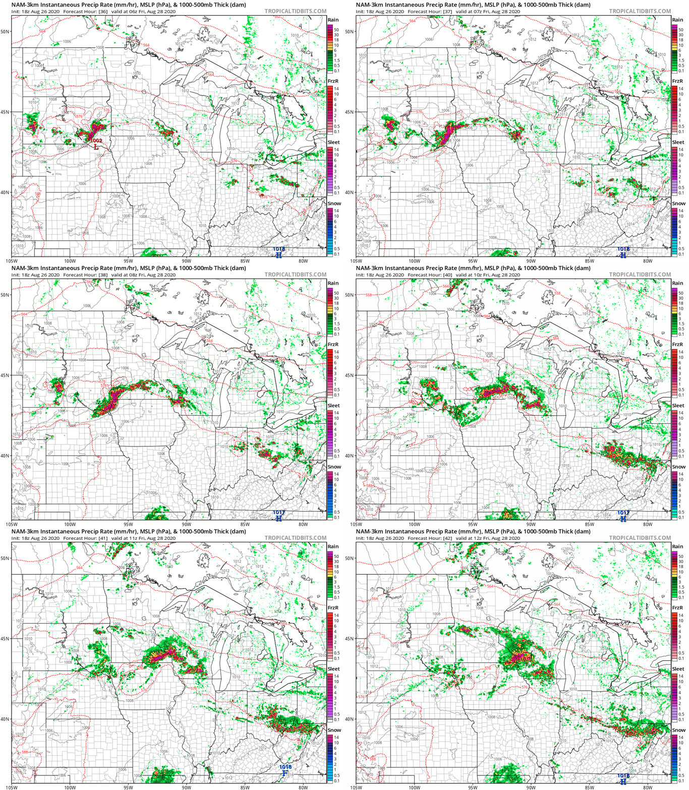
As the cold front stalls out across southern Minnesota Thursday night, thunderstorms are likely to develop along the front. At this time, the best chance for heavy, training thunderstorms appears to be just south of the Twin Cities by Friday morning.
NOAA’s NAM 3 km resolution forecast model tracks a cluster of heavy storms across southern Minnesota after midnight Thursday night into early Friday morning.
Whiff of September next week
September 1 arrives next Tuesday. The weather maps appear to be in sync with the notion of fall-like weather as September arrives. Highs hover in the 60s across northern Minnesota with low 70s in southern Minnesota early next week.

Get ready for a seasonal change in our weather pattern next week.

