
Gusty Thursday ahead
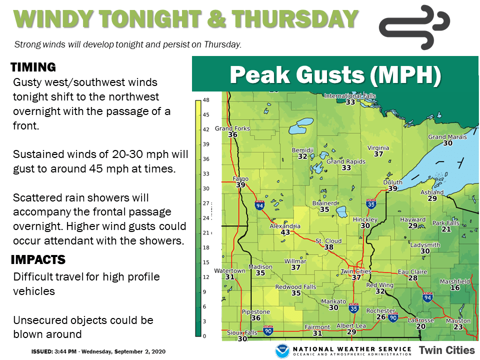
Wind gusts could hit 50 mph Thursday across western Minnesota.
Go Deeper.
Create an account or log in to save stories.
Like this?
Thanks for liking this story! We have added it to a list of your favorite stories.


Batten down the hatches Minnesota. The winds of September kick in on Thursday.
A cool front sweeps across Minnesota early Thursday. Behind the front, gusty northwest winds could exceed 40 mph in western Minnesota. Here’s a look at expected peak wind gusts Thursday courtesy of the Twin Cities NWS office.
Wind advisories are posted Thursday for the eastern Dakotas and a small part of western Minnesota.
Including the cities of Wheaton, Ortonville, Sisseton, Webster, Faulkton, Redfield, Clark, Watertown, Milbank, Hayti, Clear Lake, Fort Pierre, Onida, Pierre, Highmore, Miller, Murdo, Kennebec, and Fort Thompson
322 PM CDT Wed Sep 2 2020 /222 PM MDT Wed Sep 2 2020/
...WIND ADVISORY REMAINS IN EFFECT FROM 10 PM CDT /9 PM MDT/ THIS EVENING TO 3 AM CDT /2 AM MDT/ THURSDAY...
* WHAT...Northwest winds 25 to 35 mph with gusts up to 50 mph expected.
* WHERE...Portions of central, north central and northeast South Dakota and west central Minnesota.
* WHEN...From 10 PM CDT /9 PM MDT/ this evening to 3 AM CDT /2 AM MDT/ Thursday.
* IMPACTS...Gusty winds could blow around unsecured objects. A few power outages are possible.
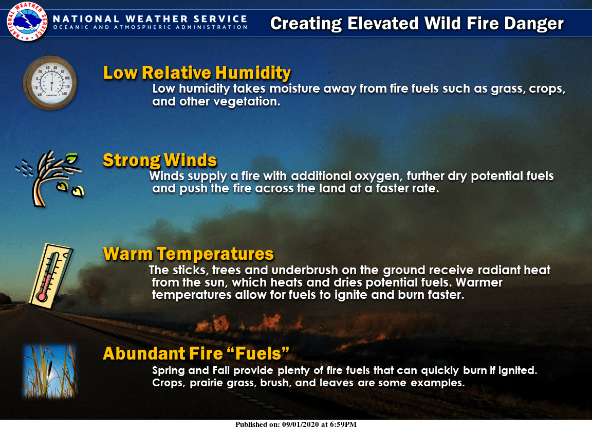
Elevated fire danger
Conditions favor the rapid spread of any fires Thursday. Here’s more on conditions from the Sioux Falls NWS office.
Turn Up Your Support
MPR News helps you turn down the noise and build shared understanding. Turn up your support for this public resource and keep trusted journalism accessible to all.

