
Mostly summery through Sunday; Labor Day polar plunge ahead
20 to 30 degrees colder early next week?
Go Deeper.
Create an account or log in to save stories.
Like this?
Thanks for liking this story! We have added it to a list of your favorite stories.


Here it comes.
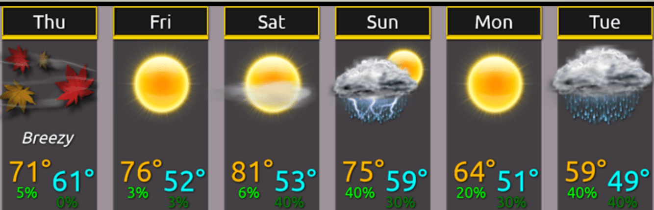
The first powerful September cold front is on the weather maps and ready to blow through Minnesota on Labor Day. Temperatures will crash as much as 20 to 30 degrees between Sunday and Tuesday in parts of Minnesota.
The season’s first frost looks likely in the traditionally colder nooks and crannies of northern Minnesota next week.
Summery finto Sunday
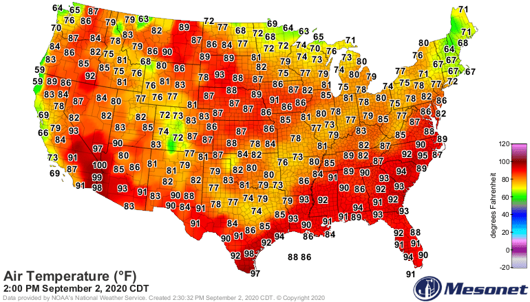
Much of Minnesota is enjoying the northern edge of a summery air mass Wednesday. Highs in the 80s edged into southern Minnesota Wednesday afternoon.
Turn Up Your Support
MPR News helps you turn down the noise and build shared understanding. Turn up your support for this public resource and keep trusted journalism accessible to all.
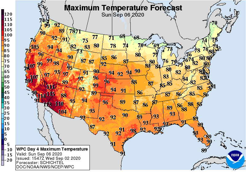
Thursday brings a cool front with temperatures about 10 degrees cooler. Warmer breezes return into the start of the Labor Day weekend. Highs in the 70s to near 80 degrees return to the Twin Cities and southern Minnesota Friday through Sunday.
Labor Day polar plunge
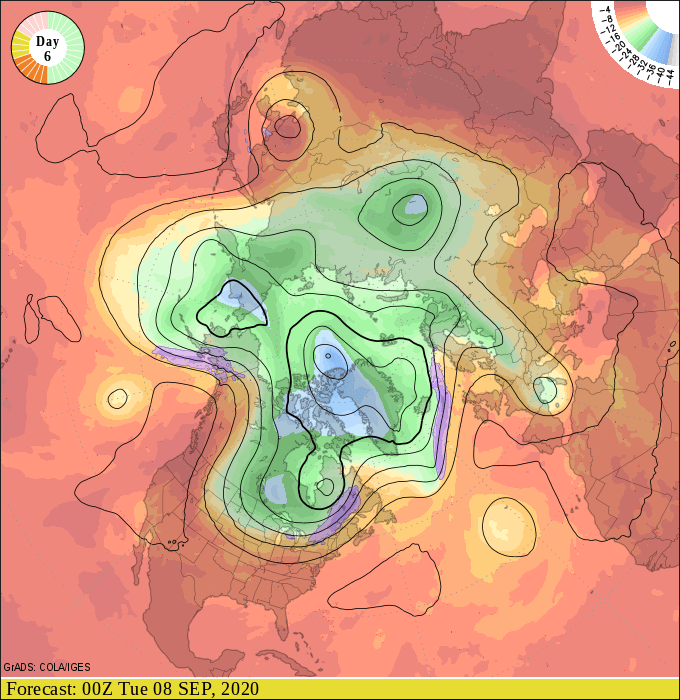
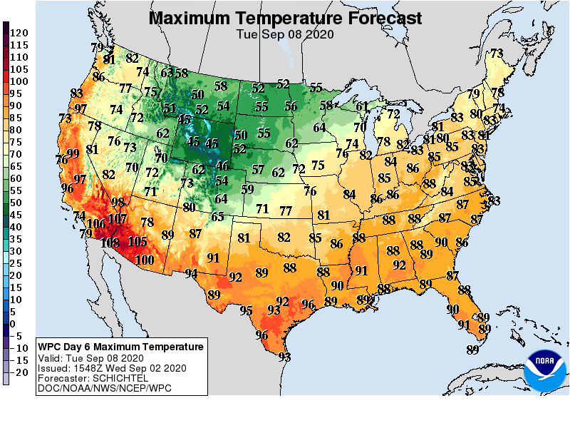
The upper air pattern shows a deep trough of low pressure spinning south from Canada by Labor Day. This will drive the season’s strongest cold front so far through Minnesota Monday and Tuesday.
Highs may not climb out of the 50s across most of Minnesota by next Tuesday.
First frost up north?
Some locations across northern Minnesota will dip into the 30s next Wednesday morning. That could produce the first frost of the season for some communities.
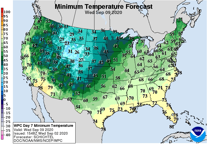
Frost is not uncommon in northern Minnesota by mid-September.
There are signs of warmer weather by the weekend of Sept. 12-13.
Stay tuned.

