
Tracking a Saturday night thunder threat
Severe risk for southern Minnesota Saturday night
Go Deeper.
Create an account or log in to save stories.
Like this?
Thanks for liking this story! We have added it to a list of your favorite stories.


Another summer holiday weekend in Minnesota. That means some great weather, a Labor Day cold front, and of course a batch of nocturnal thunderstorms.
Saturday night warm front
Our tranquil Friday weather pattern holds through Saturday. By Saturday night, warm front bubbles into southern Minnesota. Storms are likely to fire along the frontal boundary after sunset Saturday evening.
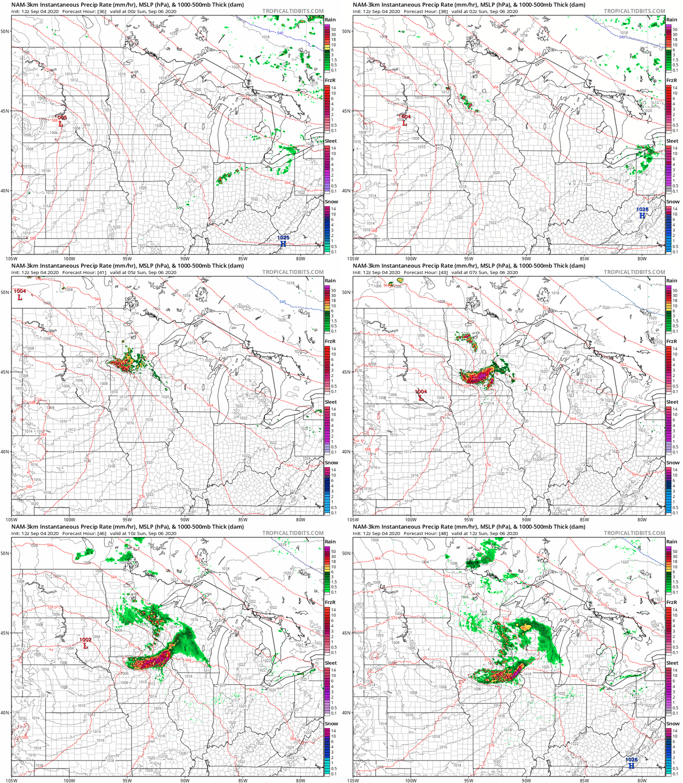
NOAA’s NAM 3 km resolution model continues to show a cluster of strong to potentially severe storms firing west of the Twin Cities Saturday night, that could roll through the Twin Cities and southern Minnesota between about 10 p.m. Saturday night and 3 a.m. Sunday.
Severe risk
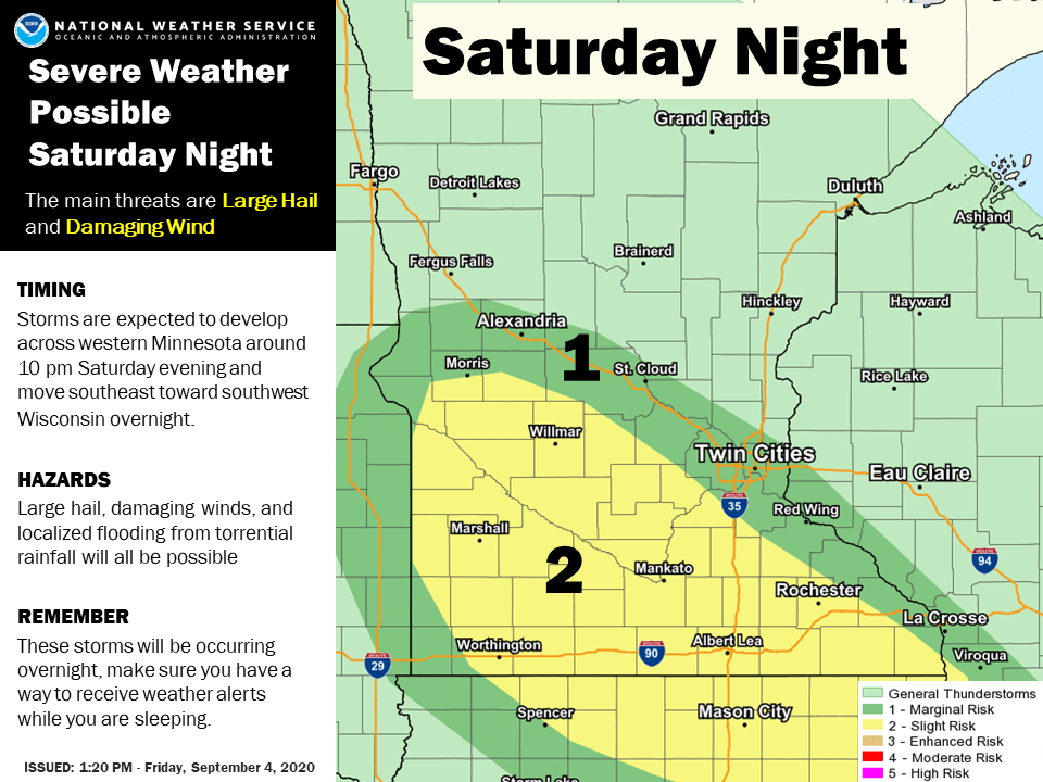
The atmosphere looks unstable enough to support some severe storms packing high winds and hail Saturday night. NOAA’s Storm Prediction Center paints a slight risk for severe storms across a big chunk of southern Minnesota Saturday night.
Bottom line: The overall weekend forecast looks mostly summery Saturday and Sunday, and cooler on Labor Day. Saturday night is the time to keep an eye out for some strong to severe thunderstorms favoring southern Minnesota. Boaters and campers should have a plan to get off the lake and into shelter quickly if necessary Saturday night.
Turn Up Your Support
MPR News helps you turn down the noise and build shared understanding. Turn up your support for this public resource and keep trusted journalism accessible to all.

