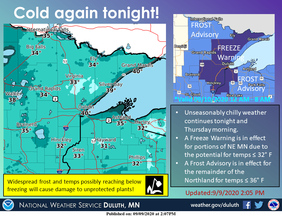
Frosty start Thursday, 80 degrees again next week?
Warming trend through this weekend across Minnesota.
There was no State Fair this year, but Minnesota’s famed weather roller coaster rolls along as usual. That collective scream you hear is Minnesotans reacting to the season’s first frost and freeze warnings.

The highest chances for killing frost and freeze Thursday morning is across northeast Minnesota away from Lake Superior.

Warming trend begins
A warming trend gradually begins to take hold across Minnesota as we move toward the weekend. Thursday brings a return to sunshine across Minnesota.
Shower chances favor Friday night into Saturday as the next low-pressure wave and frontal system approaches.

70s return
Highs rise through the 60s and reach the 70s again by Sunday across southern and western Minnesota.

Even warmer air pushes into Minnesota by next Tuesday. Highs should reach the low 80s across western Minnesota next Tuesday.

We’re not done with 70s yet this season, and another shot at 80 degrees looks likely for much of Minnesota.
Create a More Connected Minnesota
MPR News is your trusted resource for the news you need. With your support, MPR News brings accessible, courageous journalism and authentic conversation to everyone - free of paywalls and barriers. Your gift makes a difference.