
Soaking rains Friday night; 80 degrees by Tuesday?
Widespread a half inch to 1 inch rainfall totals through Saturday
Go Deeper.
Create an account or log in to save stories.
Like this?
Thanks for liking this story! We have added it to a list of your favorite stories.


Keep the rain gear handy Friday night into Saturday Minnesota. Many of us pick up another soaking rain into Saturday.
Inbound low-pressure wave
Our next low-pressure system spins across the Upper Midwest overnight.
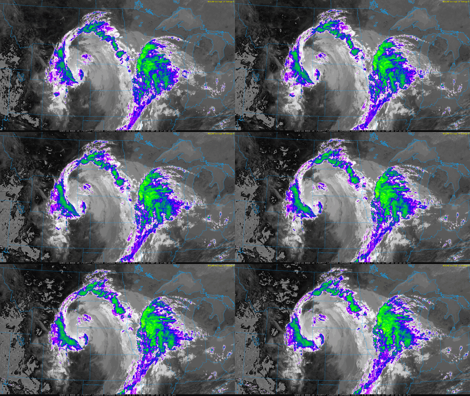
Here’s a look at the geography of the inbound system Friday afternoon via GOES-16 color-enhanced IR satellite loop. You can clearly see the low-pressure center swirling over western South Dakota, and the moisture plume feeding up ahead of the storm across the Upper Midwest.
Turn Up Your Support
MPR News helps you turn down the noise and build shared understanding. Turn up your support for this public resource and keep trusted journalism accessible to all.
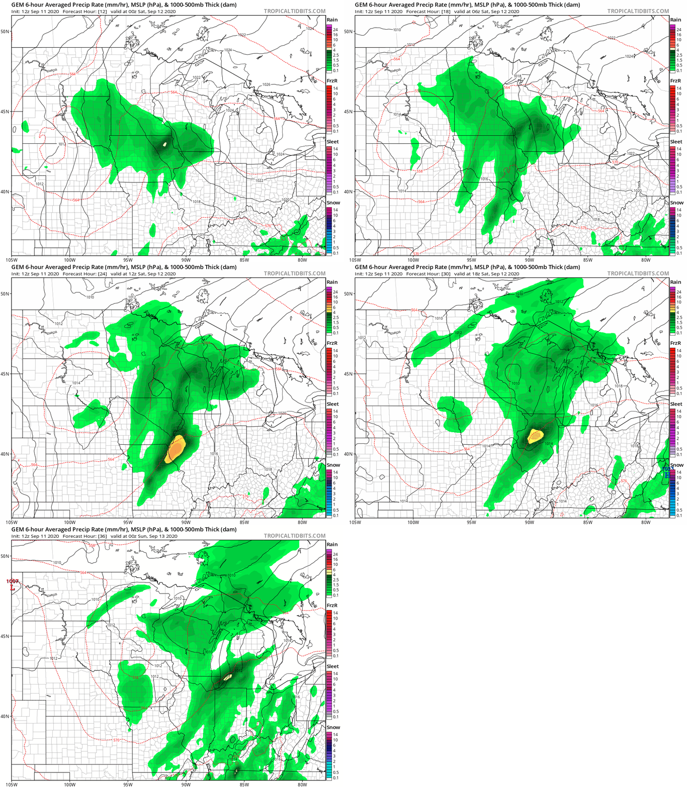
Widespread rainfall favors the overnight hours into Saturday cross Minnesota. The Canadian model paints the broad strokes with rainfall coverage spreading across Minnesota Friday night into Saturday. The heaviest rainfall favors Friday night into early Saturday morning.
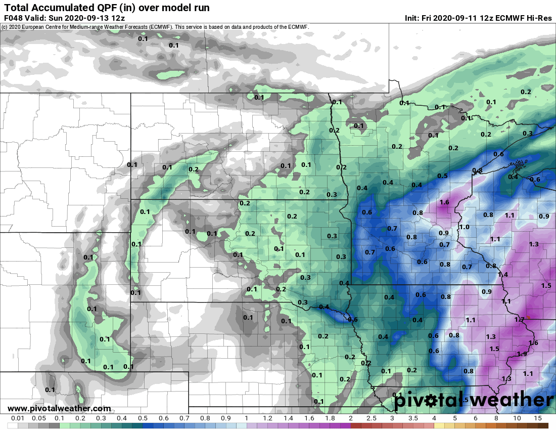
Soaking rains
This system is moving slow enough to drop soaking rains across the Upper Midwest. Much of Minnesota and western Wisconsin will pick up between a half inch and an inch rainfall by late Saturday.
Warming trend begins Sunday
Warmer breezes and sunnier skies return to Minnesota starting Sunday. Most of next week looks blissfully mild, with high temperatures in the 70s to low 80s.
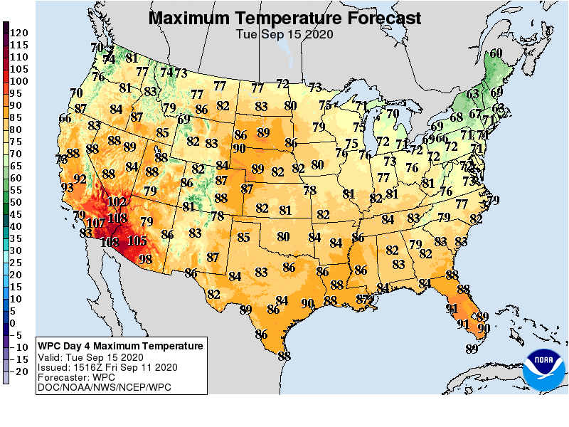
Hang in there, more late-summer like weather is on the way starting Sunday. Next week looks luxurious across Minnesota.

