
Minnesota weather whiplash: Freezing this week. 90 next week?
Wide temperature swings ahead.
Go Deeper.
Create an account or log in to save stories.
Like this?
Thanks for liking this story! We have added it to a list of your favorite stories.


Here we go again Minnesota. Get ready for some huge temperature swings across the state in the next 10 days.
Freezing first
The colder air mass sweeping into Minnesota brings freezing temperatures to northern Minnesota once again Thursday morning.

Freeze warnings and frost advisories are up once again into Thursday morning.
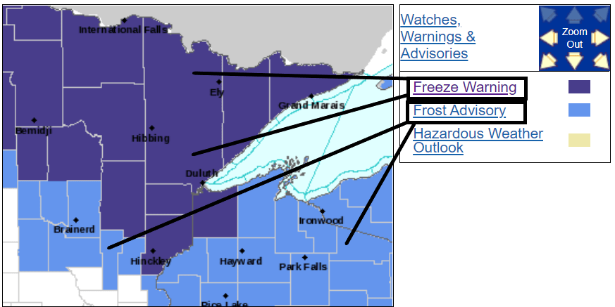
Including the cities of International Falls, Ely, Isabella, Bigfork, Hibbing, Two Harbors, Silver Bay, Grand Marais, Walker, Grand Rapids, Hill City, and Aitkin
107 PM CDT Wed Sep 16 2020
...FREEZE WARNING REMAINS IN EFFECT FROM MIDNIGHT TONIGHT TO 8 AM CDT THURSDAY...
* WHAT...Sub-freezing temperatures as low as 25 expected, coldest across the Iron Range.
* WHERE...Most of north central and northeast Minnesota.
* WHEN...From midnight tonight to 8 AM CDT Thursday.
* IMPACTS...Frost and freeze conditions will kill crops, other sensitive vegetation and possibly damage unprotected outdoor plumbing.
Milder this weekend
Temperature moderate this weekend. High reach the 70s once again across most of Minnesota by Sunday.
Turn Up Your Support
MPR News helps you turn down the noise and build shared understanding. Turn up your support for this public resource and keep trusted journalism accessible to all.

Summerlike pattern returns next week
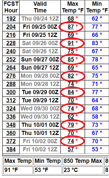
Next week’s weather maps look more August than late September. The jest stream lifts north into southern Canada. That opens the door for unseasonably warm air to filter into Minnesota once again.

NOAA’s GFS model cranks out a string of summerlike temperatures next week into the last week of September.
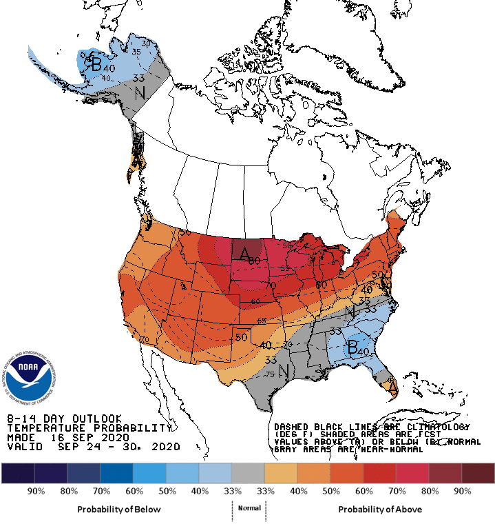
NOAA’s Climate Prediction Center’s eight- to 14-day temperature outlook strongly favors higher than average temperatures through late September.
Stay tuned.

