
Sep-tober breeze: Frost and freeze warnings likely Thursday night
Temperatures in the 30s across Minnesota Friday and Saturday morning.
Go Deeper.
Create an account or log in to save stories.
Like this?
Thanks for liking this story! We have added it to a list of your favorite stories.


Colder air is pouring into Minnesota this week. The brisk northwest flow drove scattered showers across Minnesota Wednesday.
Pea-sized hail fell at the Twin Cities NWS office in Chanhassen.
Temperatures bottom out Friday and Saturday morning
The core of the coldest air passes over Minnesota Friday into early Saturday. Low temperatures both mornings will reach the 30s across most of Minnesota. The Twin Cities inner metro core may hover a few degrees above freezing, but frost is likely in the suburbs and across most of Minnesota Friday and Saturday morning.
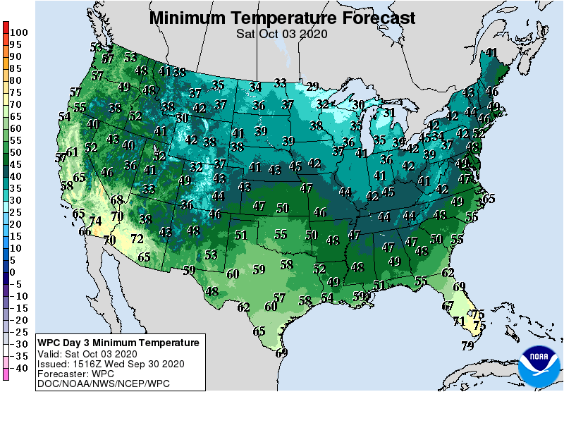
Frost and freeze warnings are likely again Thursday night into Friday morning. The average date for the first 32-degree temperature in fall at Minneapolis-St Paul International Airport is Oct. 10. It’s earlier in the suburbs.

Termperatures recover next week. Highs back into 60s and 70s look likely across most of southern and western Minnesota.

Turn Up Your Support
MPR News helps you turn down the noise and build shared understanding. Turn up your support for this public resource and keep trusted journalism accessible to all.

