
Mild October weekend; rain and thunder Sunday night into Monday
Last 80 of the year for much of southern Minnesota Friday.

Go Deeper.
Create an account or log in to save stories.
Like this?
Thanks for liking this story! We have added it to a list of your favorite stories.


These are the kind of October weekends I remember growing up in Minnesota.
We used to clean the basement and garage out every spring and fall. I remember the pristine blue October sky. I remember a morning chill giving way to a mild Saturday afternoon. I remember the sound of small planes buzzing overhead, lazily circling around Lake Minnetonka while heading to and fro Flying Cloud Airport in Eden Prairie on Saturdays in the fall.

This weekend will be one of those October weekends to savor. Saturday brings plenty of sunshine, and hopefully bluer skies. Sunday brings stiff southerly breezes and whitecaps to area lakes. But temperatures soar back into the 80s once again in southwest Minnesota, with 70s in the Twin Cities and 60s up north.
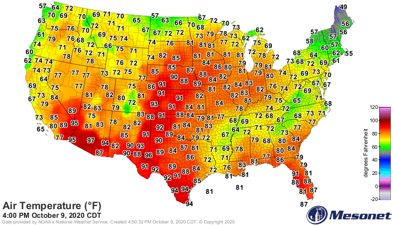
Enjoy this temperature map from Friday afternoon. We won’t see one like this again until 2021.
Turn Up Your Support
MPR News helps you turn down the noise and build shared understanding. Turn up your support for this public resource and keep trusted journalism accessible to all.
Rain Sunday night into Monday
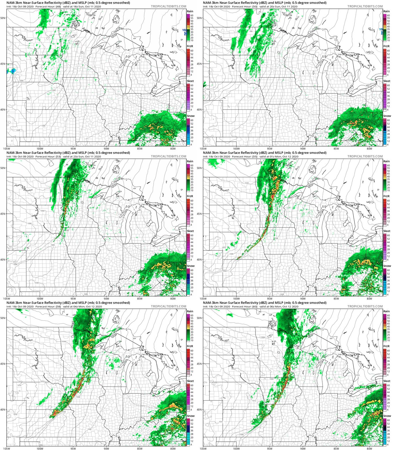
Minnesota picks up some much-needed rainfall Sunday night and Monday. A frontal system sparks a band of rain and some embedded thunderstorms.
NOAA’s MAM 3 km model develops rain the Red River Valley Sunday afternoon and moves in into eastern Minnesota including Duluth and the Twin Cities by Sunday evening.
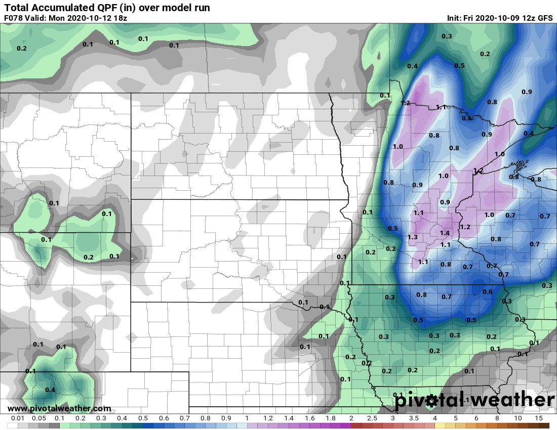
NOAA’s GFS model cranks out around an inch of rain for much of eastern Minnesota including the Twin Cities.
Big changes next week
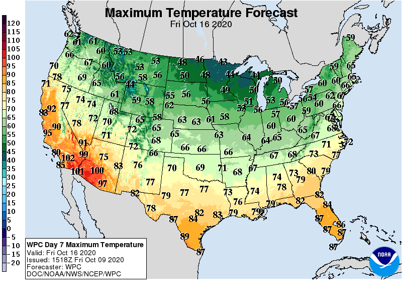
Next week opens seasonably with highs in the lower 60s in southern Minnesota and 50s up north. But the temperature bottom drops out later next week. The upper air pattern buckles with a deep, cold low-pressure trough settling in across the Upper Midwest.

Highs next Friday will be at least 30 degrees colder than today.
Get out there this weekend folks!

