
Welcome soaking rains; November front arrives Thursday
Much colder temperatures on the way late this week.
Go Deeper.
Create an account or log in to save stories.
Like this?
Thanks for liking this story! We have added it to a list of your favorite stories.


It was a welcome soaking rain across much of Minnesota Sunday night. Many locations picked up 1 to 2 inches of much-needed rainfall with the north-south oriented line of mid-October thunderstorms.
Rainfall totals of around 2 inches fell in some communities in the eastern Twin Cities.
Woodbury 1.9”
Afton 2.01”
Farmington 2.06”
Hudson, WI 2.16”
Heavy rainfall also fell along the I-35 corridor south of Duluth.
November front Thursday
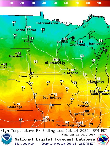
Temperatures remain seasonable through Wednesday across southern Minnesota. we enjoy more sun Tuesday. Wednesday brings a cold rain to northern Minnesota with highs in the 40s.
Turn Up Your Support
MPR News helps you turn down the noise and build shared understanding. Turn up your support for this public resource and keep trusted journalism accessible to all.
Highs in the Twin Cities make the low 60s Tuesday and Wednesday. It will still feel like late summer as close as Des Moines Wednesday.
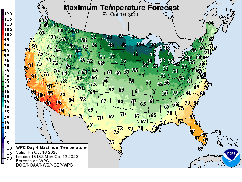
Temperatures plunge starting Thursday, as the season’s coldest air mass so far dives south from Canada. Highs Friday hover in the 30s in northern Minnesota, and 40s south.
A minor weather system may bring a few rain, or even snow showers Saturday. Some areas could see our first flakes of the season Saturday. Right now accumulations are not likely.
‘Tis the season.

