
October surprise? Growing chance for accumulating snow up north Saturday
Multiple forecast models crank out several inches of snow across northern Minnesota.

Go Deeper.
Create an account or log in to save stories.
Like this?
Thanks for liking this story! We have added it to a list of your favorite stories.


Wintry weather appears ready to arrive early this year.
Multiple forecast models now crank out accumulating snow across northern Minnesota Saturday. Most solutions favor a few inches of snow across northern and central Minnesota, but a few models bring flakes as far south as the Twin Cities area Saturday.
It’s still early in the forecast process for gauging precise snowfall accumulations Saturday. But several models including the European, Canadian, and American models drag an unseasonably cold low-pressure system across Minnesota Saturday. The system appears cold and wet enough to produce accumulating snow north of the low-pressure track.
Here’s the National Oceanic and Atmospheric Administration GFS model solution Saturday. Like most other models it suggests several hours of snow across northern Minnesota Saturday. It also cranks out a second area of snow in southern Minnesota and Iowa Saturday night into Sunday.
Turn Up Your Support
MPR News helps you turn down the noise and build shared understanding. Turn up your support for this public resource and keep trusted journalism accessible to all.
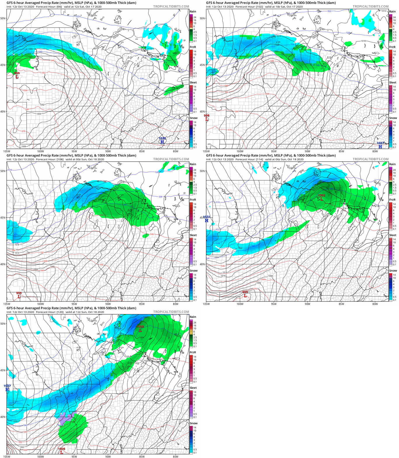
Several inches up north?
As usual forecast models differ on the precise location and magnitude of accumulating snow potential this weekend. But the general theme is for a band of a few inches of snow somewhere across northern and or central Minnesota. A few solutions suggest minor accumulations in the Twin Cities area.
Here’s the (early) European model snowfall output through Sunday.

The Duluth NWS office weighs in on snow chances this weekend in Tuesday forecast discussion.
Models are suggesting that this weekend could be the first widespread accumulating snowfall for the Northland. The 00Z Euro, if correct, would give the region several inches of snow. Meanwhile the operational 00Z GFS takes the QPF blob with this low pressure more to the south. However, when inspecting the GEFS plumes, several members agree with the Euro solution. So, overall something to keep an eye on. After consulting with the WPC, their winter weather outlook probabilities are heavily weighted towards the NBM and Euro ensemble solutions which have much lower QPF than the operational Euro. Hence, their graphics don`t depict this potential...yet. In my opinion, it looks like a good set up for snow. Plenty of cold air, a strong and energetic jet, a short wave, moisture advection from the south on a strong LLJ. Many of the cards are in place. We`re still 5 days out, so obviously things can change, but it`s worth watching.
One trend that seems certain. The weather pattern across the Upper Midwest shifts to a cold bias for the next 1-2 weeks.
Winter appears ready to show up early this year. But then again, it is 2020.

