
String of 50s and 60s likely next week
A mixed weekend forecast leads to a big warm-up next week.
Go Deeper.
Create an account or log in to save stories.
Like this?
Thanks for liking this story! We have added it to a list of your favorite stories.


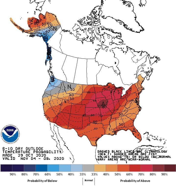
We enjoy a mini temperature roller coaster in Minnesota this weekend. But a more persistent warming trend kicks in next week across Minnesota. A string of days in the 50s and 60s is looking very likely for the first week of November.
A few snow showers overnight
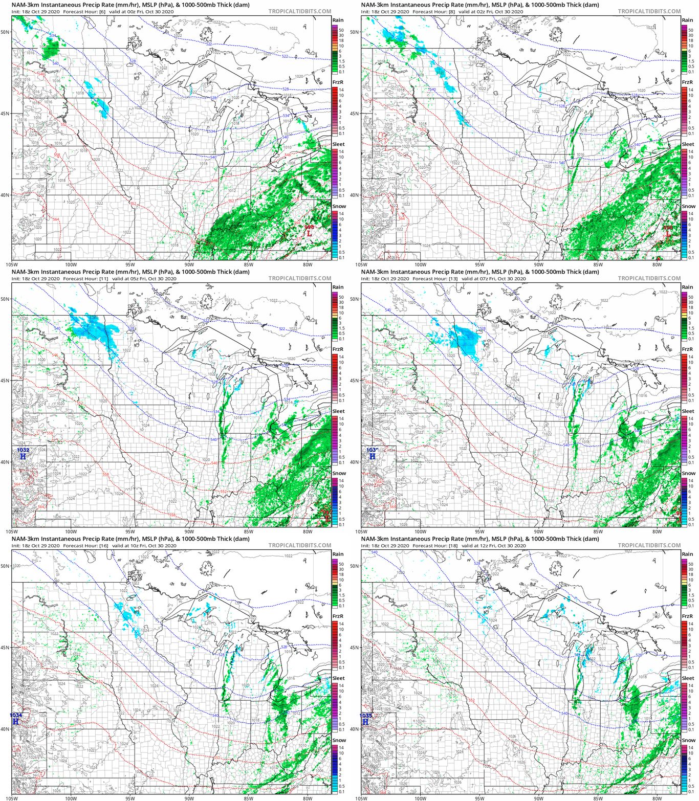
A weak weather disturbance passes across Minnesota overnight into early Friday morning. The atmosphere overhead is pretty dry, but the system will squeeze out a few snow showers and flurries.
The National Oceanic and Atmospheric Administration’s NAM 3 km resolution model captures the essence.
Milder Halloween
Highs in the 30s and 40s Friday give way to low 50s in southern Minnesota for Halloween with 40 across most of Minnesota.
Turn Up Your Support
MPR News helps you turn down the noise and build shared understanding. Turn up your support for this public resource and keep trusted journalism accessible to all.
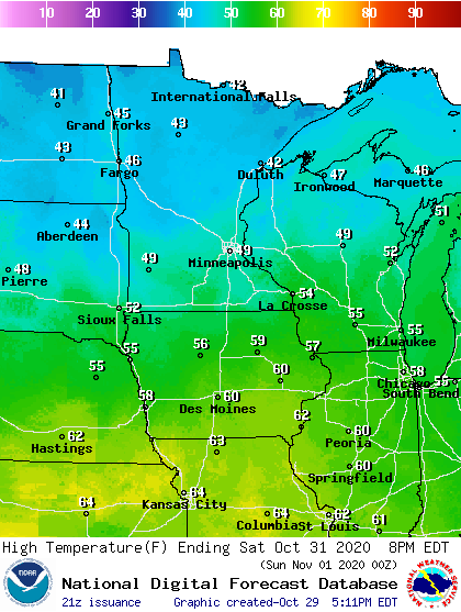
A cold front late in the day will blow in, with northwest breezes kicking up rapidly Saturday afternoon and evening. Sunday looks cool again before a bigger warming trend next week.
Mild first week of November
A more persistent warming trend arrives next week. The jet stream once again shifts north into Canada.
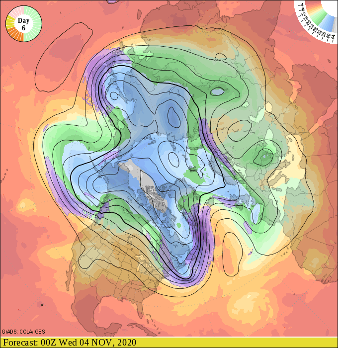
Highs reach the 50s and 60s across Minnesota next week. Here’s NOAA’s GFS model temperature output for noon next Thursday.
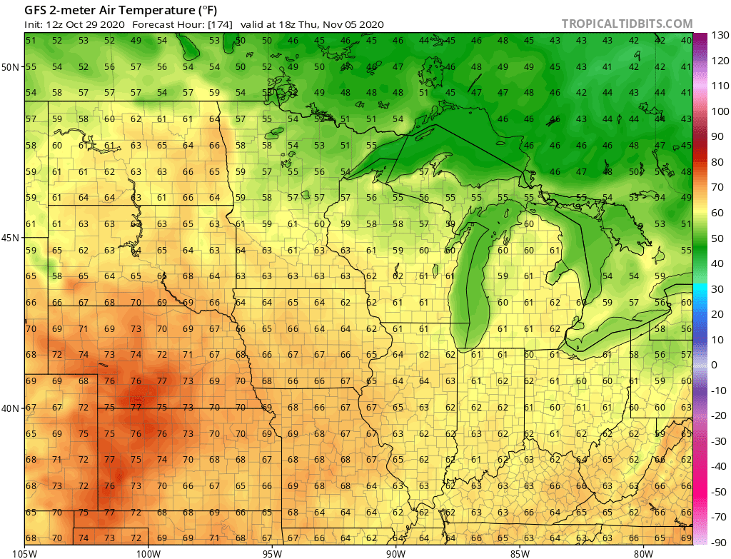
Forecast models suggest the warmth may last through the weekend of Nov. 10-11.
Stay tuned.

