
Winter weather smorgasbord: Mix of heavy snow, sleet, and ice
Heavy snow bands move northeast across Minnesota into early Wednesday morning.
Go Deeper.
Create an account or log in to save stories.
Like this?
Thanks for liking this story! We have added it to a list of your favorite stories.


It’s a wild wintry mix across Minnesota into early Wednesday.
Our lastest storm has delivered the expected range of wintry weather conditions. In southern Minnesota, freezing rain has left a coating of ice at least 1/4-inch thick on everything from trees to power lines, and cars.
In the Twin Cities and many locations, sleet is pinging off windows and windshields.
And in southwest Minnesota, a heavy snowburst moved in from South Dakota in the afternoon hours. Here’s the scene from Sioux Falls as snow dropped visibility at 1/4 mile at times.
Turn Up Your Support
MPR News helps you turn down the noise and build shared understanding. Turn up your support for this public resource and keep trusted journalism accessible to all.
Storm peaks Tuesday night
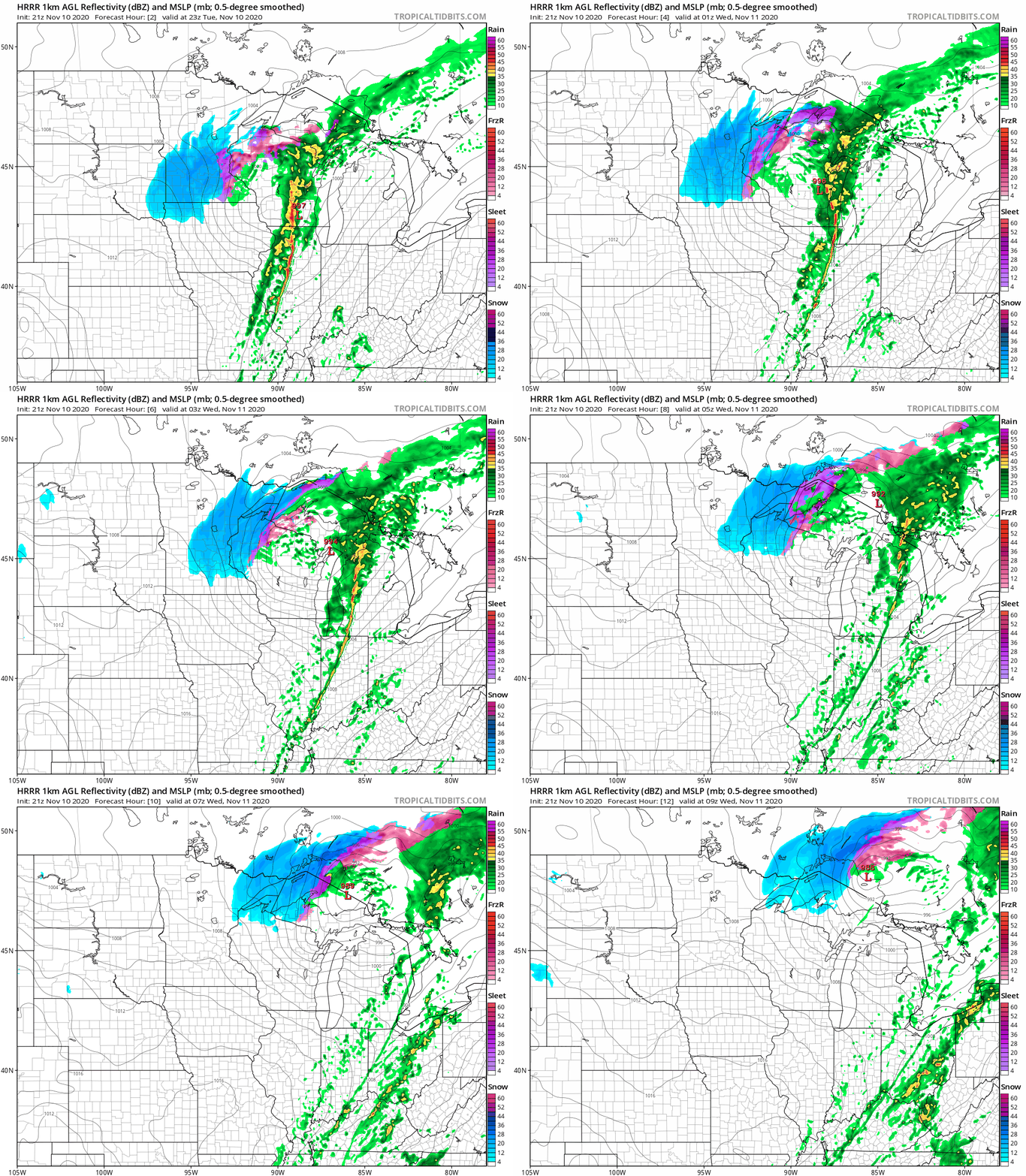
The heaviest snowfall rates sweep across Minnesota from southwest to northeast Tuesday night into early Wednesday.
NOAA’s HRRR model shows the evolution of the moderate to heavy snow bands tracking northeast. The loop below runs from 5 pm Tuesday to 3 am Wednesday.
Big snowfall range
The mixed precipitation from the Twin Cities southward to the Iowa border will cut snowfall totals accordingly.
I still think we’ll see a big snowfall gradient across the greater Twin Cities area. The southeast Twin Cities likely ends up with closer to 2”, with the best chances for 5” favoring the north and west Twin Cities.
The heaviest snow bands set up west and north of the Twin Cities, where 6”+ is possible.

Heavy snow up north
The heaviest snowfall totals with this system favor northeast Minnesota and northwest Wisconsin. Some locations could see 8” or more.


