
50s Wednesday; Friday storm track trending south?
Wide forecast model variability on Friday storm track.

Go Deeper.
Create an account or log in to save stories.
Like this?
Thanks for liking this story! We have added it to a list of your favorite stories.


It’s another MInnesota’s weather smorgasbord this week.
The first full week of December begins gray, turns blue, and threatens white. Here’s the latest read on our changeable forecast this week.
Gray Monday
Gray is the sky color of choice Monday. It’s almost welcome, considering we squinted through unusually bright sunshine for 60 percent of November days in Minnesota.
The National Oceanic and Atmospheric Administration’s GOES-16 visible satellite loop shows the low stratus cloud deck sitting over most of Minnesota Monday afternoon. But see how the western edge is beginning to push slowly east?
Turn Up Your Support
MPR News helps you turn down the noise and build shared understanding. Turn up your support for this public resource and keep trusted journalism accessible to all.
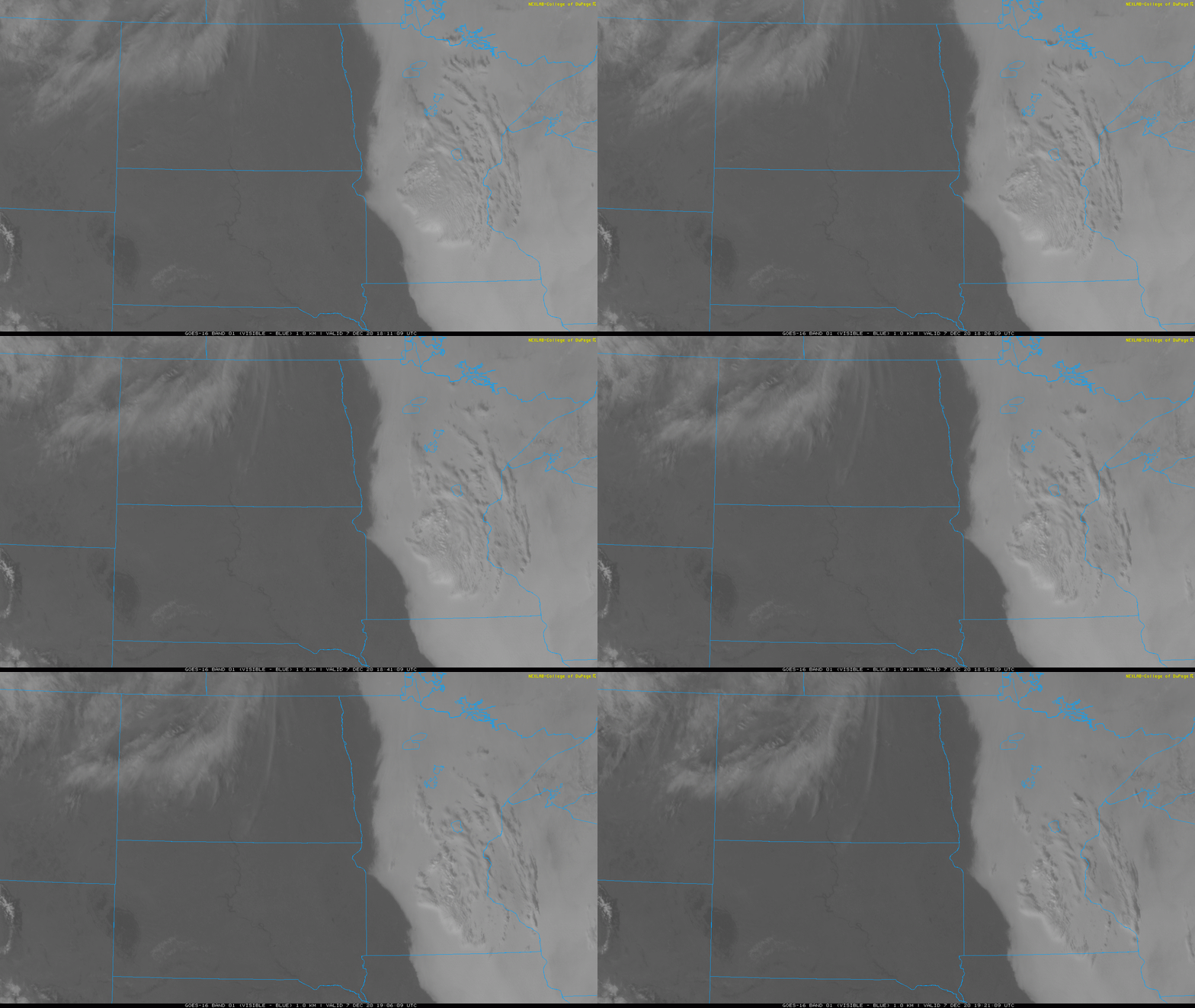
That clearing line should blow through Minnesota Tuesday. And all that sunshine in the Dakotas is heading this way.
Another mild spell ahead
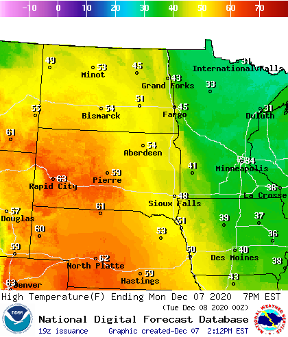
Our unseasonably mild inbound air mass is sitting over the Dakotas Monday. Temperatures Monday afternoon are soaring into the 50s in the eastern Dakotas, with 60s in the west.
The warm front blows in with enough low-level wind flow to scour out our low stratus cloud deck Tuesday.
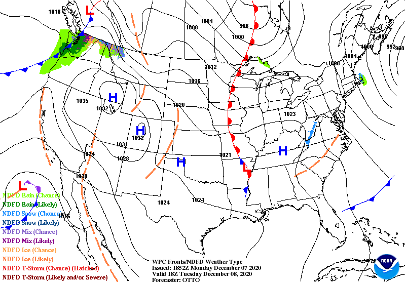
The sun should break out in Minnesota from west to east Tuesday morning. Assuming we get enough sun, we’ll have no problem hitting the 40s Tuesday.
As the thermal ridge coincides with midday maximum heating hours Wednesday, temperatures should soar into the 50s in the Twin Cities and much of southern Minnesota Wednesday afternoon.
I won’t be surprised if a few towns in southwest Minnesota tickle the 60-degree mark Wednesday afternoon.
Friday storm track: Trending south?
There’s been a shift in the Monday (12Z/7AM) forecast model runs with Friday’s possible storm track.
Previous model runs have suggested snow across a good chunk of Minnesota. But this morning’s American and European models push the storm track closer to Chicago. That would keep the bulk of accumulating snow south of most of Minnesota.
NOAA’s latest GFS model runs track the storm toward Chicago, nicking only southeast Minnesota with accumulating snow.
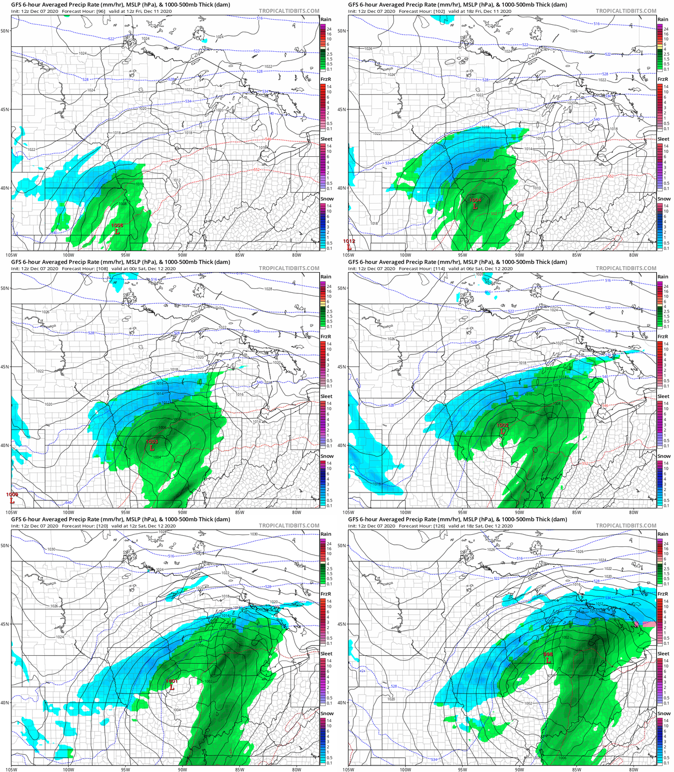
The European model cranks out a similar solution to the American GFS model, keeping snow mostly south of Minnesota.

The Canadian model is the outlier in this forecast run. It maintains a more northerly storm track that would bring significant snow to much of Minnesota, including the Twin Cities.
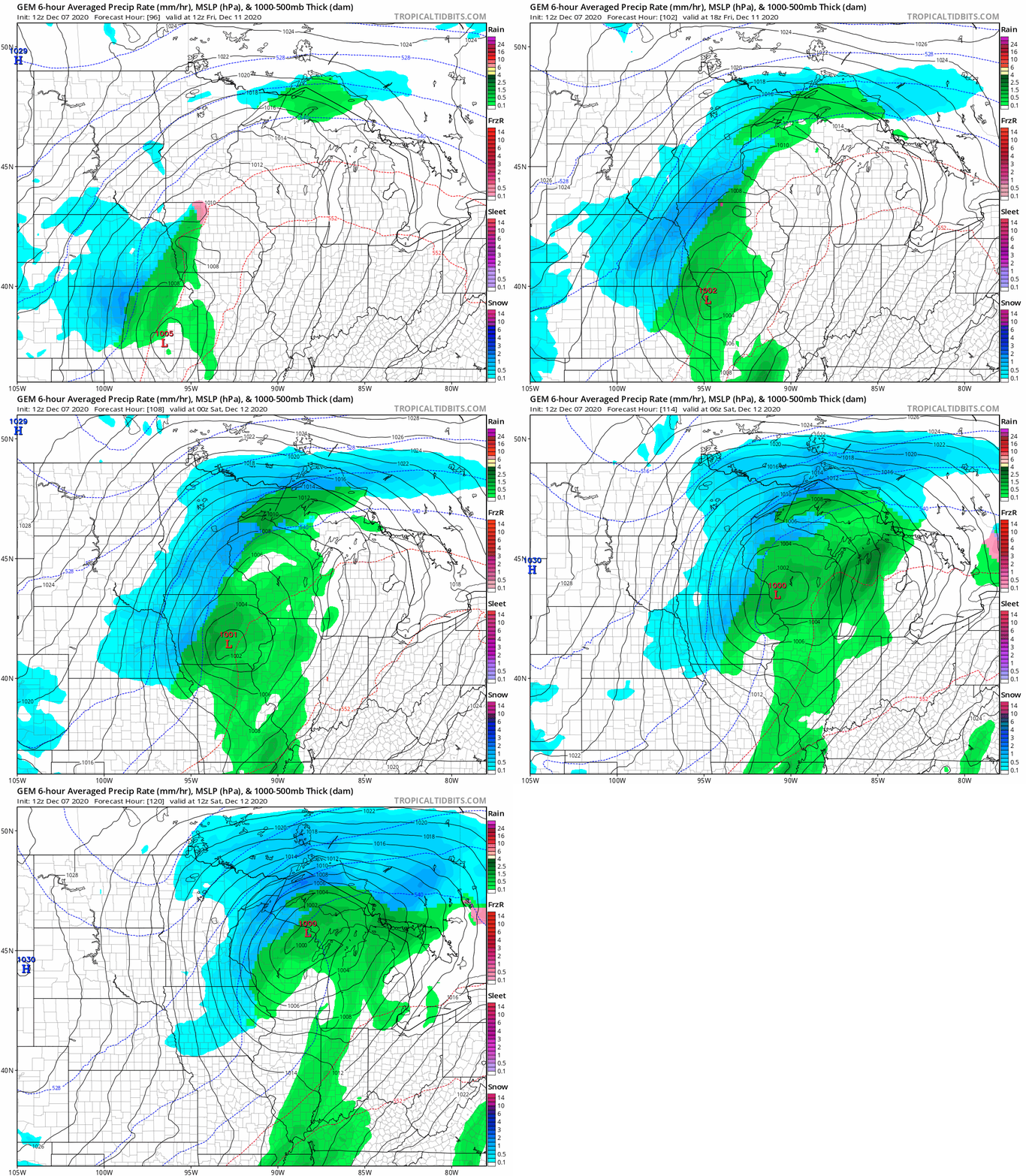
Stay tuned as we see how the forecast models sort out Friday’s storm track.

