
Pattern change ahead: From mild to wild Christmas week?
Much colder air and possible snow heading for Minnesota Christmas week
Go Deeper.
Create an account or log in to save stories.
Like this?
Thanks for liking this story! We have added it to a list of your favorite stories.


Our mild-mannered Minnesota December appears ready to take a turn for the wilder Christmas week.
Docile December so far
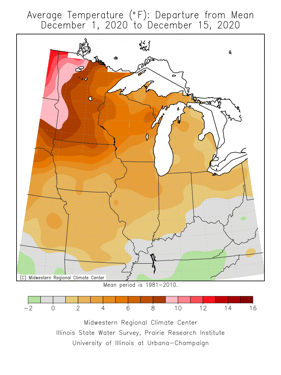
The first half of December has been unseasonably mild for Minnesota.
The Twin Cities is running almost 8 degrees (7.9) warmer than average through Dec. 15. International Falls is running closer to 10 degrees warmer than average. And parts of the Red River Valley are running 10 to 12 degrees warmer than average so far this month.
Check out the sea of warm colors on the December temperature departure map from the Midwest Regional Climate Center.
Turn Up Your Support
MPR News helps you turn down the noise and build shared understanding. Turn up your support for this public resource and keep trusted journalism accessible to all.
Mild into Monday
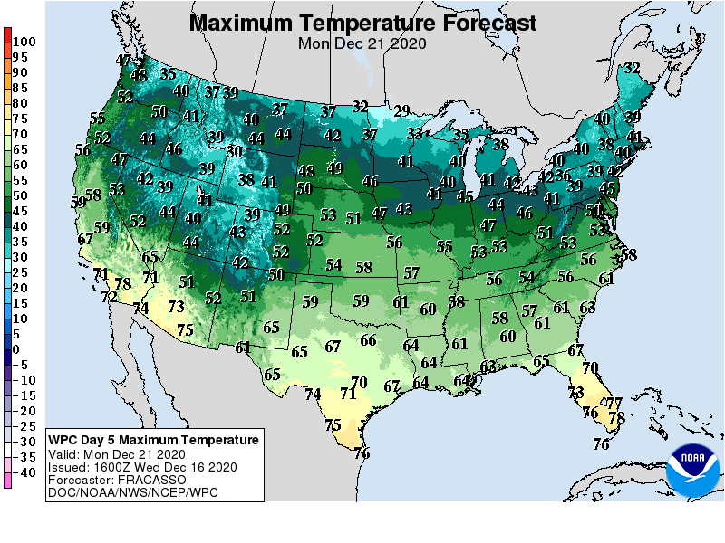
Overall temperatures will run milder than average into Monday. Friday, Sunday and Monday look like the mildest days. Highs may crack 40 degrees once again across southern Minnesota Friday, Sunday and Monday.
Snow chance next Tuesday and Wednesday?
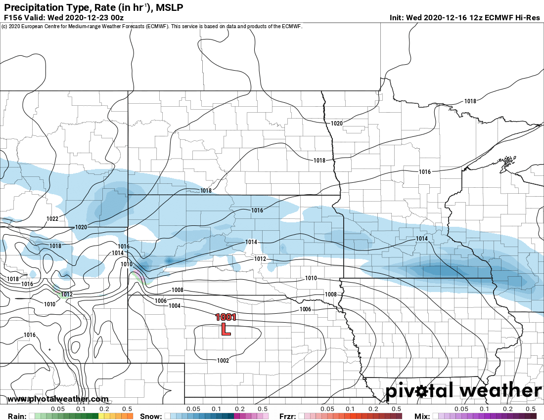
The best chance for a white Christmas across most of Minnesota arrives next Tuesday and Wednesday. The forecast models are always sketchy nearly a week out, but most solutions suggest at least a chance of accumulating snow for parts of Minnesota next Tuesday and or Wednesday.
The European and American models favor some snow for southern Minnesota.
Colder by Christmas?
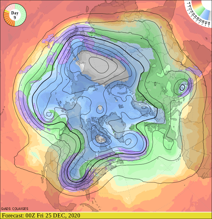
Most forecast models agree with a shot of much colder air will plunge south by Christmas Eve and Christmas Day. The upper air forecast maps plunge a deeper low-pressure trough across the central U.S. by Christmas Eve.
Today’s model runs continue to suggest sub-zero lows in northern Minnesota by Christmas morning, with temperatures closer to zero across southern Minnesota.
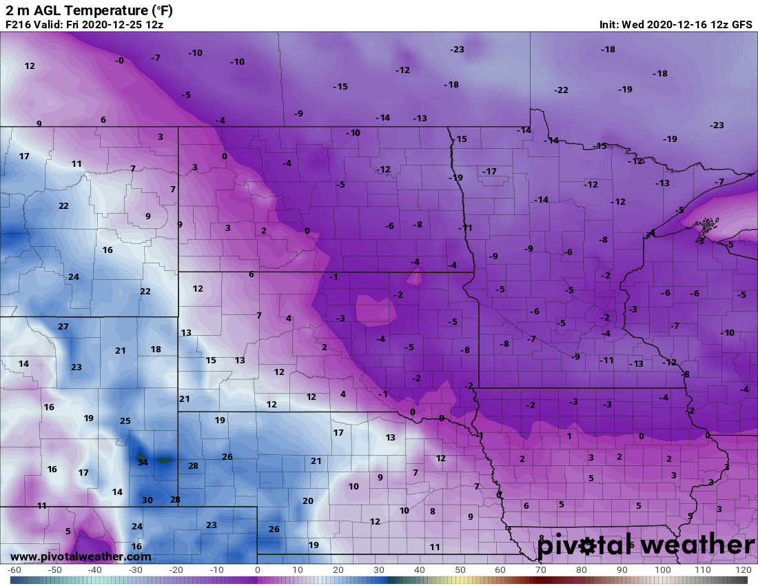
It looks like Christmas week is likely to transition to a much colder pattern by Christmas Day.
Stay tuned.

