Wednesday snow: 3 to 6-plus inches north, squeaking out a white Christmas in Twin Cities?
40s south Tuesday, wind and snow arrive Wednesday

Go Deeper.
Create an account or log in to save stories.
Like this?
Thanks for liking this story! We have added it to a list of your favorite stories.


It looks like a photo finish for a white Christmas this year in the Twin Cities.
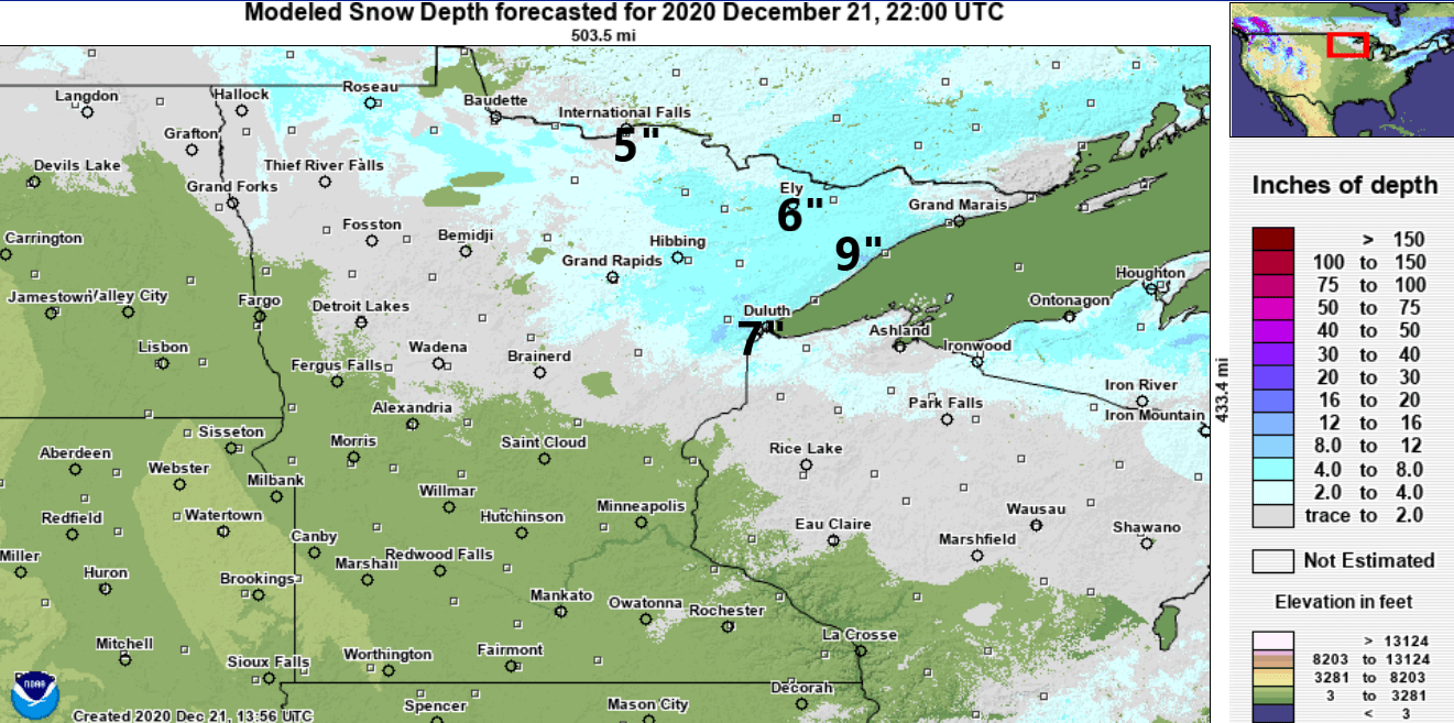
Most of Minnesota is still sporting bare ground as we head into Christmas week. Here’s the snow cover map late Monday from NOAA’s National Remote Sensing Hydrologic Center.
Mild Tuesday
Tuesday brings yet another (relatively) mild south breeze across Minnesota. Winds will gust to near 30 mph at times Tuesday afternoon. Highs will reach the 40s across southern Minnesota, including the Twin Cities.
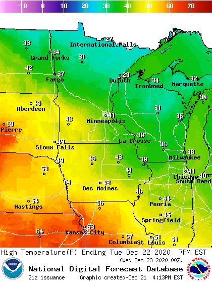
The average high and low Tuesday for the Twin Cities are 25 and 10. So far the Twin Cities is running more than 8 degrees warmer than average for December.
Turn Up Your Support
MPR News helps you turn down the noise and build shared understanding. Turn up your support for this public resource and keep trusted journalism accessible to all.
Wednesday storm
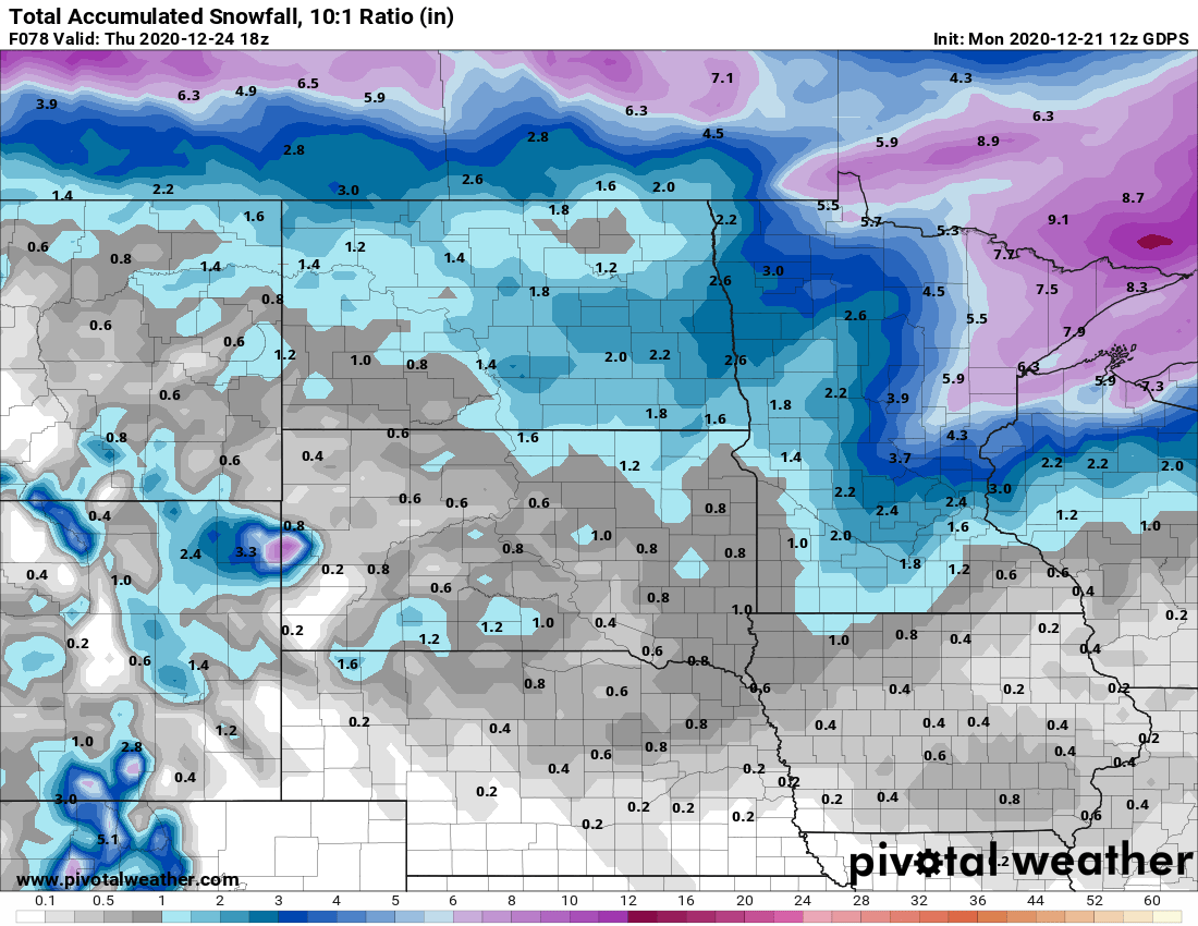
Forecast model consensus is improving slightly on Wednesday likely snow system. The heaviest snow favors northern Minnesota, but the Twin Cities and southern Minnesota may get just enough to eke out a white Christmas.
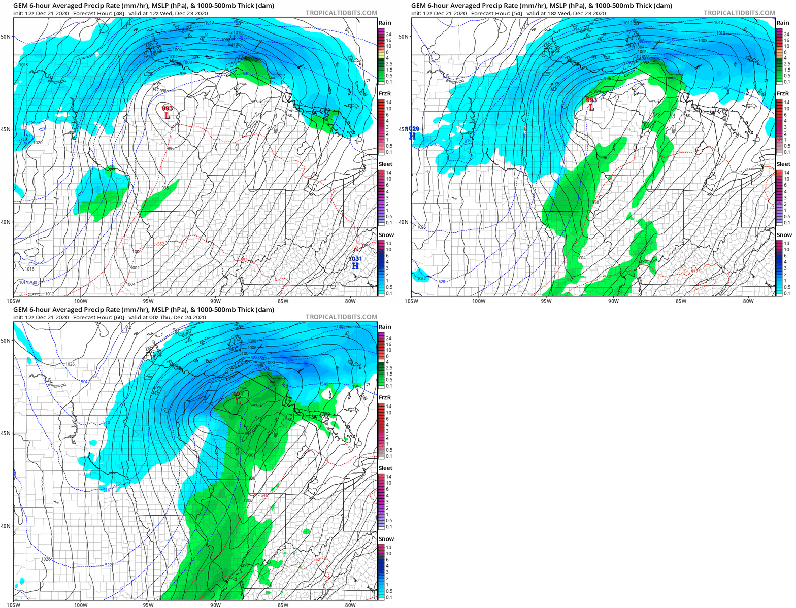
The Canadian model below is typical of forecast model solutions that push a tightly wrapped low-pressure system across central Minnesota Wednesday. Snow and strong winds will wrap around the north and west sides of the low.
Heaviest snowfall up north
The heaviest snowfall with this system favors northern Minnesota. That’s where I could easily see snowfall totals of 3 inches to more than 7 inches in most areas.
As of Monday afternoon, this does not look like a major storm from a snowfall perspective for the Twin Cities and southern Minnesota. But it will produce plenty of wind, and likely enough snow to create bad roads and eke out a white Christmas. Most forecast models favor 1 to 3 inches of snow in the Twin Cities, with the best chance for 3-inch favoring areas north of Twin Cities.
Cold Christmas
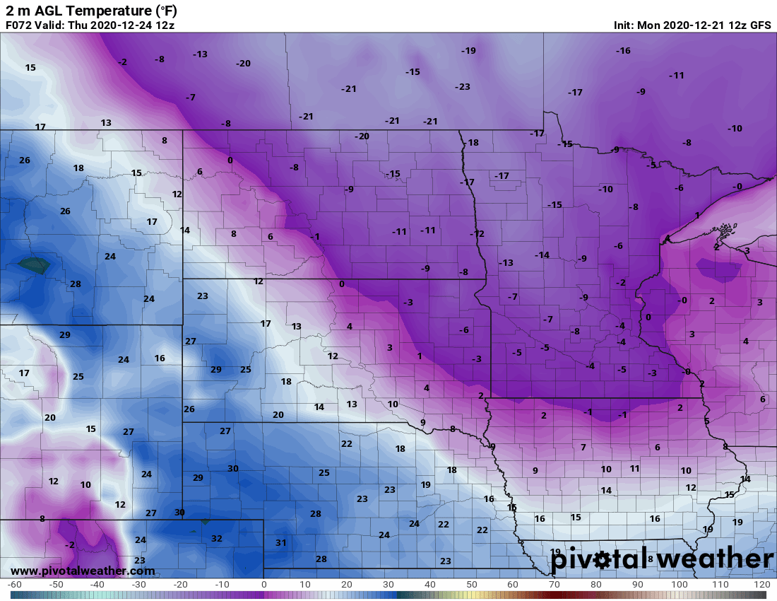
Behind the system, the first true arctic air mass invades Minnesota. Lows will dip below zero in the Twin Cities on Christmas Eve and Christmas Day. Lows should approach minus 20 in parts of northern Minnesota.