
Storm update: Southward shift, snowfall totals increasing for the Twin Cities
Heavier snow now likely in the Twin Cities. Highest totals in northeast Minnesota.

Go Deeper.
Create an account or log in to save stories.
Like this?
Thanks for liking this story! We have added it to a list of your favorite stories.


Just in time for white Christmas fans.
The midday forecast model runs show a distinct southward shift in Wednesday’s winter storm track. That brings the center of the storm, and heavier snowfall totals much closer to the greater Twin Cities area. Check the latest evolving National Weather Service winter weather advisories and warnings here.
Here’s my latest read on Wednesday’s winter storm.
Update at 6 p.m.: Forecast models continuing to pump up snowfall for the greater Twin Cities area. Latest (18Z) NAM 3 km cranks out 8 inches for the Twin Cities.
Turn Up Your Support
MPR News helps you turn down the noise and build shared understanding. Turn up your support for this public resource and keep trusted journalism accessible to all.
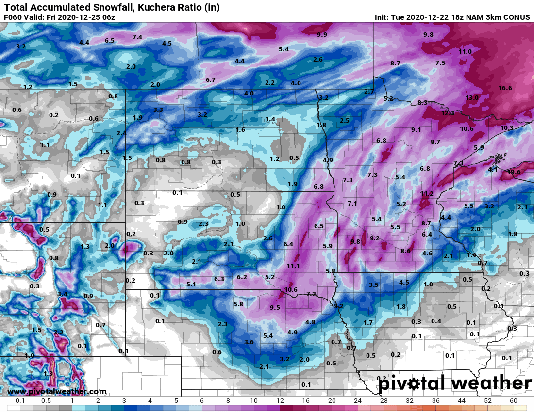
NOAA’s 18Z GFS model is even higher.
I’m inclined to agree and update MSP projected snowfall totals into the 4 to 8-plus inches range. Totals could go higher based on tonight’s 0Z model runs.
I’ll have an updated post tonight around 10 p.m.
The system
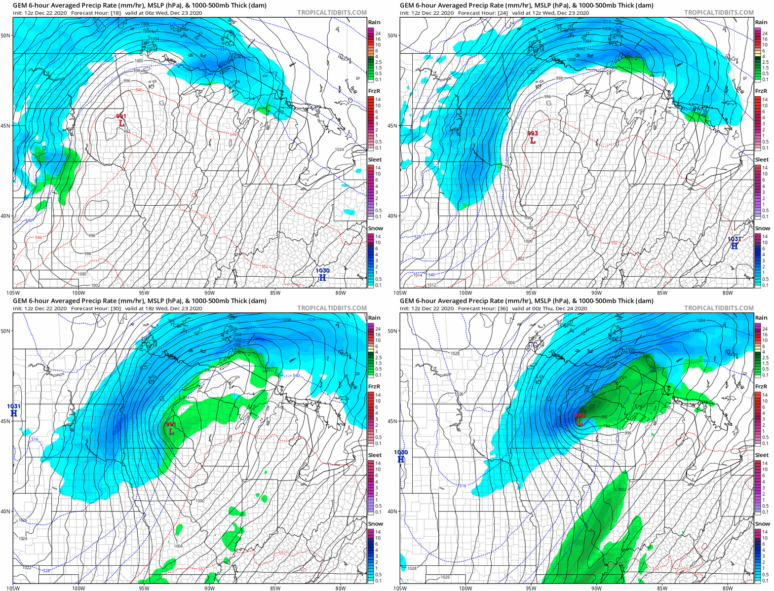
A potent, wrapped-up low-pressure system will track from west to east across Minnesota Wednesday. Forecast models generally agree the storm will move into western Minnesota Wednesday morning, and spin close to the Twin Cities area by midday Wednesday.
The Canadian model is similar to the European model with the storm track. It tracks the low through south-central Minnesota to very near the Twin Cities by midday Wednesday. Note the depiction of an intense snow band near the Twin Cities by late Wednesday afternoon.
Quick-hitting storm
One thing that jumps out at me is the quick-hitting nature of this system. Ahead of the low axis, it’s going to be a fairly mild, almost pleasant December morning. Some areas will see drizzle or light rain on the front side of the system. But once the low passes your location, there will be a rapid onset of cold, snow, and wind.
Here’s the European model forecast map for noon Wednesday. Note the dramatic difference in weather conditions between the east and western Twin Cities area.
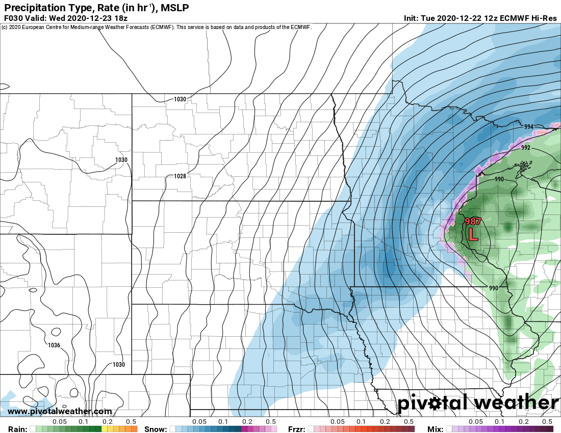
While the magnitude may be different here, this almost reminds me of an Armistice Day storm scenario, with a sudden shift from relatively mild weather, to intense wind and snow in a matter of a couple of hours.
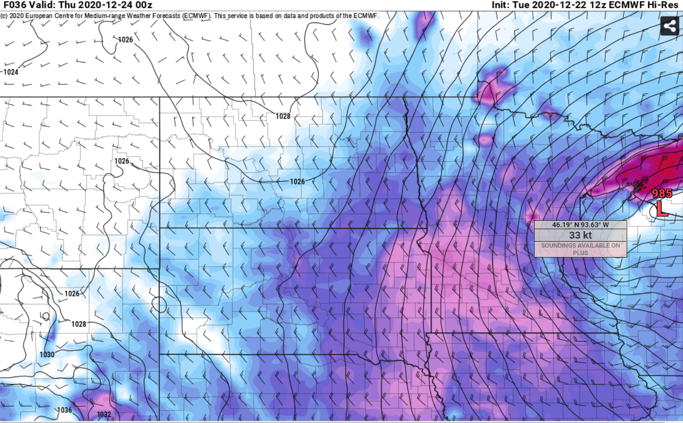
High winds and blowing snow
This storm will produce wind gusts over 50 mph and driving snow on the backside. We may see near-blizzard conditions in open areas Wednesday.
Snowfall totals
The southward shift in the storm track brings heavier snowfall totals to the Twin Cities and more of southern Minnesota. The American GFS model seems to be lagging with lighter snowfall trends for the greater Twin Cities.
The European and Canadian models favor a heavier snow axis setting up through the greater Twin Cities. The European (10:1 snow to water ratio) chart seems to be a reasonable mid-range of snowfall totals. It cranks out 6 to 10-inch snowfall totals across northeast Minnesota, with closer to 3 to 6 inches around the Twin Cities.
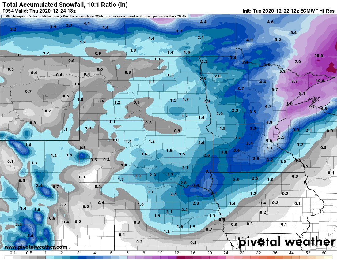
It should be noted that the European and Canadian Kuchera method snowfall forecasts suggest significantly higher, potentially double-digit, snowfall totals for the Twin Cities.

I’m inclined to think these may be overdone, but it’s certainly not out of the question that parts of the Twin Cities could pick up more than 6 inches of snow.
Bottom line: Snow and wind will increase rapidly from west to east across Minnesota Wednesday. This will be a quick-hitting system, and weather and travel conditions will rapidly deteriorate. I expect near-blizzard conditions in open areas Wednesday.
For the Twin Cities area, drizzle and rain will likely change to snow during the midday hours in the Twin Cities. A burst of several hours of heavy snow and wind will arrive Wednesday afternoon into the evening.
The storm will wind down overnight into Christmas Eve morning.
Season’s coldest air mass by Christmas Eve
Subzero air will follow the storm on Christmas Eve and Christmas Day.

