
January opens mild, arctic cold on the horizon?
Temperatures running about 10 degrees warmer than average this week
Go Deeper.
Create an account or log in to save stories.
Like this?
Thanks for liking this story! We have added it to a list of your favorite stories.


Minnesota’s milder than average winter rolls on this week.
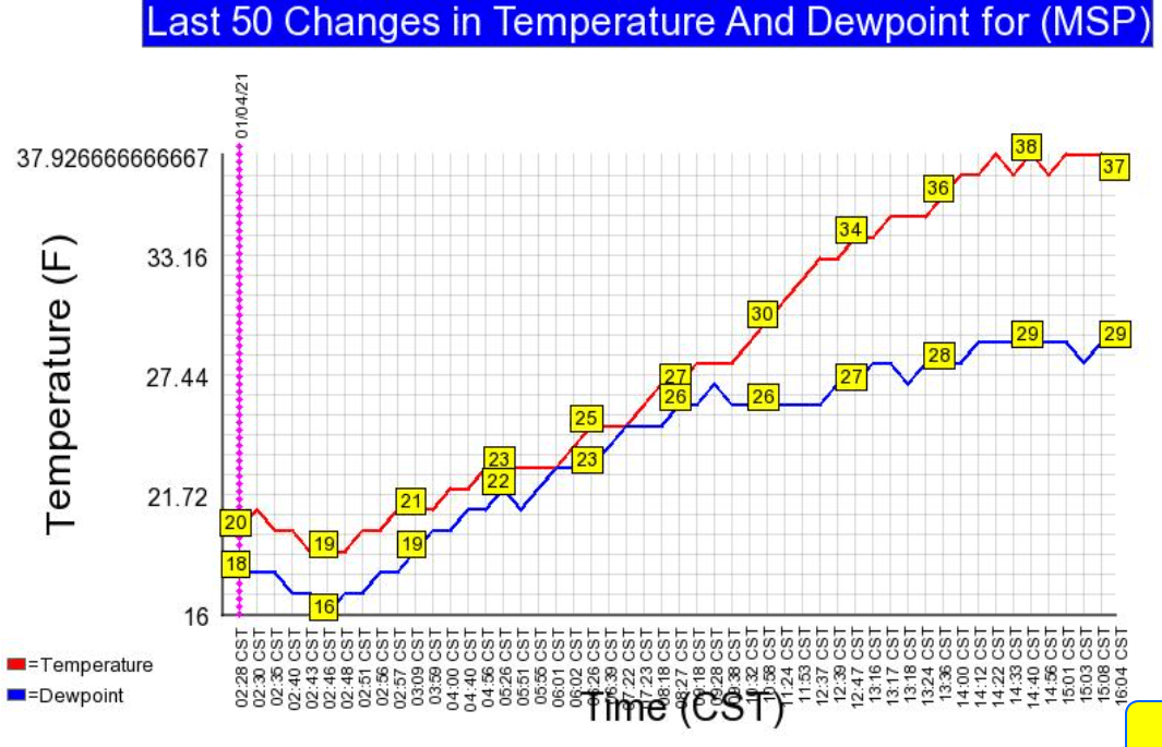
Temperatures are running more than 10 degrees warmer than average in Minnesota again today. The average high and low for Jan. 4 at the Minneapolis-St. Paul International Airport are 24 and 8 degrees. The airport bottomed out at 19 degrees early Monday. Temperatures soared to 38 degrees Monday afternoon under brilliant sunshine.
The national temperature map shows the lack of any Arctic air masses across the lower 48 states Monday afternoon.

Highs will run in the 30s most of the week across much of southern and western Minnesota.
Turn Up Your Support
MPR News helps you turn down the noise and build shared understanding. Turn up your support for this public resource and keep trusted journalism accessible to all.
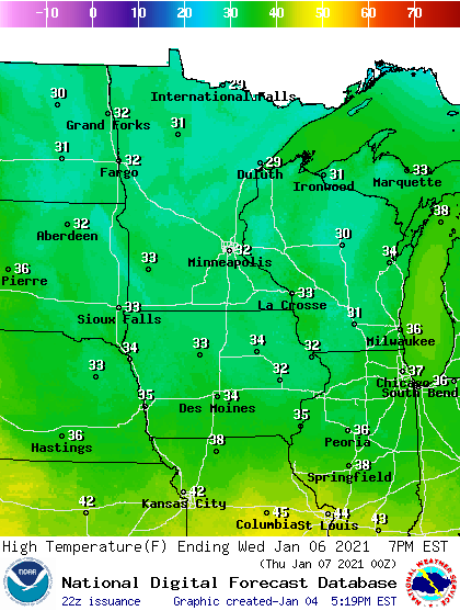
Overall temperatures will run between 5 and 10 degrees warmer than average this week across most of Minnesota.
Arctic cold by mid-month?
Right now I don’t see any big snows on the horizon just yet. The upper air forecast maps suggest a shot of colder arctic air may arrive around mid-month. The jet stream appears ready to dive deep into the central United States around Jan. 17.
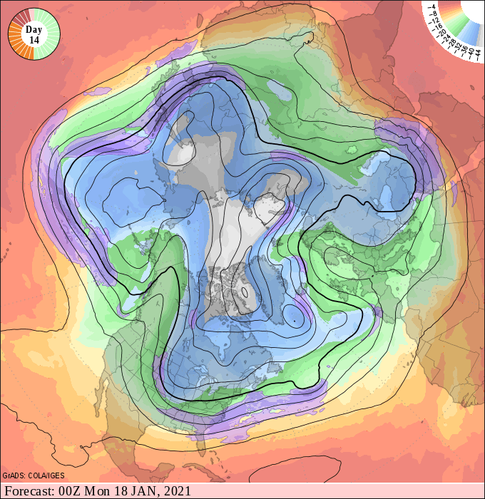
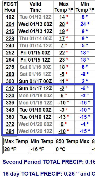
If that pattern verifies, much colder air will dive south across the eastern U.S. in mid-January. An early look at NOAA’s 16-day outlook suggests a shot of subzero air arriving between about Jan. 16-20.
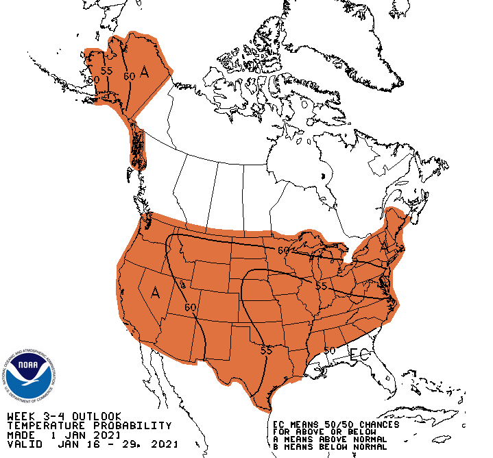
There are some early indications the colder pattern could be transitory, and that milder air may return by late January. NOAA’s week 3 to 4 temperature outlook suggests milder than average temperatures overall for late January.
Stay tuned.

