Dense fog advisory until 11 am; Classic January weekend ahead
Still tracking potential subzero air in about 10 days.
Go Deeper.
Create an account or log in to save stories.
Like this?
Thanks for liking this story! We have added it to a list of your favorite stories.


Thick fog again
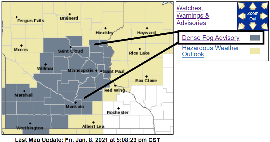
Dense fog advisories are up again from the Twin Cities through St. Cloud into southwest Minnesota.
Including the cities of St Cloud, Sauk Rapids, Elk River, Cambridge, Center City, Willmar, Litchfield, Monticello, Minneapolis, Blaine, St Paul, Stillwater, Olivia, Hutchinson, Gaylord, Chanhassen, Chaska, Victoria, Shakopee, Hastings, Redwood Falls, New Ulm, St Peter, Le Sueur, Faribault, St James, Mankato, Waseca, and Fairmont
218 PM CST Fri Jan 8 2021
...DENSE FOG ADVISORY IN EFFECT FROM 9 PM THIS EVENING TO 11 AM CST SATURDAY...
* WHAT...Visibility one quarter mile or less in dense fog.
* WHERE...Portions of central, east central, south central and southwest Minnesota.
* WHEN...From 9 PM this evening to 11 AM CST Saturday.
* IMPACTS...Hazardous driving conditions due to low visibility.
* ADDITIONAL DETAILS...Slick spots on roads, overpasses, and sidewalks are also possible as the fog freezes on exposed surfaces.
Mild winter so far
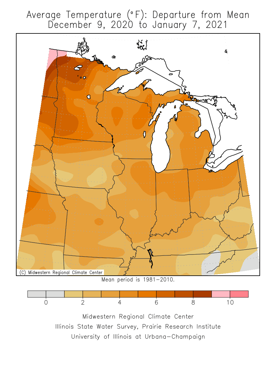
It’s been a mild winter so far for Minnesota.
Turn Up Your Support
MPR News helps you turn down the noise and build shared understanding. Turn up your support for this public resource and keep trusted journalism accessible to all.
The Twin Cities area is running about 6 degrees warmer than average so far since the start of meteorological winter on December 1. Parts of northwest Minnesota are running closer to 9 degrees warmer than average.
Classic winter weekend
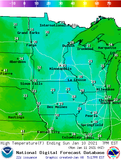
This weekend brings seasonal temperatures and light winds. Highs will run in the 20s to near 30 degrees this weekend.
Expect clouds with a few sunny breaks this weekend.
Arctic air ahead?
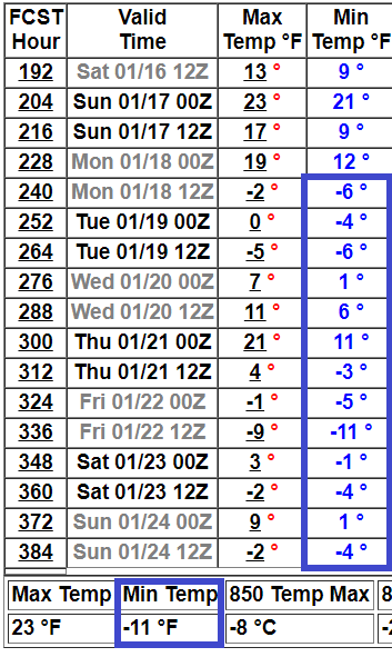
I’m still watching the potential for a shot of subzero air in about 10 days. NOAA’s upper air forecast maps still suggest a frigid northwest flow pattern developing after next week.
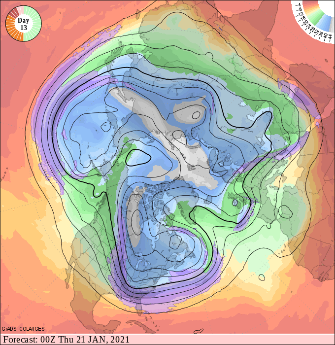
NOAA’s GFS model 16-day outlook still cranks out a few subzero nights starting around January 17.