
January thaw: Highs in the 40s likely by Wednesday
Winter in Minnesota is running about 6 degrees warmer than average so far
Go Deeper.
Create an account or log in to save stories.
Like this?
Thanks for liking this story! We have added it to a list of your favorite stories.


Welcome to Winter Lite.
Our milder than average weather pattern continues into midweek across Minnesota. Highs Monday again pushed into the 30s for many locations. Temperatures surged into the 50s in the upstream air mass in South Dakota Monday.
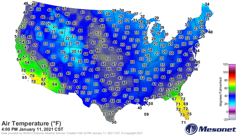
Tuesday brings another day of mild southwest breezes. Another January warm front is heading this way and blows through Minnesota on Wednesday.
Tuesday’s highs will be a few degrees warmer than Monday. Highs will reach the mid-40s in southwest Minnesota.
Turn Up Your Support
MPR News helps you turn down the noise and build shared understanding. Turn up your support for this public resource and keep trusted journalism accessible to all.
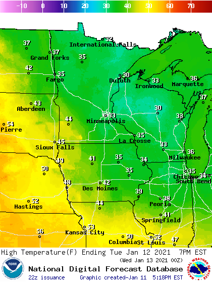
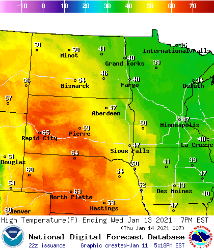
Wednesday brings peak warmth with this January thaw. My temperature computations suggest the mid-40s for the Twin Cities and southern Minnesota Wednesday afternoon. I won’t be surprised to see 50s in southwest Minnesota this week.
And check out the remarkable warmth of the inbound air mass over the snow-free areas of Nebraska and South Dakota where temperatures will hit or exceed 60 degrees on Jan. 13.
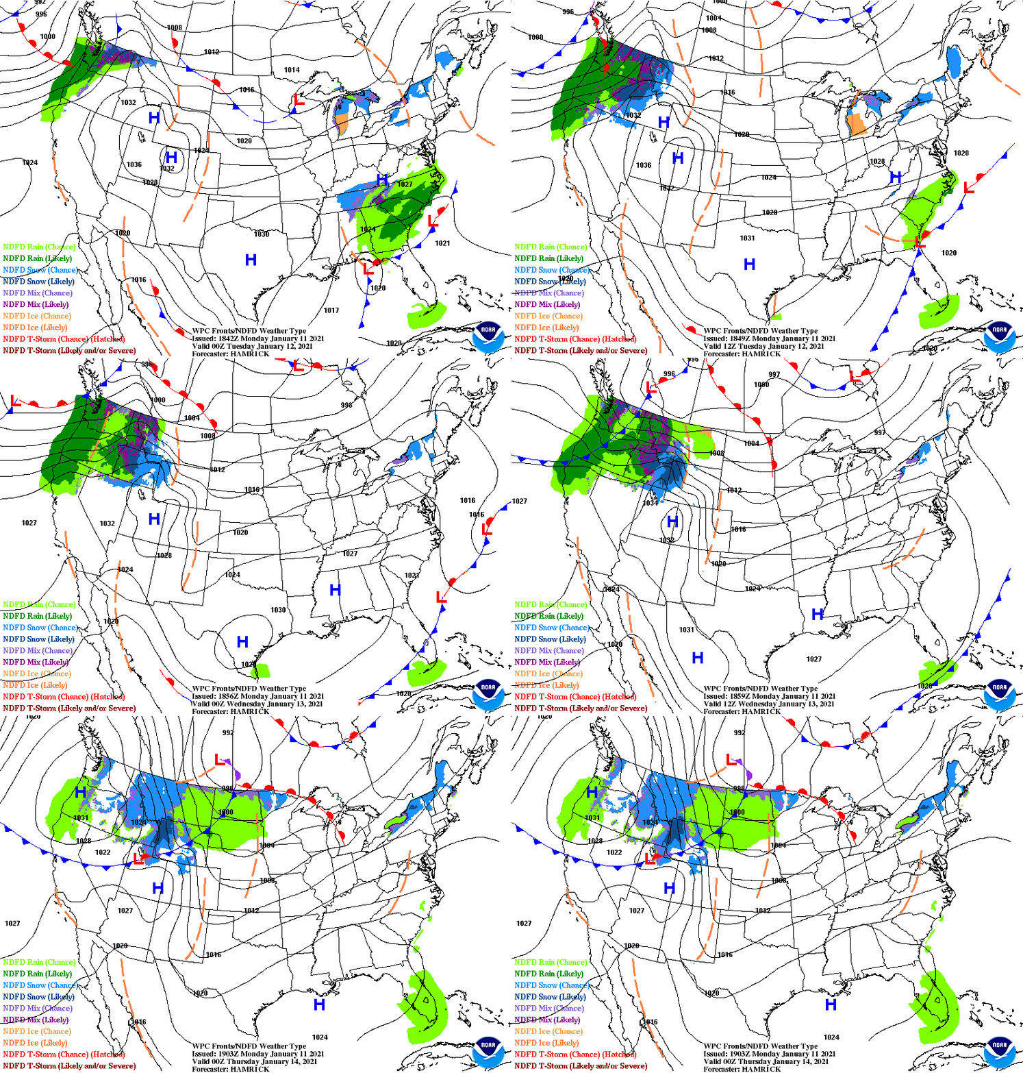
Cold front Thursday
As you can see on the surface weather map above, a low-pressure system and cold front will sweep through Thursday after our unseasonably warm Wednesday. Look for a chance of rain or snow Thursday, with gusty northwest winds driving much colder air southward.
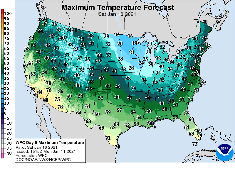
High by Saturday will be slightly colder than average, with 20s south and teens in northern Minnesota.
There are still signs of possible subzero air by around Jan. 22.

