Storm update: Heaviest snow bands through noon Friday
Blizzard and winter storm warnings continue into Friday.
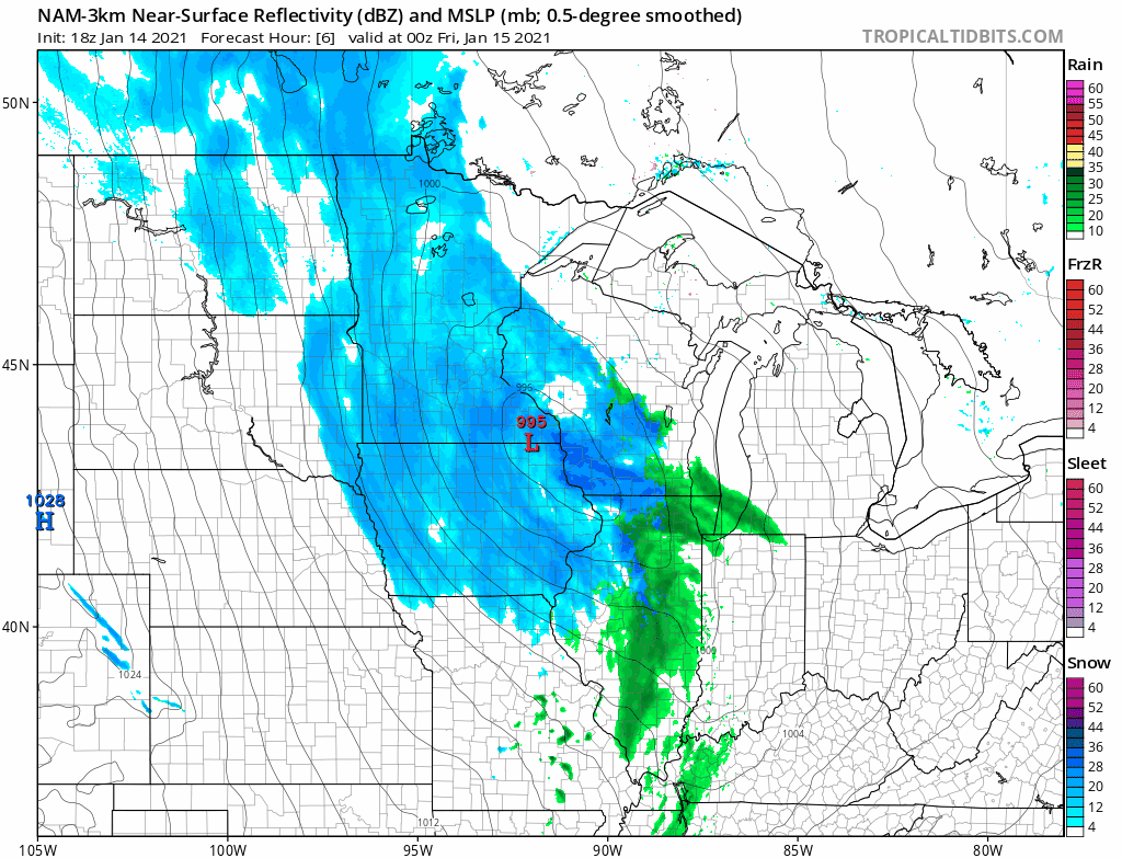
Updated: 10 p.m.
Bands of moderate snow pushed back into the Twin Cities Thursday evening as expected. Expect snowfall to continue for most of the overnight hours through midday Friday. Snowfall rates may taper Friday morning through the afternoon before ending.
The late evening 0Z forecast model runs still suggest an additional 2 to 5 inches across the Twin Cities by late Friday. Heavier snowfall totals of 4 to 8 inches are likely across southern Minnesota.
Here’s an update on Minnesota’s winter storm as we head through Thursday night into Friday morning.
Warnings
Winter storm and blizzard warnings remain in effect for much of southern Minnesota. Winter weather advisories cover much of central Minnesota and northwest Wisconsin.
Political Coverage Powered by You
Your gift today creates a more connected Minnesota. MPR News is your trusted resource for election coverage, reporting and breaking news. With your support, MPR News brings accessible, courageous journalism and authentic conversation to everyone - free of paywalls and barriers. Your gift makes a difference.
Heaviest snow overnight
The low-pressure system deepens overnight into Friday morning. The heaviest snowfall bands rotate around the low between about 9 p.m. Thursday and noon Friday. That’s when the bulk of accumulating snow will fall.
NOAA’s NAM 3 km resolution model shows bands of moderate to heavy snow into midday Friday.
Snowfall totals
Around an inch of sloppy snow fell in the Twin Cities area through Thursday afternoon. Central Minnesota has picked up 2 to 3 inches in many areas.
1 ESE Nisswa [Crow Wing Co, MN] CO-OP OBSERVER reports SNOW of 2.00 INCH at 3:44 PM CST
Hinckley [Pine Co, MN] PUBLIC reports SNOW of 3.00 INCH at 4:50 PM CST
Breezy Point [Crow Wing Co, MN] PUBLIC reports SNOW of 3.50 INCH at 2:58 PM CST
Another 4 to 8 inches is likely in a wide zone across southern Minnesota including the Twin Cities. That should bring snowfall totals to between 5 and 10 inches across much of southern Minnesota.
Here’s the updated graphic from the National Weather Service in the Twin Cities late Thursday afternoon for additional snowfall expected.
Bottom line: Snowfall intensity and winds will peak between 9 p.m. Thursday and noon Friday. Snowfall totals between 5 and 10 inches will be common across southern Minnesota including the Twin Cities by Friday evening. High winds with gusts near and over 50 mph in southern Minnesota will produce blizzard conditions in open areas.