
Light snowy dusting overnight; colder week except for Wednesday
A more significant snow chance Saturday?
Go Deeper.
Create an account or log in to save stories.
Like this?
Thanks for liking this story! We have added it to a list of your favorite stories.


We’re finally getting some more typical temperatures for January in Minnesota. This week brings plenty of hours in the teens and single digits above and below zero.
The one mild day this week is Wednesday, when highs will pop back into the 30s once again.
Snowy dusting overnight
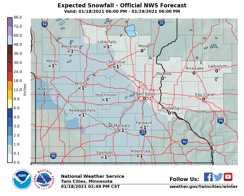
Southwest Minnesota picks up a snowy dusting overnight into Tuesday morning.
Turn Up Your Support
MPR News helps you turn down the noise and build shared understanding. Turn up your support for this public resource and keep trusted journalism accessible to all.
Around an inch will fall in southwest Minnesota, with less than an inch as you work northeast toward the Twin Cities. The snow won’t be heavy, but with cold temperatures, some roads may be slick overnight into Tuesday morning.
Closer to zero
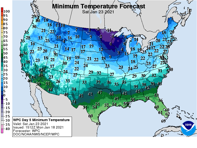
By late this week, overnight low temperatures will hover a few degrees either side of zero in Minnesota. Check out the expected low Saturday morning.
Snow chance Saturday
Some warmer air appears ready to try and overrun the cold air dome Saturday. That process creates a snowfall-generating lift in Minnesota winters.
Monday’s Canadian model favors a wave of accumulating snow across southern Minnesota Saturday.

The American model is similar for Saturday. It’s too early in the forecast process for credible snowfall total forecasts. Stay tuned to see how this evolves this week.

