
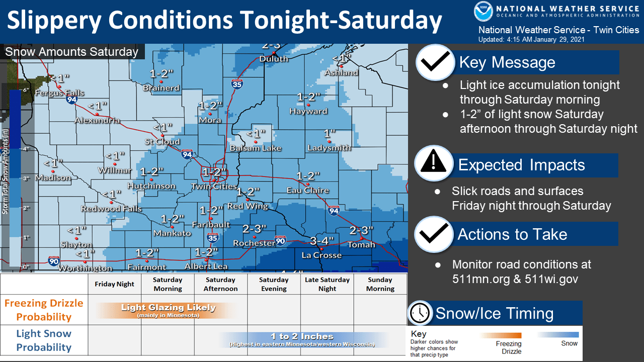
Light ice and snow: Freezing drizzle and 1 to 2 inches of snow this weekend
Winter weather advisory covers much of Minnesota
Go Deeper.
Create an account or log in to save stories.
Like this?
Thanks for liking this story! We have added it to a list of your favorite stories.


It’s a light but wintry mix this weekend.
Winter weather advisories are up for the southwest two-thirds of Minnesota into Sunday. The advisory zone runs basically south and west from Bemidji to Hinckley line.
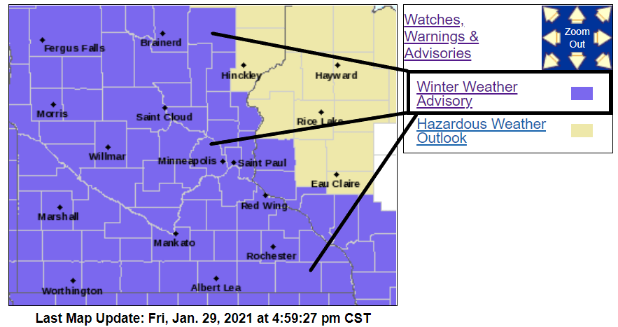
Including the cities of Cambridge, Center City, Minneapolis, Blaine, St Paul, Chanhassen, Chaska, Victoria, Shakopee, Le Sueur, Mankato, Fairmont, and Blue Earth
252 PM CST Fri Jan 29 2021 ...WINTER WEATHER ADVISORY IN EFFECT FROM 4 AM SATURDAY TO 6 AM CST SUNDAY...
* WHAT...Mixed precipitation expected. Total snow accumulations of up to two inches and ice accumulations of up to a tenth of an inch.
* WHERE...Portions of east central and south central Minnesota.
* WHEN...From 4 AM Saturday to 6 AM CST Sunday.
* IMPACTS...Plan on slippery road conditions.
Light ice and snow
Temperatures this weekend hover closer to freezing in the lowest mile of the atmosphere. That means mixed precipitation types including freezing drizzle, possibly sleet and graupel, and snow.

NOAA’s NAM 3 km resolution model paints a light wintry mix across Minnesota.
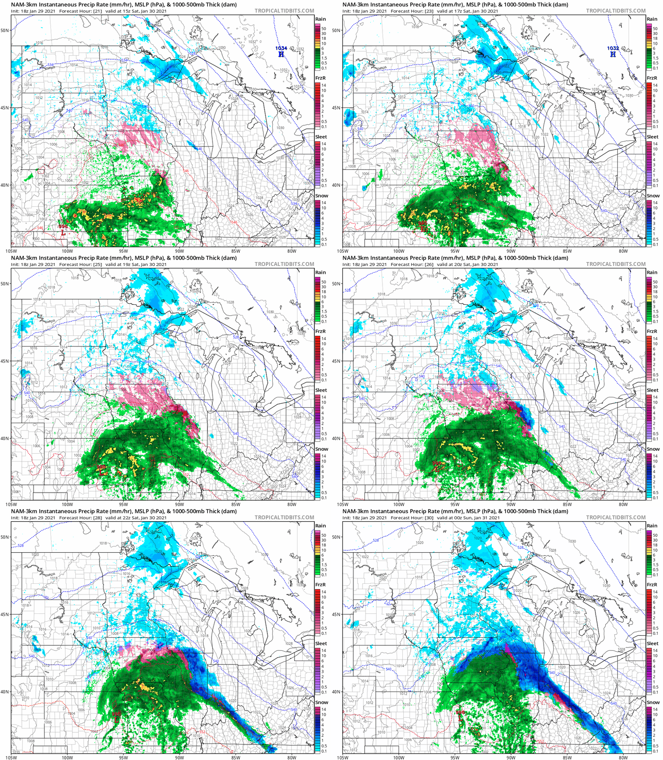
Overall snowfall accumulations look light, with most areas picking up an inch or 2. But with light snow falling on top of a thin icy coating, untreated streets and surfaces will get slick.
Be careful out there walking this weekend.
Turn Up Your Support
MPR News helps you turn down the noise and build shared understanding. Turn up your support for this public resource and keep trusted journalism accessible to all.

