
Probably polar: Winter's coldest air mass late next week?
Tracking polar vortex potential late next week

Go Deeper.
Create an account or log in to save stories.
Like this?
Thanks for liking this story! We have added it to a list of your favorite stories.


The coldest air of winter for parts of Minnesota appears growingly likely to invade in about a week.
We’re still tracking a potential polar vortex outbreak late next week into the first weekend of February. Forecast models show a buckle in the jet stream that is likely to drive the coldest temperatures so far this winter into parts of Minnesota.
Snow first?
Arctic air invasions are notorious for spinning up snow systems on the leading edge as they plunge south into the Upper Midwest. Today’s forecast models continue trends that evolved this week suggesting a possible snowfall event ahead Wednesday and Thursday of the arctic outbreak.
Here’s NOAA’s GFS model from 6 p.m. next Wednesday to 6 p.m. Thursday.
Turn Up Your Support
MPR News helps you turn down the noise and build shared understanding. Turn up your support for this public resource and keep trusted journalism accessible to all.
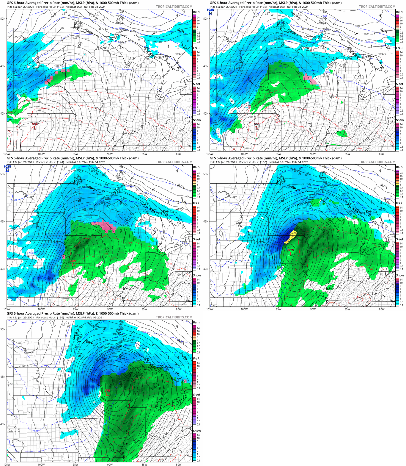
A mild Wednesday may produce rain or mixed precipitation, which likely changes to all snow Wednesday night into Thursday. The storm track is still too far out to be precise, but this system will likely generate a band of heavier snowfall somewhere in Minnesota.
Polar vortex surges south
The medium-range forecast maps a week out still drive a lobe of the polar vortex south into Minnesota by next weekend, Feb. 6 and 7.
This may not be the Mother Lode of the coldest Arctic air, but temperature guidance suggests minus 10s to minus 20s are growingly likely in southern Minnesota including the Twin Cities area.
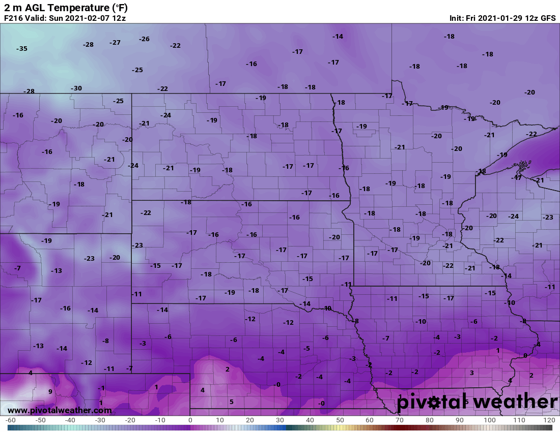
It should be noted that the European model brings less-severe subzero air into Minnesota next weekend.
Several locations in northern Minnesota have reached minus 35 so far this winter season. The coldest temperature recorded at the Minneapolis-St. Paul International Airport so far this winter is minus 5 on Christmas morning.

