
Mild winter so far; snow chance and bitter cold on the way this week
Minnesota is running 6 to 15 degrees warmer than average so far this winter
Go Deeper.
Create an account or log in to save stories.
Like this?
Thanks for liking this story! We have added it to a list of your favorite stories.


It’s a very mild winter so far in Minnesota.
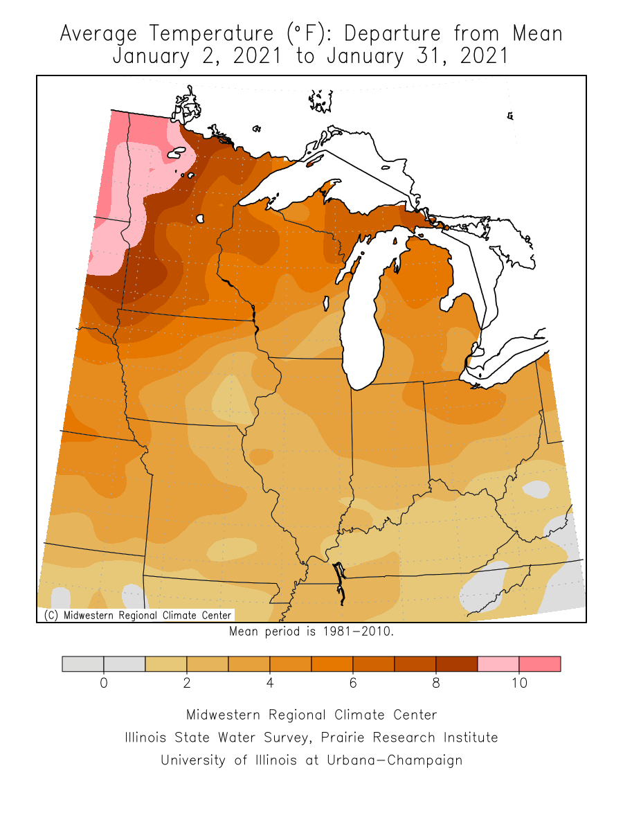
Two-thirds of Meteorological winter is in the books now. December was 5.6 degrees warmer than average in the Twin Cities. January temperatures were 6.5 degrees warmer than average in the Twin Cities.
It’s been even warmer compared to average in western Minnesota. parts of the Red River Valley ran 10 to 15 degrees warmer than average in January.
Mild Wednesday ahead
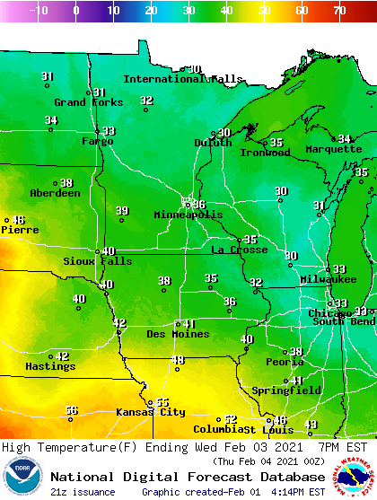
Our mild bias continues through Wednesday. Temperatures Wednesday afternoon will challenge 40 degrees in southwest Minnesota, with 30s covering most of the state.
Thursday snow chance
A low-pressure system will spin up Thursday in Colorado and track east toward Chicago. NOAA’s GFS model paints the rain to snow scenario across Minnesota Thursday.

Early snowfall forecasts look light to moderate so far. A blotchy snowfall pattern seems likely to produce 2 to 4 inches across parts of Minnesota, and possibly in the Twin Cities area.
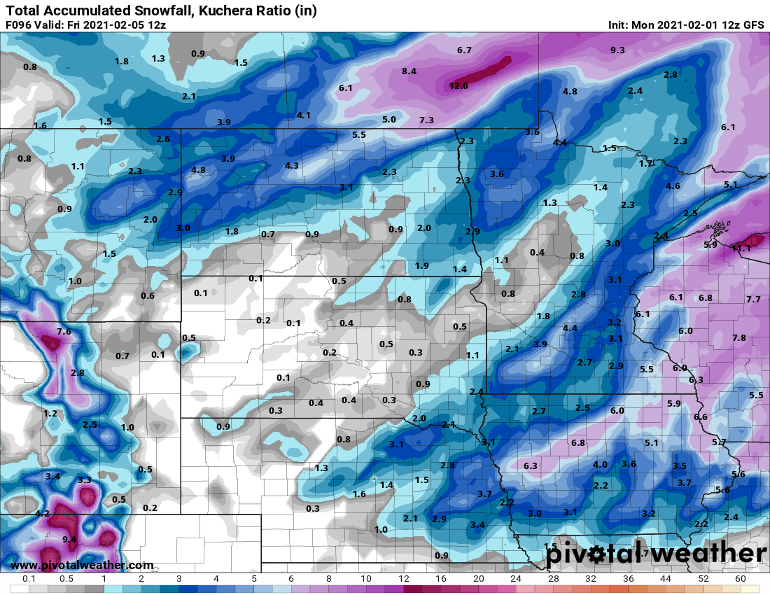
Stay tuned for possible storm track changes. That could change snowfall forecasts this week.
Turn Up Your Support
MPR News helps you turn down the noise and build shared understanding. Turn up your support for this public resource and keep trusted journalism accessible to all.

