
Twin Cities rides snowy edge Thursday; near-blizzard in southern Minnesota
Sharp snowfall cutoff in northwest Twin Cities. Bitter cold this weekend.
Go Deeper.
Create an account or log in to save stories.
Like this?
Thanks for liking this story! We have added it to a list of your favorite stories.


A messy winter storm pushes into Minnesota starting in the overnight hours and lasting into Thursday. The system will bring a wide variety of weather conditions to Minnesota.
Let’s break down the timing and impacts.
The system
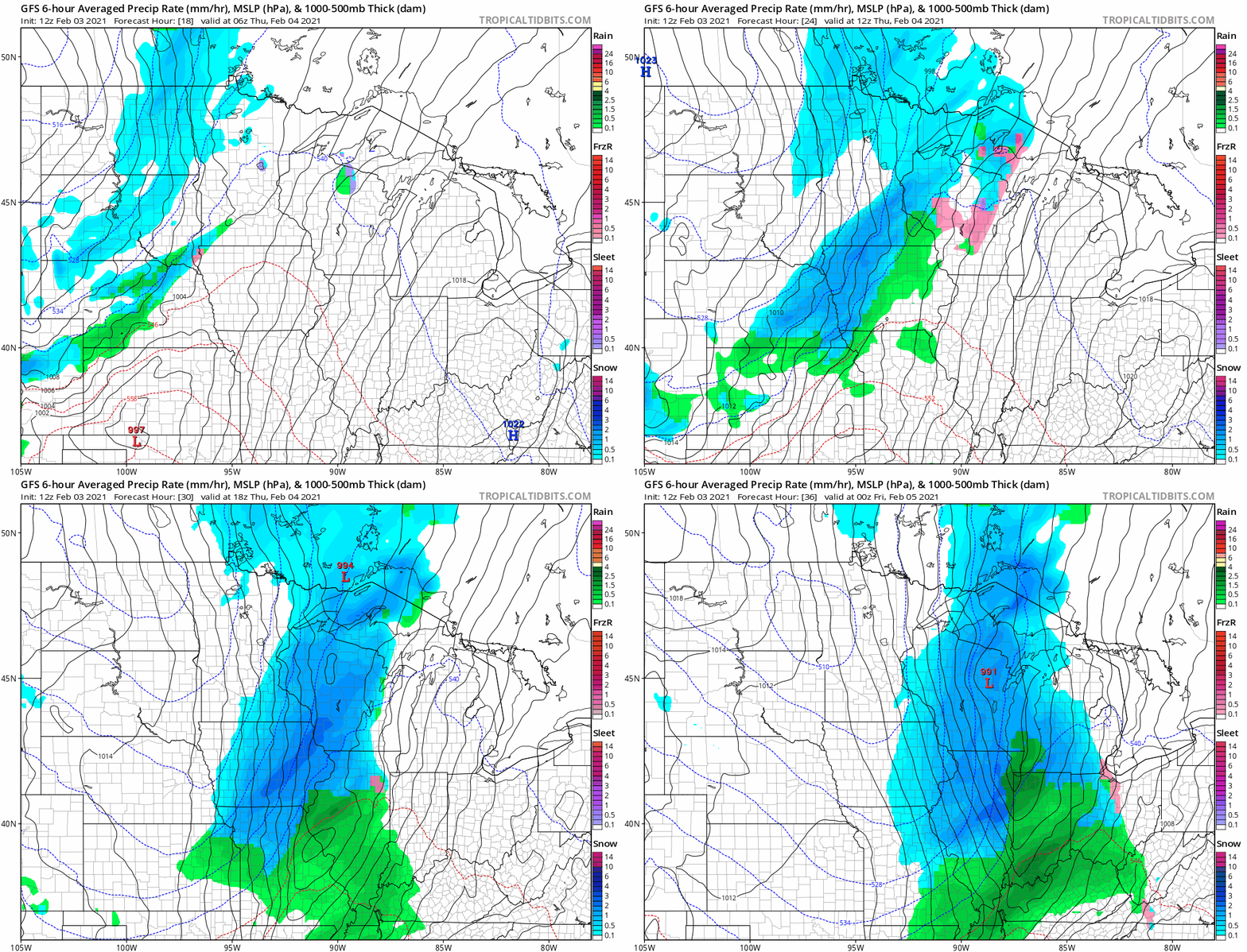
A low-pressure system forming in Colorado will ride up a cold front plowing through the Midwest Thursday. The system will bring a wintry mix overnight that will change to all snow by morning. Precipitation will end from west to east in Minnesota late Thursday.
Here’s the National Oceanic and Atomospheric NOAA’s GFS model depiction of the system.
Turn Up Your Support
MPR News helps you turn down the noise and build shared understanding. Turn up your support for this public resource and keep trusted journalism accessible to all.
Messy precipitation mix overnight
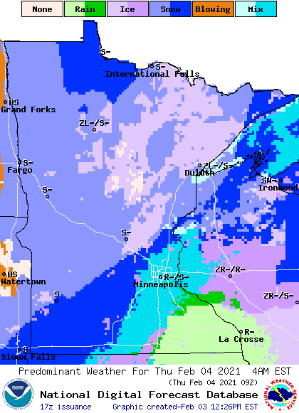
A wintry mix of rain, ice, and snow will develop across Minnesota overnight. Precipitation will change to snow by early Thursday morning. Thursday morning could feature an icy coating with snow coming down for morning rush hours.
Snowfall totals
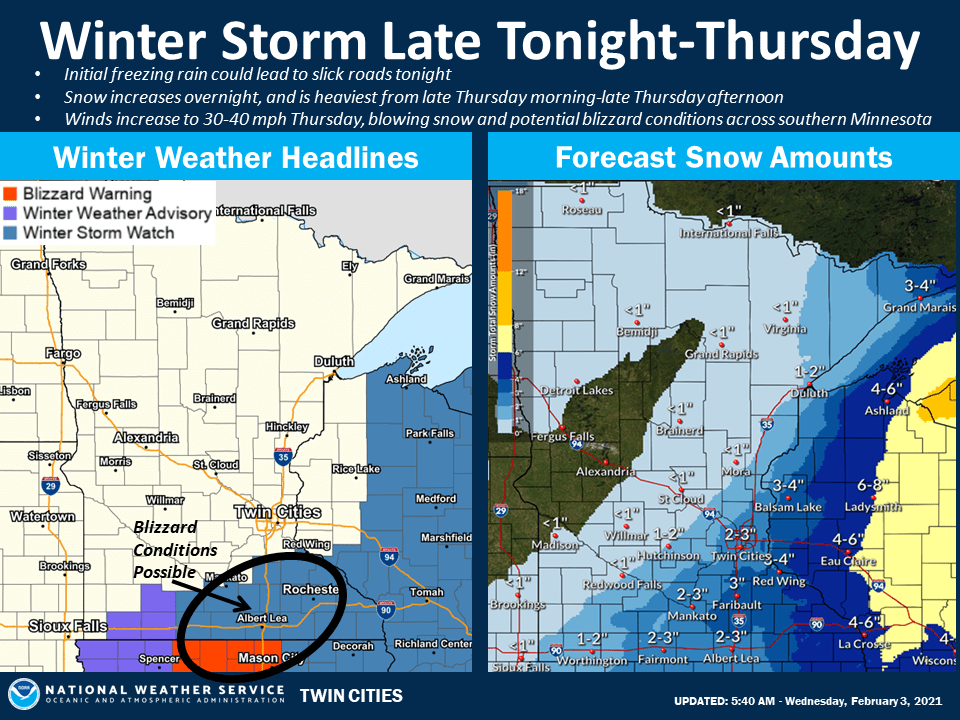
This system will heaviest snowfall across southeast Minnesota and Wisconsin. Here’s a breakdown of likely snowfall totals across Minnesota.
Little or no snowfall is likely across most of western and central Minnesota.
A big snowfall gradient is likely across the Twin Cities from the northwest (1 inch or less) to southeast. (3 to 4 inches) Any small shift in the storm track could change snowfall totals.
A zone of 3 to 6 inches+ is likely east and southeast of the Twin Cities.
This European model snowfall output shows the potential for a sharp snowfall cutoff across the Twin Cities. This scenario would produce little snow in the northwest half of the Twin Cities, and a few inches in the far southeast.

Here’s the latest available advisory and snowfall map from the Twin Cities NWS office.
Near-blizzard conditions in southern Minnesota
Blizzard warnings are up for northern Iowa. The combination of winds and blowing snow could produce near-blizzard conditions in southern Minnesota.

Expect travel conditions to quickly deteriorate if you are traveling east or south of the Twin Cities Thursday.

