
20 degrees below in Twin Cities? Next Arctic air surge looks even colder.
This weekend's Arctic shot looks a few degrees colder than last weekend.
Go Deeper.
Create an account or log in to save stories.
Like this?
Thanks for liking this story! We have added it to a list of your favorite stories.


The next lobe of the Polar Vortex will dive into Minnesota this weekend. This next shot of subzero air looks even colder than last weekend’s air mass. Temperatures bottomed out at negative 16 in the Twin Cities last Sunday morning. It hit minus 43 in Cotton on Monday morning.
The upper air maps show the core of this bitter air mass diving south into Minnesota this weekend.
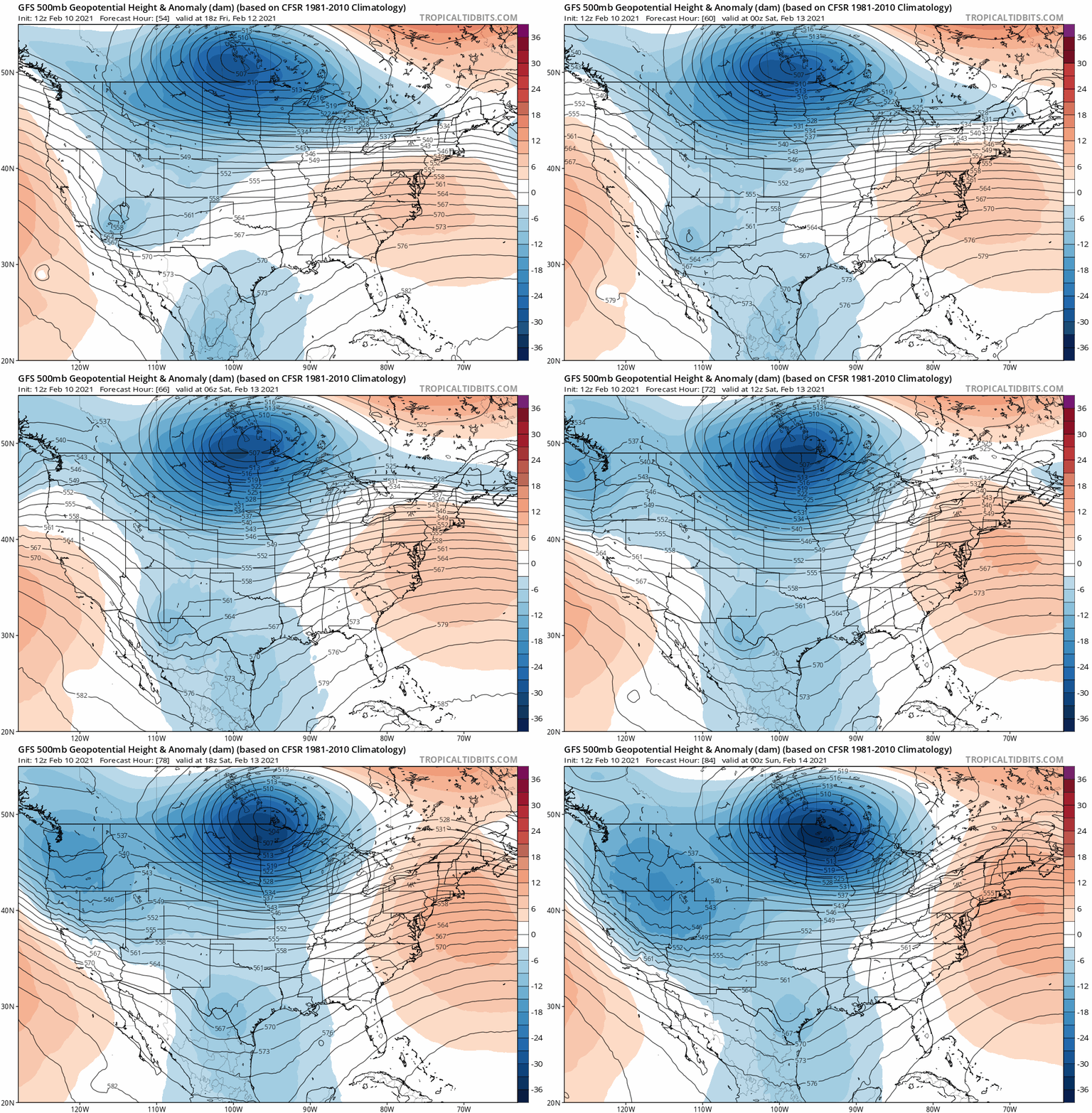
Peak cold this weekend
Bitter cold is cold enough in winter. But forecasting peak cold during an Arctic outbreak is tricky. Several factors come into play like snow cover, cloud cover, and even local wind direction.
Every indication suggests next weekend will be a few degrees colder than last weekend. Extreme weather events are often underestimated by many forecasts.
Turn Up Your Support
MPR News helps you turn down the noise and build shared understanding. Turn up your support for this public resource and keep trusted journalism accessible to all.
Here is NOAA’s minimum temperature forecast for Presidents’ Day on Monday. Note the forecast minimum of minus 15 for the Twin Cities and minus 22 in northern Minnesota.
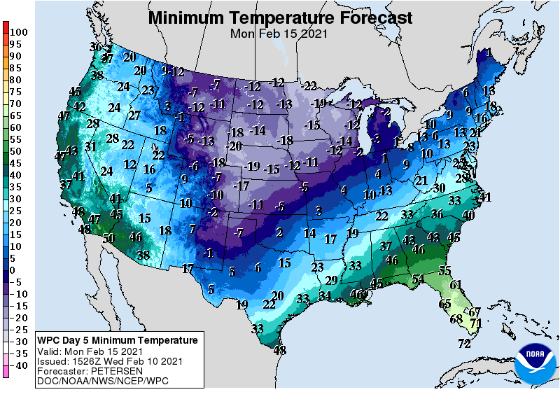
Last weekend’s forecasts underestimated the level of cold by several degrees in the Twin Cities, and by more than 10 degrees in northern Minnesota.
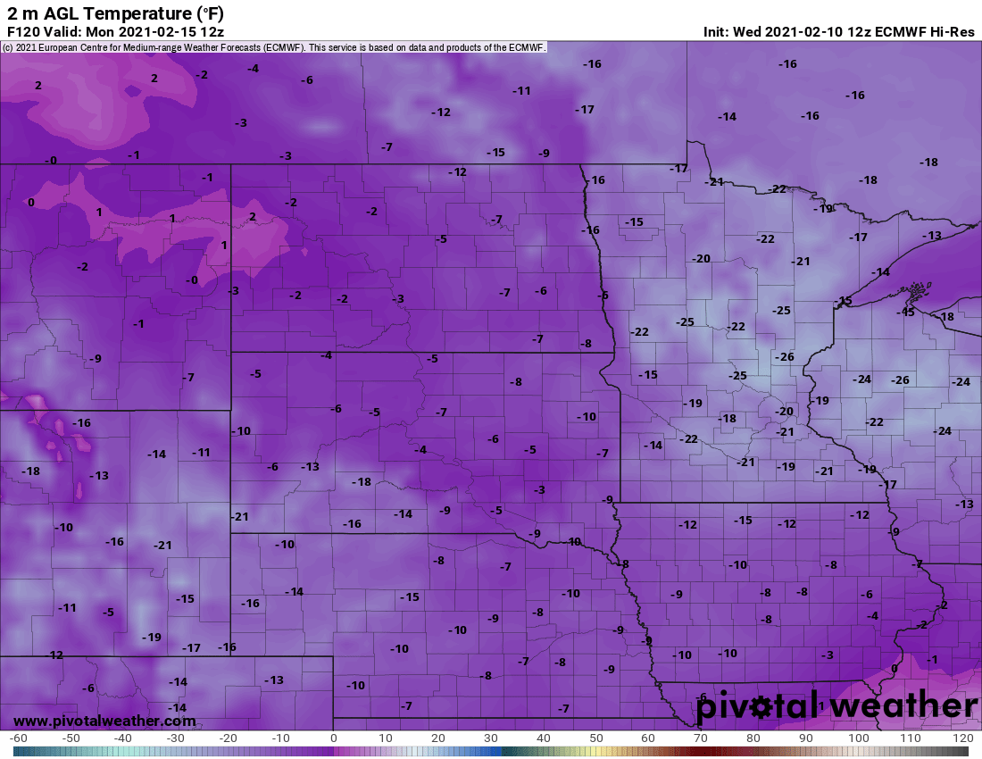
This weekend’s forecast models are running even colder than last week. The European model is the most conservative with next weekend's cold outbreak. It cranks out a low of negative 20 for the Twin Cities next Monday morning.
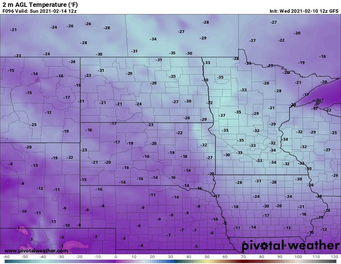
The American GFS model is noted by modelers and practicing meteorologists as having a “cold bias.” It cranks out some incredibly cold numbers for Sunday morning, suggesting a low of negative 32 for the Twin Cities.
Other forecast models like the Canadian crank out lows in the negative 20s for the Twin Cities next weekend.
How low will it go?
My read of trends this weekend suggests that we will get colder than the negative 15 we recorded at MSP Airport last weekend. Sunday and Monday mornings will likely be the two coldest mornings in this next subzero Arctic cold wave. I think that minus 20 is a likely outcome for the Twin Cities by Monday morning. Lows in the minus 20s are likely in the Twin Cities suburbs and much of southern Minnesota. And I won’t be surprised to see minus 40 again in the colder nooks of northern Minnesota.
This is serious cold. Stay tuned, and stay warm Minnesota.

