
45 below zero at Cotton, Minnesota Friday; Twin Cities near 20 below this weekend
Core of winter's coldest air arrives this weekend.
Go Deeper.
Create an account or log in to save stories.
Like this?
Thanks for liking this story! We have added it to a list of your favorite stories.


This is what the bottom of winter feels like Minnesota.
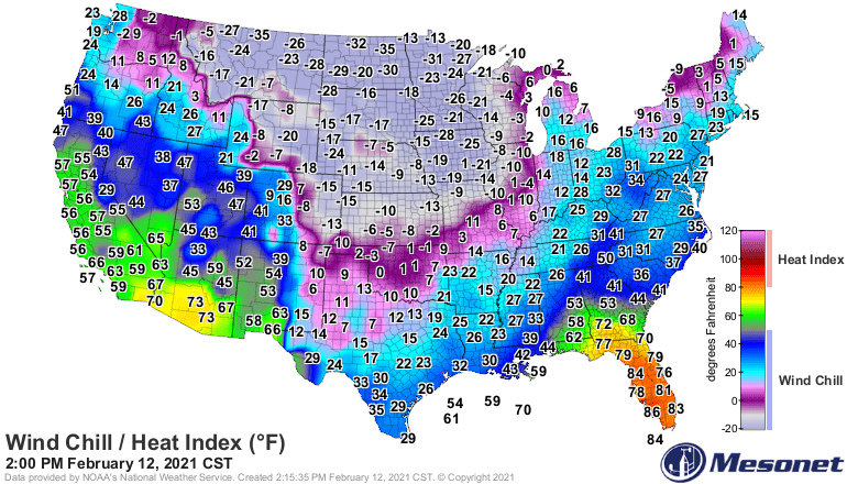
The core of winter’s coldest air mas oozes into Minnesota this weekend. The mercury plunged to 45 degrees below zero in Cotton, Minnesota Friday morning. Several locations in northern Minnesota exceeded 40-below.
Cotton: minus 45
Ely: minus 44
Kabetogema : minus 41
Coldest weekend of winter
This weekend will be a few degrees colder than last weekend for most Minnesota locations. Expect more negative 40s up north. The Twin Cities bottomed out at negative 16 last weekend. I think we’ll see minus 20 at MSP Airport this weekend, with minus 20s to near 30 below zero in some of the colder the ‘burbs like Lakeville.
Again, the numbers below seem too conservative for me for northern Minnesota, where lows will likely crater into the negative 30s to negative 40s again this weekend.
Turn Up Your Support
MPR News helps you turn down the noise and build shared understanding. Turn up your support for this public resource and keep trusted journalism accessible to all.
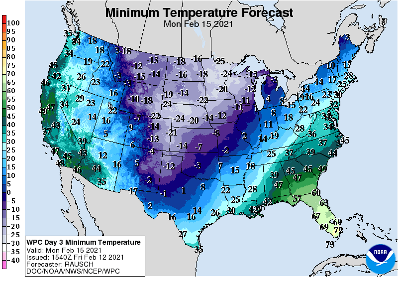
Record lows for the Twin Cities this weekend are minus 23 for Saturday morning, and minus 25 for Sunday and Monday mornings.
Cold wave breaks next week
The upper air pattern finally kicks the Polar Vortex lobe out of Minnesota next week. By next weekend a Pacific flow pattern mercifully returns to Minnesota.
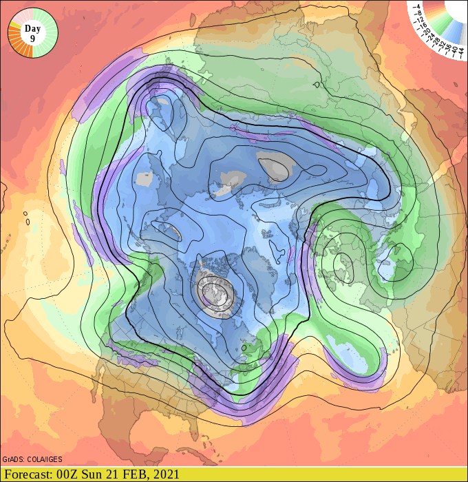
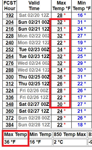
Highs will gradually warm into the teens above zero next week. There are signs of a (sustained?) thaw by the weekend of February 20-21.
Stay warm this weekend. The worst of our winter cold will be behind us in about 5 days.

