
Whiplash: Monday will be 80 degrees warmer than last weekend up north.
Highs in the 40s likely next week in the Twin Cities
Go Deeper.
Create an account or log in to save stories.
Like this?
Thanks for liking this story! We have added it to a list of your favorite stories.


Get ready for another wild temperature swing Minnesota.
Last weekend brought temperatures of minus 40 to minus 50 in northern Minnesota. By next Monday temperatures will reach the upper 30s — above zero — up north. That means temperatures will be as much as 85 degrees warmer in locations like Ely next Monday than it was last weekend.
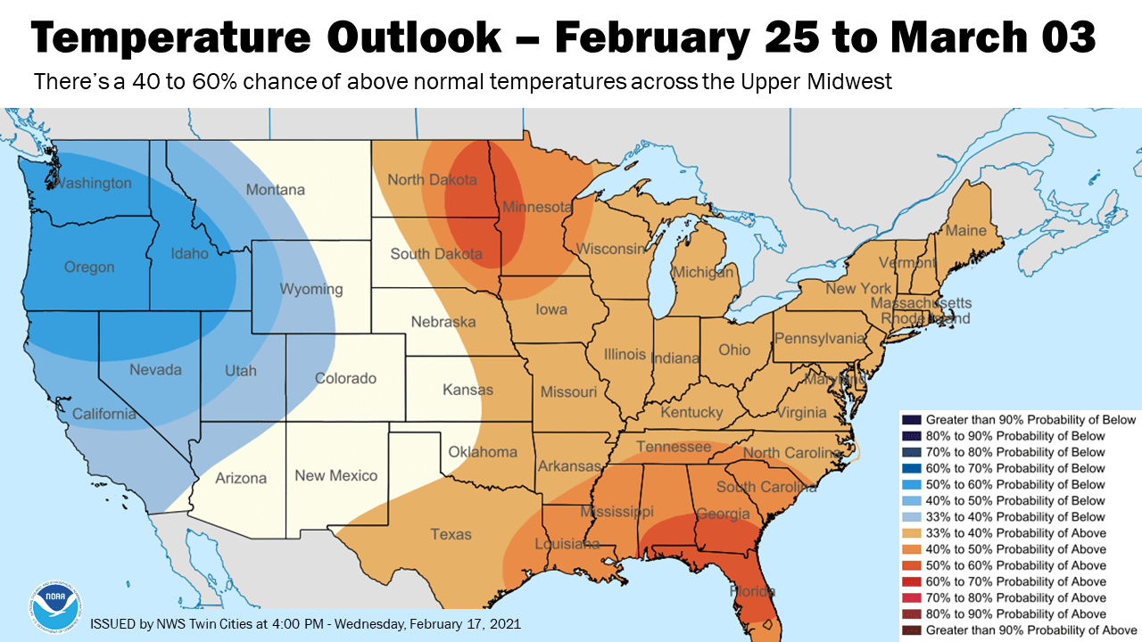
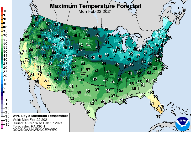
The Twin Cities and western Minnesota will bask in highs in the 40s early next week. Temperatures could reach 50 degrees in western Minnesota.
Jet stream changes
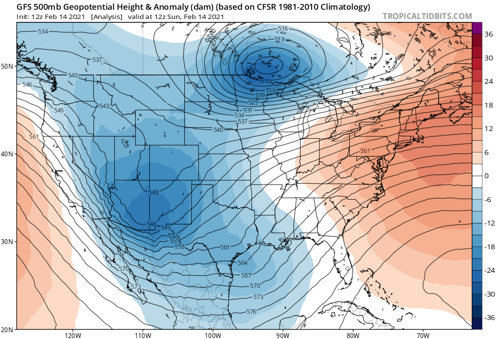
The reason for the big change in air masses over the next week is a major shift in the upper air pattern across North America. Last weekend’s upper air chart shows a frigid compact polar vortex core spinning across northern Minnesota. Note the second cold core heading for Texas.
Turn Up Your Support
MPR News helps you turn down the noise and build shared understanding. Turn up your support for this public resource and keep trusted journalism accessible to all.
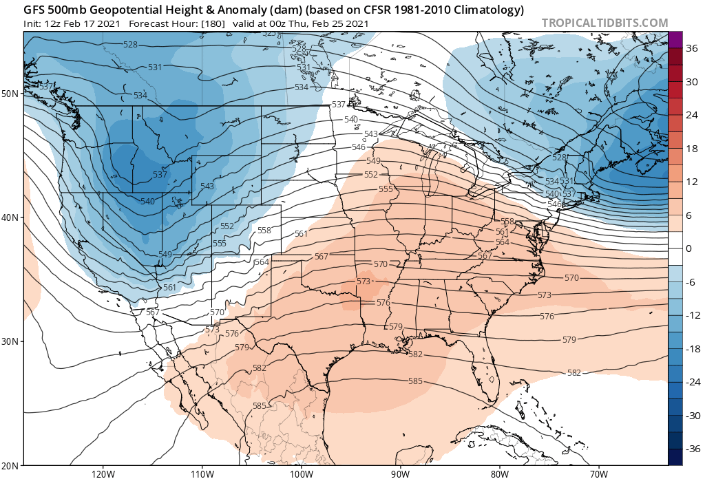
By next week, a mild Pacific flow pattern aloft allows much milder air into the Upper Midwest.
Medium-range temperature guidance suggests highs in the 30s and 40s will dominate most of next week in Minnesota.
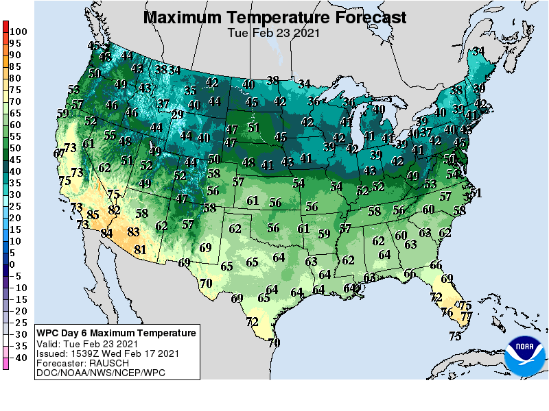
With a higher sun angle and temperature sin the 40s, we’ll start to see some snowmelt next week in Minnesota.
We know we’ll see more snow and potential subzero cold in March. But signs strongly suggest we are leaving the worst of winter’s subzero cold behind this week.
Stay tuned.

