
40s and 50s through Tuesday. More snow possible late next week?
Snow chances increase by next Friday.
Go Deeper.
Create an account or log in to save stories.
Like this?
Thanks for liking this story! We have added it to a list of your favorite stories.


By now you've probably seen the seasonal memes.
Winter
Fool's Spring
Second Winter
Spring of Deception (You are here!)
Third Winter
Actual Spring
Summer
False Fall
Second Summer
Actual Fall
Yes, we may be living in the spring of deception now. We know Minnesota is not out of the woods for accumulating snow well into April lately. The last three years have brought a string of unprecedented heavy snow events.
Unseasonably mild for now
Our daily freeze-thaw cycles continue this week. Icy mornings give way to mild afternoons.
The air mass over Minnesota continues to overperform. Temperatures shot well into the 40s again today across southern Minnesota.
Turn Up Your Support
MPR News helps you turn down the noise and build shared understanding. Turn up your support for this public resource and keep trusted journalism accessible to all.
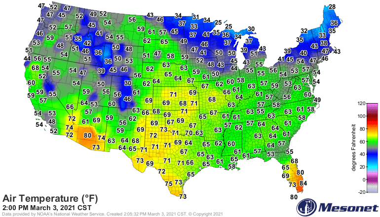
The Twin Cities nudged 48 degrees around 1 p.m. That’s a full 13 degrees warmer than the average of 35 degrees.
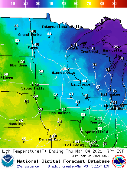
High temperatures will continue to run mostly in the 30s north and 40s central and south into the weekend. Temperatures in mostly snow-free southwest Minnesota will continue to push into the lower 50s.
April-like by Sunday
Sunday through Tuesday will feel more April than March. Highs will soar into the 50s across southern Minnesota with temperatures pushing 60-degrees in the west.

Rain likely next Tuesday
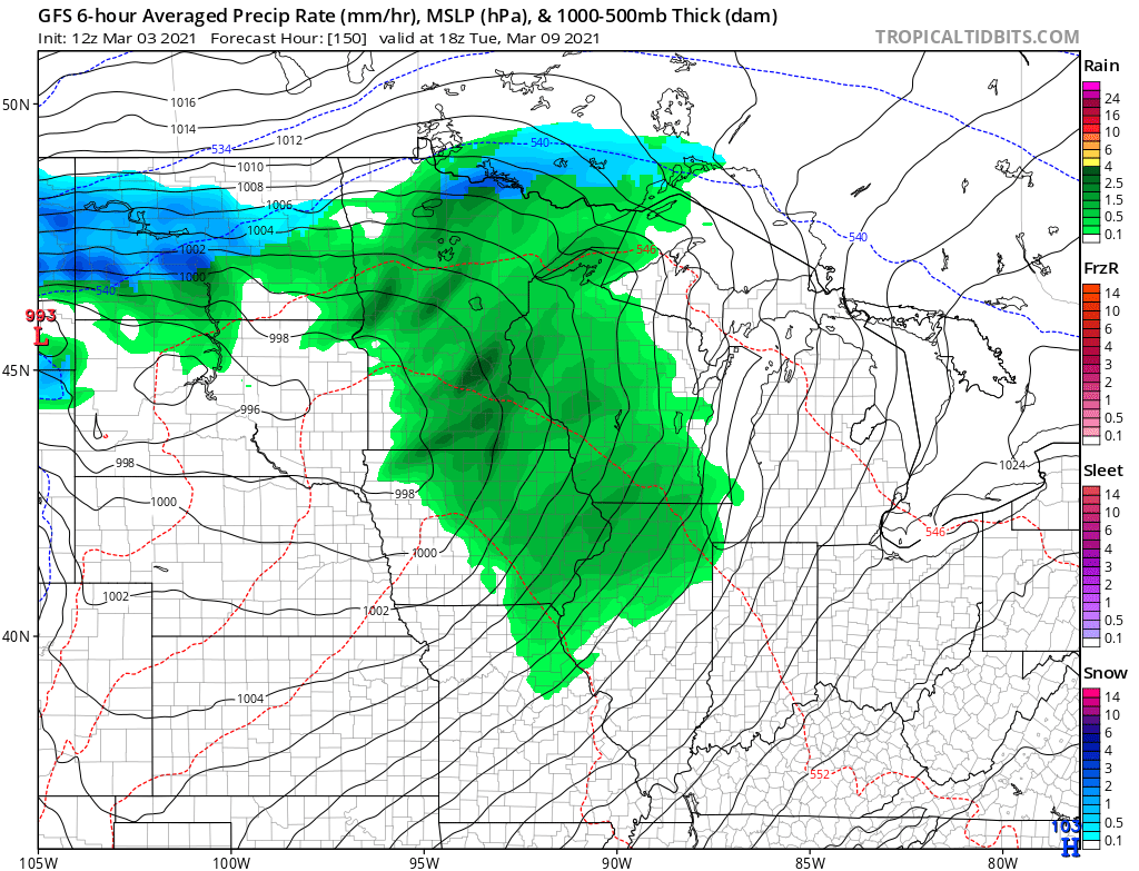
The atmosphere looks plenty warm enough for rain with an inbound weather system next Tuesday and Wednesday.
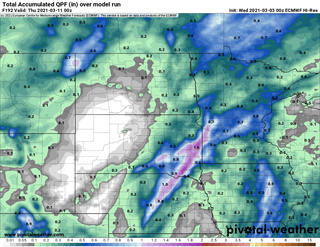
Forecast models suggest much of Minnesota could pick up rainfall totals of a quarter to a half an inch or more by late Wednesday. Here’s the European model output.
Snow chance next Friday and Saturday?
A few forecast models hint at a stronger, colder storm system late next week. It’s still too early for high or even medium confidence, but The National Oceanic and Atmospheric Administration’s GFS pains a snow producer somewhere across southern Minnesota by next Friday and Saturday, March 12-13.
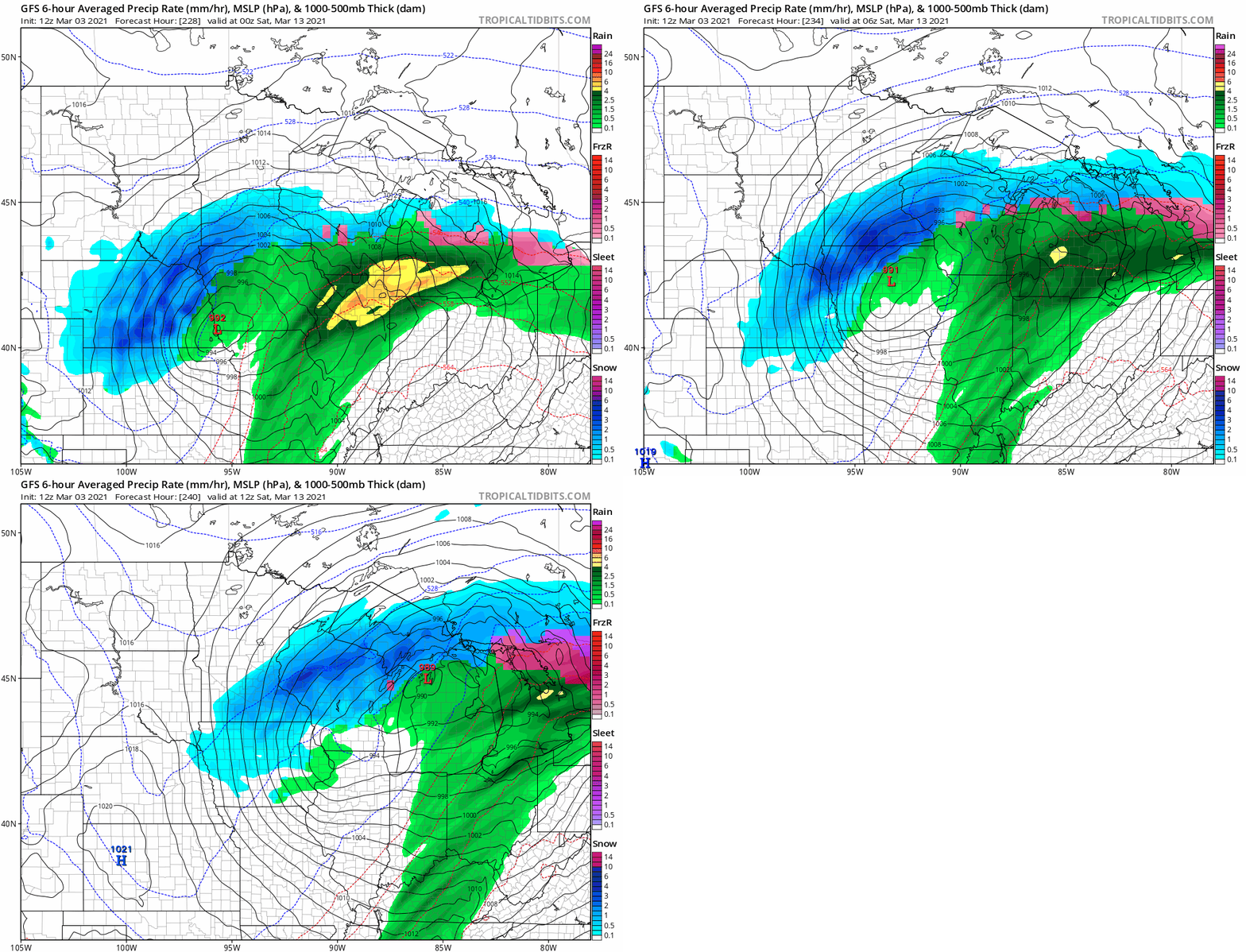
Enjoy the mild week ahead. Minnesota’s spring of deception may give way to our next season called “third winter.”

