
Record warmth: 70s close to Twin Cities Tuesday
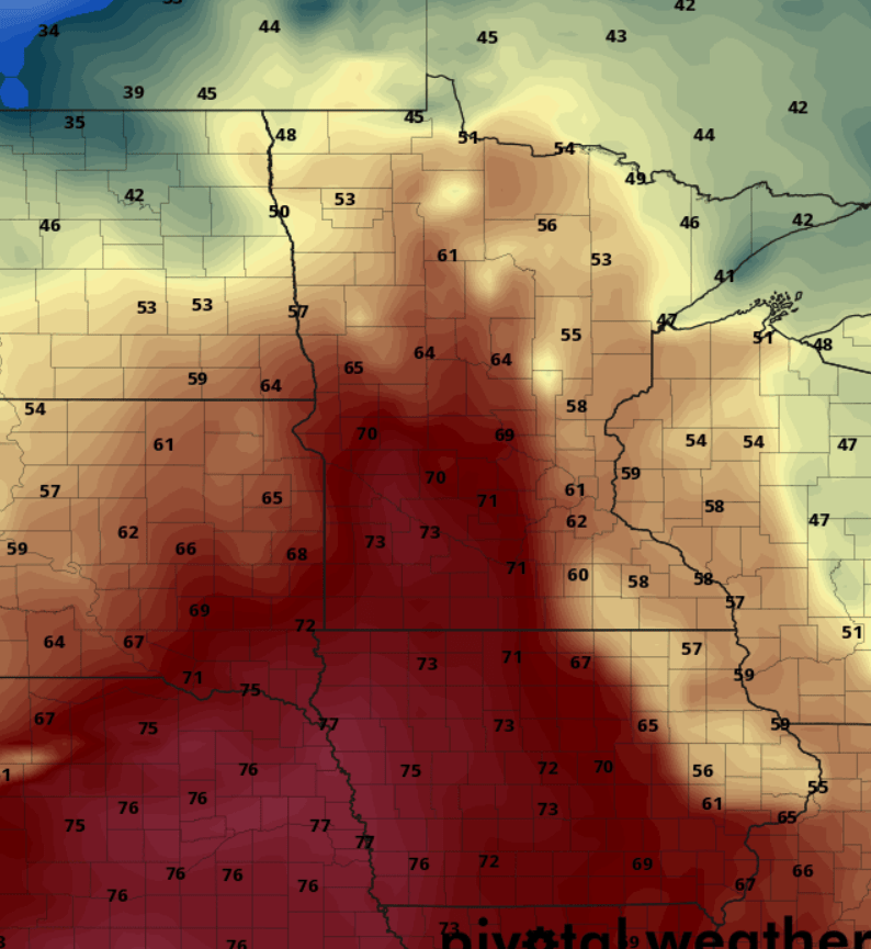
Highs in the 60s will be widespread Tuesday. Western Minnesota will push past 70 degrees.
Go Deeper.
Create an account or log in to save stories.
Like this?
Thanks for liking this story! We have added it to a list of your favorite stories.


It’s an April preview. Or maybe May.
Our unseasonably warm March pushes into record territory Tuesday. The Canadian model above seems to have a decent handle on the magnitude of Tuesday’s warmth. Highs likely reach the 70s in the southwest quarter of Minnesota, with 60s pushing across much of the state.
The record high for the Twin Cities Tuesday is 61 degrees set way back in 1879. With temperatures in the mid to upper 60s in the Twin Cities Tuesday afternoon we should set a new record with ease.
Mild, but windy
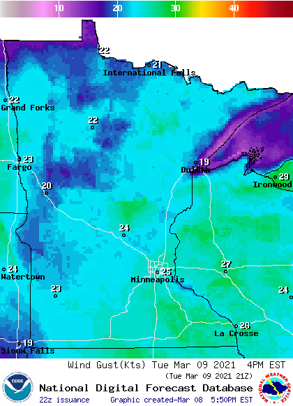
Tuesday will be the warmest day in four months, but the winds will make it feel a little cooler. Southerly winds will gust to 30 mph Tuesday.
Turn Up Your Support
MPR News helps you turn down the noise and build shared understanding. Turn up your support for this public resource and keep trusted journalism accessible to all.
Wet Wednesday
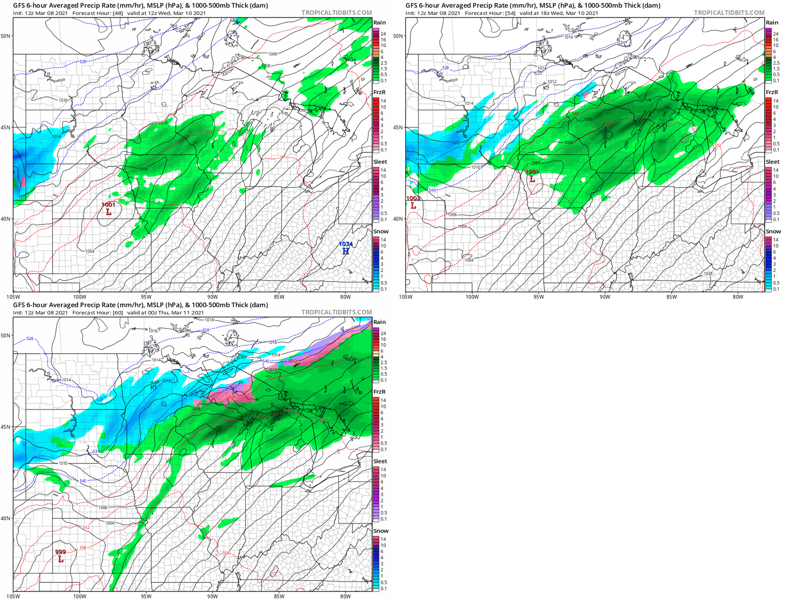
Wednesday brings cooler temperatures and some light rain and snow to Minnesota. NOAA’s GFS model shows the rain and snow zones.
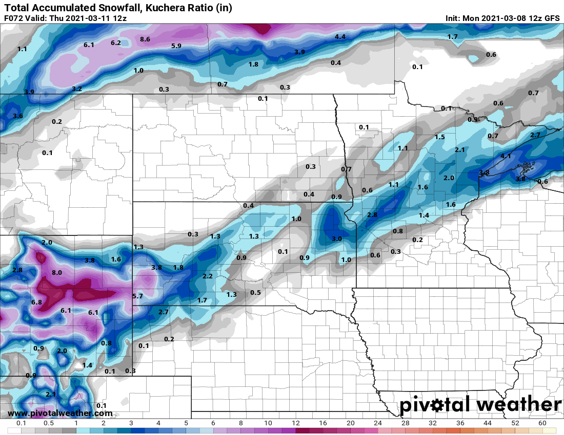
A narrow band of 1 to 3 inches appears likely across central and northeast Minnesota by Wednesday night.
Temperatures through the upcoming weekend will run in the 30s north and 40s south.

The average high and low in the Twin Cities next weekend are 40 and 23 degrees.

