Record highs falling Tuesday; rain and snow arrive Wednesday
Temperatures in the 60s pushing into Minnesota
Go Deeper.
Create an account or log in to save stories.
Like this?
Thanks for liking this story! We have added it to a list of your favorite stories.


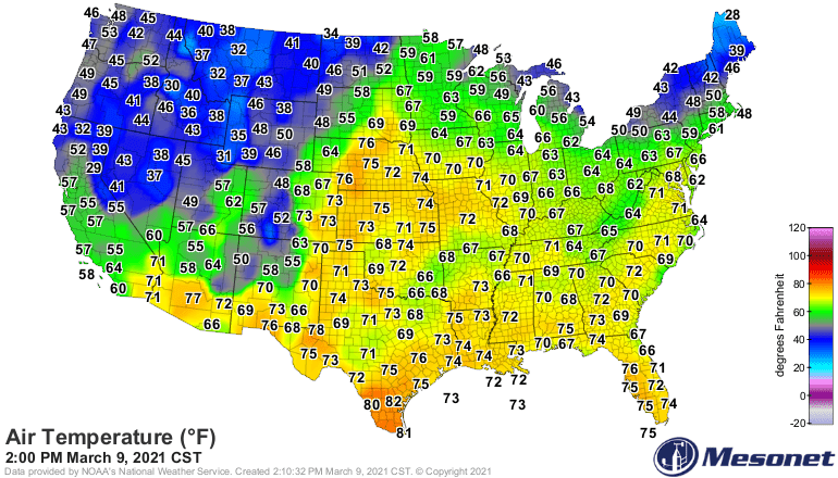
Our long-anticipated Tuesday warm front has arrived. Temperatures are surging into the 60s across most of southern and western Minnesota, with 50s up north.
Record highs falling
Many locations in Minnesota will set record high temperatures Tuesday. The Twin Cities has already broken a 132-year-old record. Tuesday’s record high of 61 degrees was set back in 1879.
Several high-temperature records have fallen in northern Minnesota and Wisconsin.
Wednesday rain and snow
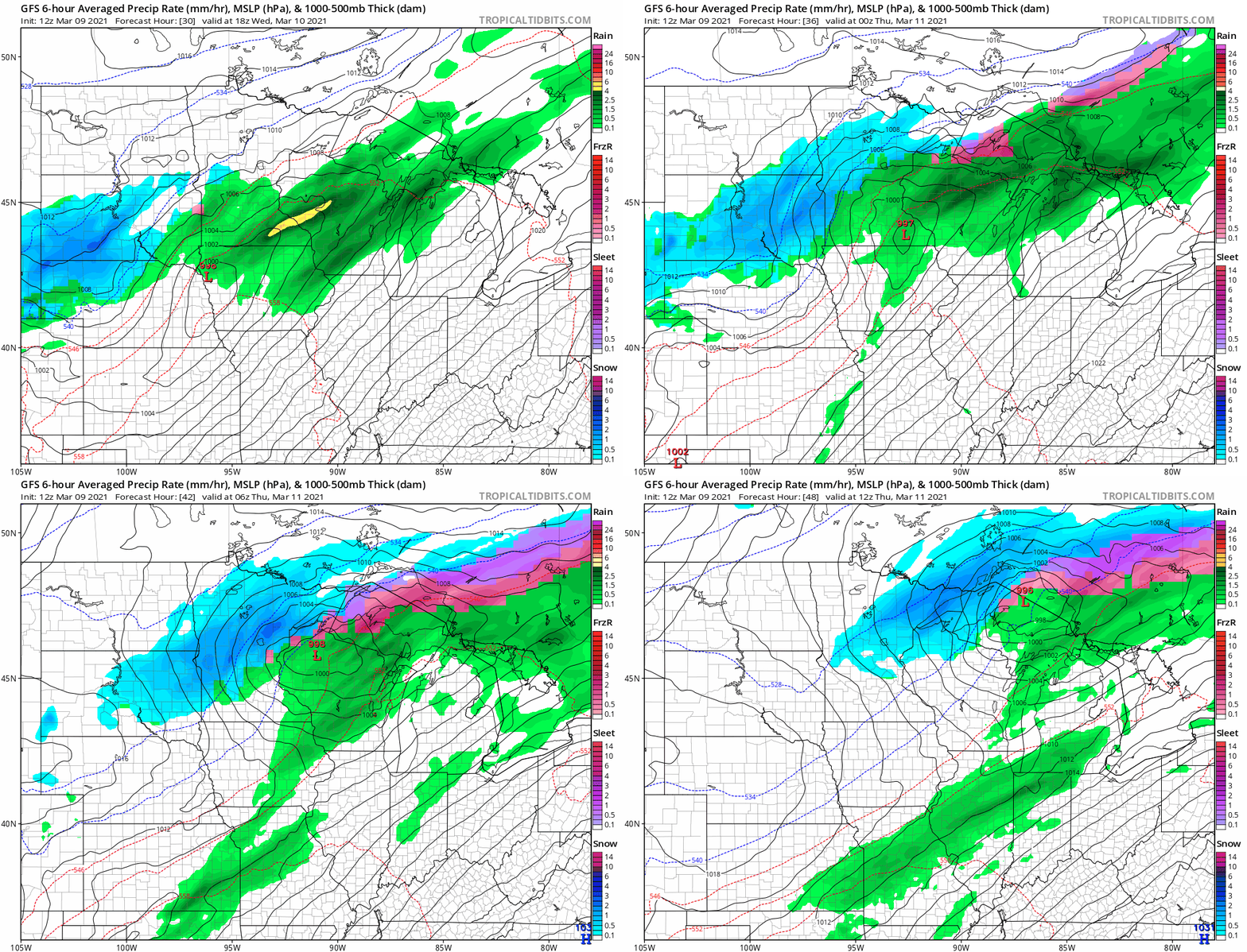
A low-pressure system tracks through southeast Minnesota Tuesday. The rain-snow line will set up across central Minnesota. It will be mostly rain in the Twin Cities, with snow from west-central Minnesota to the North Shore.
Turn Up Your Support
MPR News helps you turn down the noise and build shared understanding. Turn up your support for this public resource and keep trusted journalism accessible to all.
NOAA’s GFS model paints the rain and snow zones across Minnesota Wednesday into early Thursday.
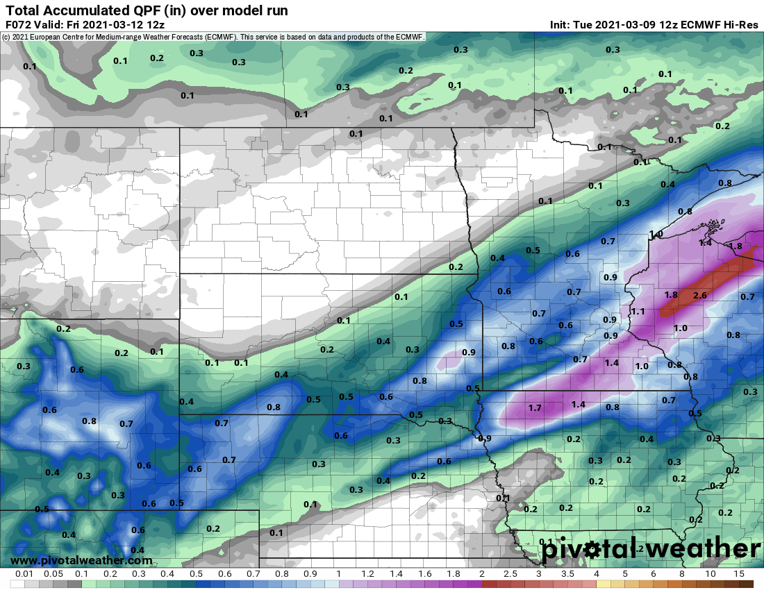
Precipitation will fall as mostly rain for the Twin Cities and southern Minnesota. More than .50 inch will fall in many locations.
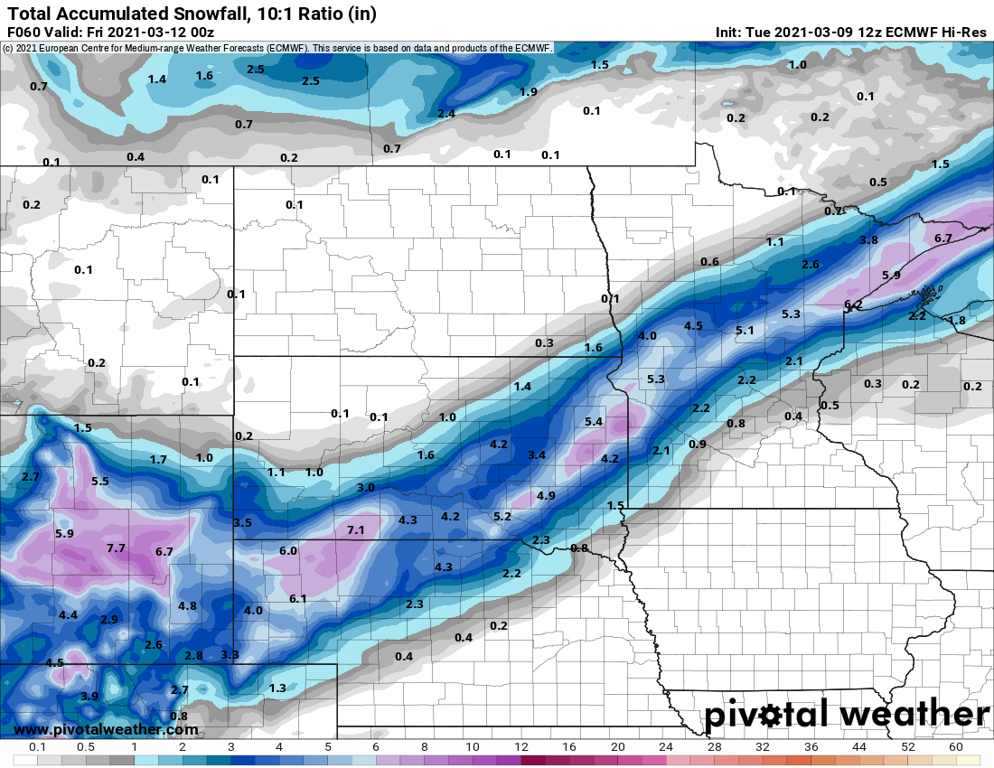
A band of 2 to 4 inches is likely from near Ortonville through Brainerd. The Iron Range and North Shore communities could pick up heavier 3 to 6 inches snowfall total.
Here is the latest National Weather Service Twin Cities snowfall projection.
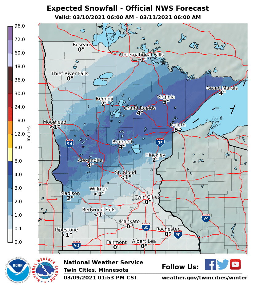
The Iron Range and North Shore communities could pick up heavier 3 to 6 inches snowfall total.
Here’s the European model snowfall output.