
A shot at 60 this weekend; another 1 to 2 inches of rain by Tuesday?
Another significant storm system arrives early next week
Go Deeper.
Create an account or log in to save stories.
Like this?
Thanks for liking this story! We have added it to a list of your favorite stories.


Spring in Minnesota is like a dance: Two steps forward. One step back.
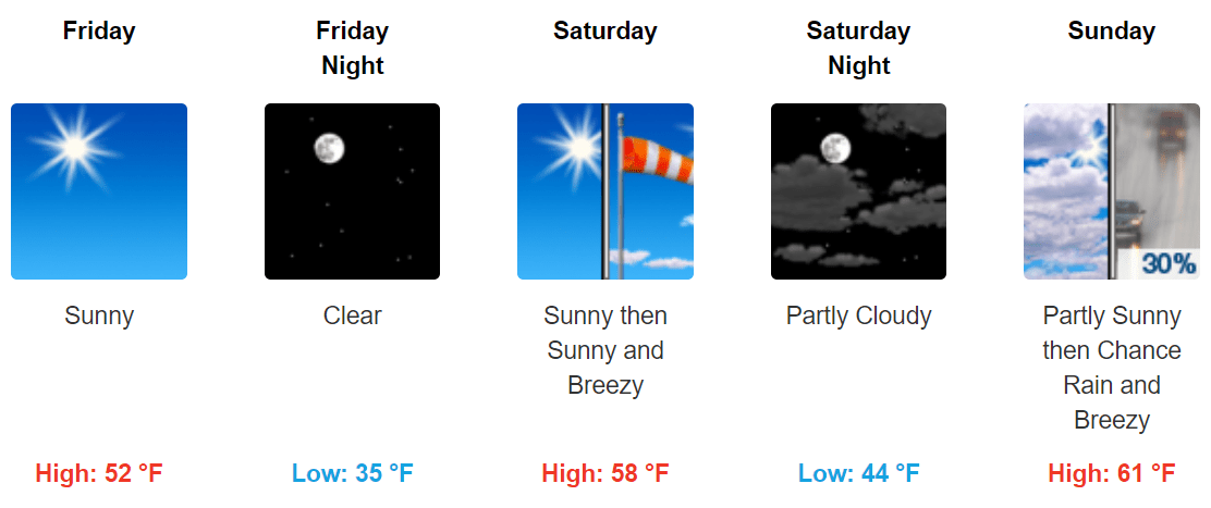
This weekend brings two more steps forward as temperatures warm into the 50s, with 60 degrees possible in parts of Minnesota. Friday looks spectacular if you like sunshine, lighter winds, and highs in the 50s. Saturday brings gusty south winds with highs in the 50s to near 60.
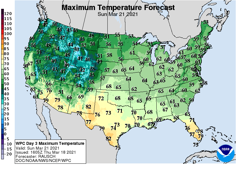
Highs Sunday should push the 60 degree-mark in the Twin Cities, with 50s all the way to Canada.
Another soaker next week
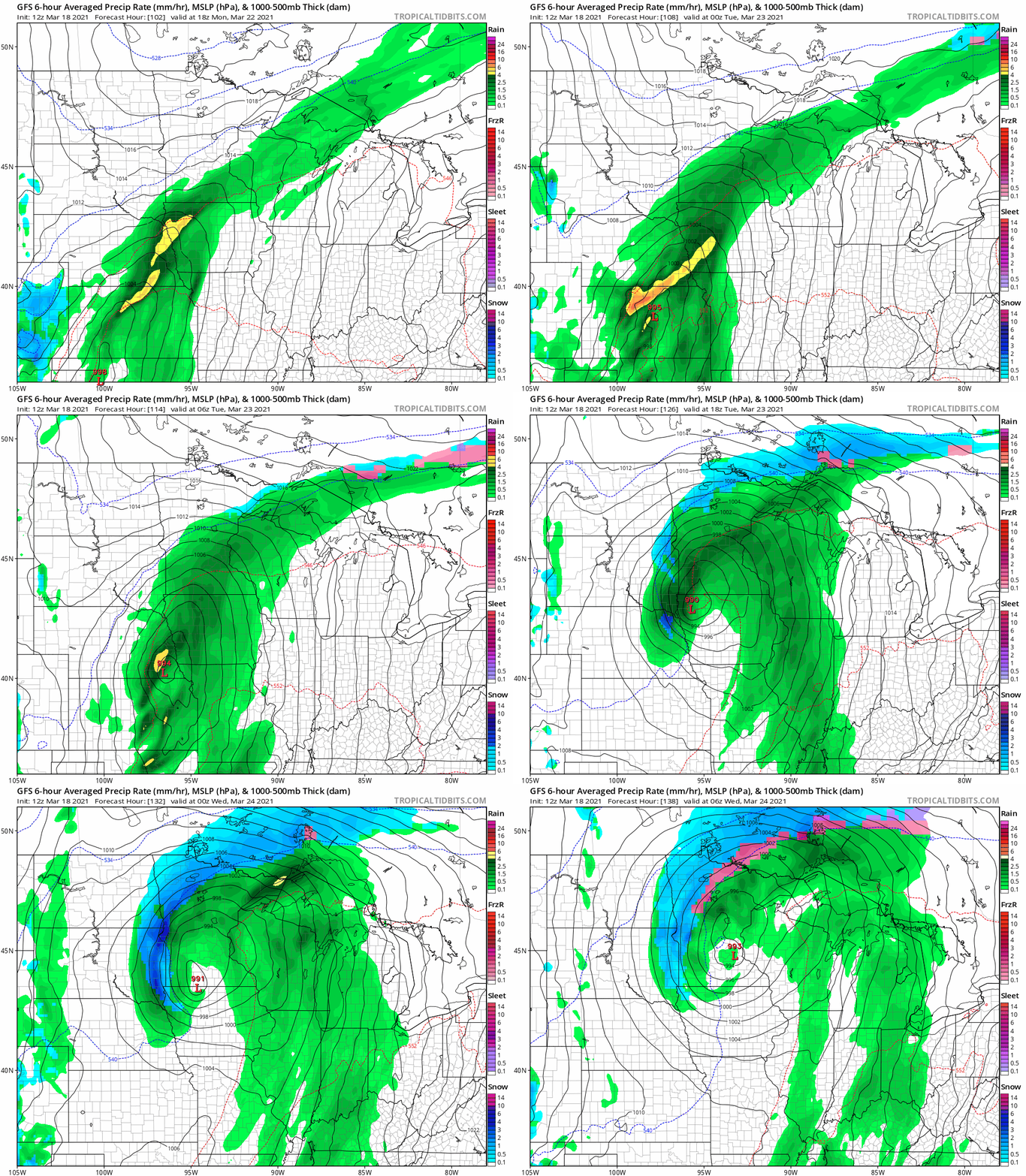
A strong and unseasonably warm storm system for March rolls into Minnesota again Monday into Tuesday. NOAA’s GFS model suggests a wrapped-up system that will produce mostly rain for the Twin Cities. There may be enough cold air to generate snow in western and northern Minnesota.
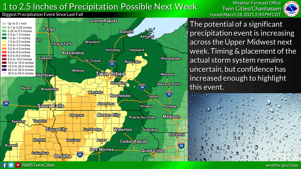
This system will have a deep moisture tap from the Gulf of Mexico. That will produce potentially some heavy rainfall totals. There may be thunderstorms within the system too. Much of southern Minnesota looks likely to pick up another 1 to 2-plus inches of precipitation next Tuesday.
Enjoy the milder weekend, then get ready for some more potentially heavy April-like showers in March next week.
Turn Up Your Support
MPR News helps you turn down the noise and build shared understanding. Turn up your support for this public resource and keep trusted journalism accessible to all.

